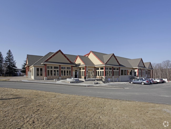
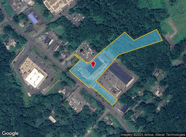
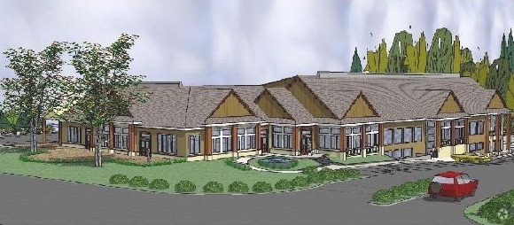
Property Record
123 S Main St, Newtown, CT 06470
NEARBY LISTINGS FOR SALE OR LEASE
Property Detail
123 S Main St
NEWT-000037-000002-000038
Fairfield
Regionalshoppingcenterormallwithanchorstore
Connecticut
X
38
09001C0168F
3.66 AC
2025
Newtown
2025
Westchester/So Connecticut
230502
Bridgeport-Stamford-Norwalk, CT
21,721 SF
DEMOGRAPHICS near 123 S Main St
1 Mile
3 Mile
5 Mile
2024 Total Population
2,163
14,907
38,535
2029 Population
2,155
14,976
38,664
Pop Growth 2024-2029
(0.37%)
+ 0.46%
+ 0.33%
Average Age
43
43
43
2024 Total Households
625
5,201
13,807
HH Growth 2024-2029
(1.92%)
+ 0.21%
+ 0.20%
Median Household Inc
$118,452
$133,735
$131,679
Avg Household Size
2.50
2.70
2.70
2024 Avg HH Vehicles
2.00
2.00
2.00
Median Home Value
$386,388
$422,304
$423,366
Median Year Built
1972
1974
1977
Nearby Places
Map Layers
Map Styles
 Street
 Aerial
- Restaurants
- Banks
- Shops
- Fitness
- Groceries
PUBLIC TRANSPORTATION
COMMUTER RAIL
Bethel Station (New Haven Line - Metro-North Commuter Railroad Company (Metro-North))
DRIVE
WALK
Distance
Bethel Station (New Haven Line - Metro-North Commuter Railroad Company (Metro-North))
18 min
9.6 mi
AIRPORT
Tweed/New Haven
DRIVE
WALK
Distance
Tweed/New Haven
49 min
30.3 mi
Freight Ports
Port of New Haven
DRIVE
WALK
Distance
Port of New Haven
43 min
27.4 mi
SALE & LEASE HISTORY
LISTING DATE
SALE/LEASE

Sep 26, 2016
For Lease
Nov 04, 2025
For Lease
Jun 06, 2023
For Sale
Jun 05, 2023
For Sale
Feb 18, 2019
For Lease
Aug 17, 2021
For Lease
Nearby Properties
Address
Land Use
TOTAL SIZE
Lot Size
Zoning
Address
Land Use
TOTAL SIZE
Lot Size
Zoning
114.88 AC
CA
Address
Land Use
TOTAL SIZE
Lot Size
Zoning
37.66 AC
R-2
Address
Land Use
TOTAL SIZE
Lot Size
Zoning
86,039 SF
15.68 AC
R-2
Address
Land Use
TOTAL SIZE
Lot Size
Zoning
21.20 AC
PS
Address
Land Use
TOTAL SIZE
Lot Size
Zoning
167,124 SF
37.33 AC
M-1
Address
Land Use
TOTAL SIZE
Lot Size
Zoning
133,516 SF
34.02 AC
R-1
Address
Land Use
TOTAL SIZE
Lot Size
Zoning
8.13 AC
B-1/2
Address
Land Use
TOTAL SIZE
Lot Size
Zoning
11,000 SF
185 AC
FHAR
Address
Land Use
TOTAL SIZE
Lot Size
Zoning
43.38 AC
EH-10
Address
Land Use
TOTAL SIZE
Lot Size
Zoning
1,498 SF
11.75 AC
R-2
Address
Land Use
TOTAL SIZE
Lot Size
Zoning
13,922 SF
62.75 AC
EH-10
Address
Land Use
TOTAL SIZE
Lot Size
Zoning
3.97 AC
P-1
Address
Land Use
TOTAL SIZE
Lot Size
Zoning
9.60 AC
R-1
Address
Land Use
TOTAL SIZE
Lot Size
Zoning
62,765 SF
29.91 AC
R-3
Address
Land Use
TOTAL SIZE
Lot Size
Zoning
102.71 AC
M-2A
Address
Land Use
TOTAL SIZE
Lot Size
Zoning
19.16 AC
R-2
Address
Land Use
TOTAL SIZE
Lot Size
Zoning
23.95 AC
M-1
Address
Land Use
TOTAL SIZE
Lot Size
Zoning
154.75 AC
CA
Address
Land Use
TOTAL SIZE
Lot Size
Zoning
212,698 SF
24.68 AC
M-1
Address
Land Use
TOTAL SIZE
Lot Size
Zoning
252,800 SF
22.70 AC
M-1
Address
Land Use
TOTAL SIZE
Lot Size
Zoning
12,074 SF
22.73 AC
SDD1
Address
Land Use
TOTAL SIZE
Lot Size
Zoning
45,079 SF
Address
Land Use
TOTAL SIZE
Lot Size
Zoning
30,220 SF
5.48 AC
M-4
Address
Land Use
TOTAL SIZE
Lot Size
Zoning
13.30 AC
M-5
Address
Land Use
TOTAL SIZE
Lot Size
Zoning
158,754 SF
17.74 AC
M-1
Address
Land Use
TOTAL SIZE
Lot Size
Zoning
13.98 AC
M-4
Address
Land Use
TOTAL SIZE
Lot Size
Zoning
46,620 SF
7.55 AC
B-1/2
Address
Land Use
TOTAL SIZE
Lot Size
Zoning
7.52 AC
M-1
Address
Land Use
TOTAL SIZE
Lot Size
Zoning
124,412 SF
18.74 AC
M-1
Address
Land Use
TOTAL SIZE
Lot Size
Zoning
15.72 AC
I2
The World's #1 Commercial Real Estate Marketplace
Connect with us
© 2025 CoStar Group
The information above has been obtained from sources believed reliable. While we do not doubt its accuracy we have not verified it and make no guarantee, warranty or representation about it. It is your responsibility to independently confirm its accuracy and completeness. Any projections, opinions, assumptions, or estimates used are for example only and do not represent the current or future performance of the property. The value of this transaction to you depends on tax and other factors which should be evaluated by your tax, financial, and legal advisors. You and your advisors should conduct a careful, independent investigation of the property to determine to your satisfaction the suitability of the property for your needs.