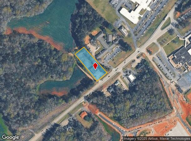
Property Record
123 Sparta Hwy, Eatonton, GA 31024
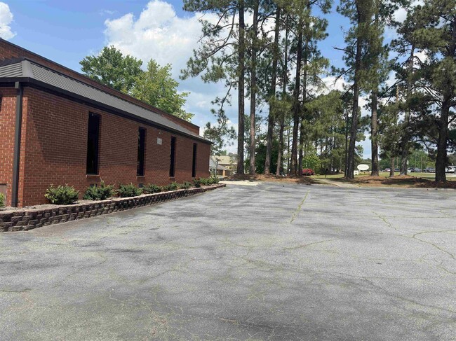
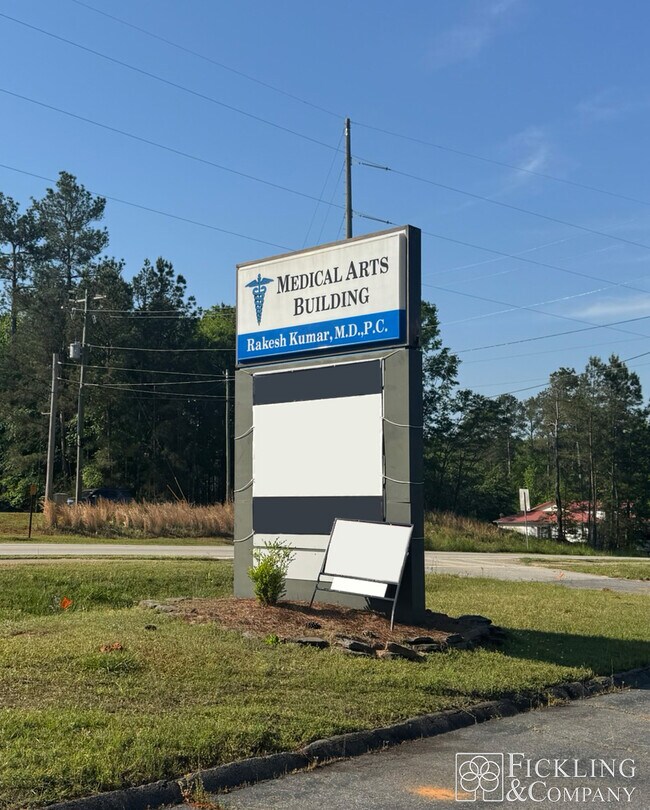
This Property Is For Sale
Current Lease Availabilities
NEARBY LISTINGS FOR SALE OR LEASE
Property Detail
123 Sparta Hwy
063-012
Commercial 43 1
Medicalbuilding
DR OFFICES HWY 44
X
Putnam
13141C0125B
Georgia
2024
1.07 AC
2025
Georgia Northeast
960204
Other Market Areas
2,640 SF
DEMOGRAPHICS near 123 Sparta Hwy
1 Mile
3 Mile
5 Mile
2024 Total Population
1,594
5,309
6,754
2029 Population
1,663
5,558
7,137
Pop Growth 2024-2029
+ 4.33%
+ 4.69%
+ 5.67%
Average Age
41
40
40
2024 Total Households
616
2,060
2,634
HH Growth 2024-2029
+ 4.55%
+ 4.81%
+ 5.81%
Median Household Inc
$34,999
$40,909
$43,324
Avg Household Size
2.50
2.50
2.50
2024 Avg HH Vehicles
2.00
2.00
2.00
Median Home Value
$80,154
$132,476
$152,243
Median Year Built
1979
1979
1982
Nearby Places
Map Layers
Map Styles
 Street
 Aerial
- Restaurants
- Banks
- Shops
- Fitness
- Groceries
Nearby Properties
Address
Land Use
TOTAL SIZE
Lot Size
Zoning
Address
Land Use
TOTAL SIZE
Lot Size
Zoning
149,526 SF
60 AC
A-1 CITY
Address
Land Use
TOTAL SIZE
Lot Size
Zoning
56,712 SF
2.79 AC
PUBLIC
Address
Land Use
TOTAL SIZE
Lot Size
Zoning
7,800 SF
40.10 AC
PUBLIC CIT
Address
Land Use
TOTAL SIZE
Lot Size
Zoning
64,786 SF
12.20 AC
PUBLIC CIT
Address
Land Use
TOTAL SIZE
Lot Size
Zoning
8,000 SF
14.17 AC
PUBLIC CIT
Address
Land Use
TOTAL SIZE
Lot Size
Zoning
9,785 SF
1.35 AC
R-1 CITY
Address
Land Use
TOTAL SIZE
Lot Size
Zoning
30,000 SF
30.90 AC
I-2 CITY
Address
Land Use
TOTAL SIZE
Lot Size
Zoning
22,685 SF
2.06 AC
PUBLIC
Address
Land Use
TOTAL SIZE
Lot Size
Zoning
25,686 SF
29.53 AC
PUBLIC CIT
Address
Land Use
TOTAL SIZE
Lot Size
Zoning
14,267 SF
18.97 AC
PUBLIC
Address
Land Use
TOTAL SIZE
Lot Size
Zoning
130,923 SF
19.41 AC
C-2 CITY
Address
Land Use
TOTAL SIZE
Lot Size
Zoning
3,051 SF
7.13 AC
R-3 CITY
Address
Land Use
TOTAL SIZE
Lot Size
Zoning
14,390 SF
13.86 AC
R-2 CITY
Address
Land Use
TOTAL SIZE
Lot Size
Zoning
73,740 SF
22.71 AC
PUBLIC
Address
Land Use
TOTAL SIZE
Lot Size
Zoning
25,125 SF
23 AC
PUBLIC CIT
Address
Land Use
TOTAL SIZE
Lot Size
Zoning
169,300 SF
24.79 AC
I-2 CITY
Address
Land Use
TOTAL SIZE
Lot Size
Zoning
11,608 SF
31.72 AC
I-2 CITY
Address
Land Use
TOTAL SIZE
Lot Size
Zoning
121,200 SF
2.75 AC
I-2 CITY
Address
Land Use
TOTAL SIZE
Lot Size
Zoning
11,588 SF
2.33 AC
R-1 CITY
Address
Land Use
TOTAL SIZE
Lot Size
Zoning
1,920 SF
83.80 AC
PUBLIC CIT
Address
Land Use
TOTAL SIZE
Lot Size
Zoning
1,848 SF
6.25 AC
R-3 CITY
Address
Land Use
TOTAL SIZE
Lot Size
Zoning
8,912 SF
3.93 AC
C-2 CITY
Address
Land Use
TOTAL SIZE
Lot Size
Zoning
13,503 SF
5 AC
PUBLIC
Address
Land Use
TOTAL SIZE
Lot Size
Zoning
8,270 SF
0.45 AC
R-1 CITY
Address
Land Use
TOTAL SIZE
Lot Size
Zoning
20,350 SF
1.64 AC
C-1 CITY
Address
Land Use
TOTAL SIZE
Lot Size
Zoning
22,730 SF
5.77 AC
PUBLIC CIT
Address
Land Use
TOTAL SIZE
Lot Size
Zoning
18,080 SF
16 AC
C-1 CITY
Address
Land Use
TOTAL SIZE
Lot Size
Zoning
327,128 SF
13.29 AC
I-2 CITY
Address
Land Use
TOTAL SIZE
Lot Size
Zoning
5,040 SF
21.93 AC
R-2 CITY
Address
Land Use
TOTAL SIZE
Lot Size
Zoning
7,560 SF
43.06 AC
A-1 CITY
The World's #1 Commercial Real Estate Marketplace
Connect with us
© 2026 CoStar Group
The information above has been obtained from sources believed reliable. While we do not doubt its accuracy we have not verified it and make no guarantee, warranty or representation about it. It is your responsibility to independently confirm its accuracy and completeness. Any projections, opinions, assumptions, or estimates used are for example only and do not represent the current or future performance of the property. The value of this transaction to you depends on tax and other factors which should be evaluated by your tax, financial, and legal advisors. You and your advisors should conduct a careful, independent investigation of the property to determine to your satisfaction the suitability of the property for your needs.