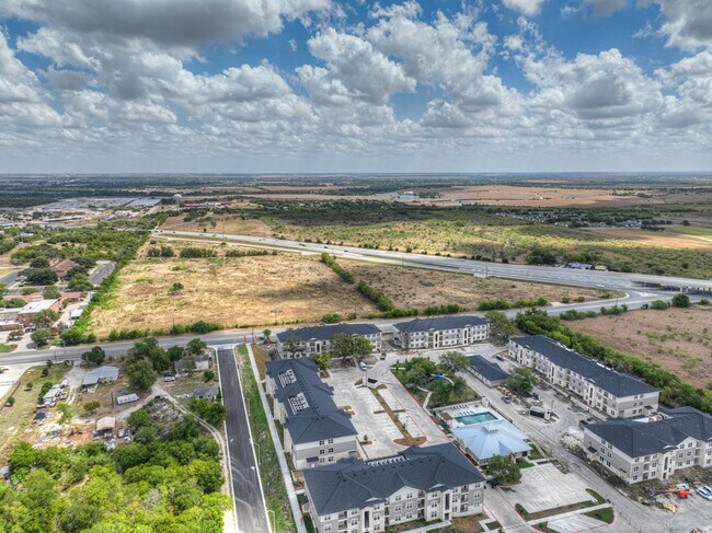
Property Record
123 State Highway 123, San Marcos, TX 78666


NEARBY LISTINGS FOR SALE OR LEASE
Property Detail
123 State Highway 123
Austin-Round Rock, TX
Barnett O Kane Survey
R15891
A0281 BARNETT O KANE SURVEY, TRACT PT 1, ACRES 20.084
Vacantlandnec
Hays
X
Texas
48055C0200F
1
2024
20.08 AC
2025
Hays County
010100
Austin
DEMOGRAPHICS near 123 State Highway 123
1 Mile
3 Mile
5 Mile
2024 Total Population
7,493
44,453
85,869
2029 Population
9,984
57,718
110,502
Pop Growth 2024-2029
+ 33.24%
+ 29.84%
+ 28.69%
Average Age
35
34
33
2024 Total Households
3,136
16,967
33,900
HH Growth 2024-2029
+ 34.18%
+ 32.13%
+ 30.84%
Median Household Inc
$39,010
$40,400
$37,635
Avg Household Size
2.30
2.40
2.30
2024 Avg HH Vehicles
2.00
2.00
2.00
Median Home Value
$193,108
$230,750
$251,891
Median Year Built
2005
1997
1997
Nearby Places
Map Layers
Map Styles
 Street
 Aerial
- Restaurants
- Banks
- Shops
- Fitness
- Groceries
PUBLIC TRANSPORTATION
COMMUTER RAIL
San Marcos Amtrak (Texas Eagle - Amtrak)
DRIVE
WALK
Distance
San Marcos Amtrak (Texas Eagle - Amtrak)
7 min
2.8 mi
AIRPORT
Austin-Bergstrom International
DRIVE
WALK
Distance
Austin-Bergstrom International
49 min
38.4 mi
Freight Ports
Calhoun Port
DRIVE
WALK
Distance
Calhoun Port
168 min
137.8 mi
SALE & LEASE HISTORY
LISTING DATE
SALE/LEASE

Sep 02, 2017
For Sale
Apr 20, 2021
For Sale
Nearby Properties
Address
Land Use
TOTAL SIZE
Lot Size
Zoning
Address
Land Use
TOTAL SIZE
Lot Size
Zoning
70,432 SF
45.07 AC
Address
Land Use
TOTAL SIZE
Lot Size
Zoning
623,823 SF
1.46 AC
Address
Land Use
TOTAL SIZE
Lot Size
Zoning
855,000 SF
95.65 AC
Address
Land Use
TOTAL SIZE
Lot Size
Zoning
215,932 SF
3.67 AC
Address
Land Use
TOTAL SIZE
Lot Size
Zoning
419,973 SF
23.69 AC
Address
Land Use
TOTAL SIZE
Lot Size
Zoning
289,554 SF
76.50 AC
Address
Land Use
TOTAL SIZE
Lot Size
Zoning
458,948 SF
35.43 AC
Address
Land Use
TOTAL SIZE
Lot Size
Zoning
545,643 SF
2.69 AC
Address
Land Use
TOTAL SIZE
Lot Size
Zoning
279,131 SF
22.46 AC
Address
Land Use
TOTAL SIZE
Lot Size
Zoning
466,968 SF
15.19 AC
Address
Land Use
TOTAL SIZE
Lot Size
Zoning
352,285 SF
12.75 AC
Address
Land Use
TOTAL SIZE
Lot Size
Zoning
283,033 SF
19.46 AC
Address
Land Use
TOTAL SIZE
Lot Size
Zoning
223,401 SF
9.75 AC
Address
Land Use
TOTAL SIZE
Lot Size
Zoning
184,438 SF
12.57 AC
Address
Land Use
TOTAL SIZE
Lot Size
Zoning
343,560 SF
10.40 AC
Address
Land Use
TOTAL SIZE
Lot Size
Zoning
255,621 SF
8.83 AC
Address
Land Use
TOTAL SIZE
Lot Size
Zoning
277,659 SF
10.77 AC
Address
Land Use
TOTAL SIZE
Lot Size
Zoning
307,962 SF
14.23 AC
Address
Land Use
TOTAL SIZE
Lot Size
Zoning
24.14 AC
Address
Land Use
TOTAL SIZE
Lot Size
Zoning
179,764 SF
3.27 AC
Address
Land Use
TOTAL SIZE
Lot Size
Zoning
115.78 AC
Address
Land Use
TOTAL SIZE
Lot Size
Zoning
341,111 SF
20.94 AC
Address
Land Use
TOTAL SIZE
Lot Size
Zoning
145,336 SF
0.87 AC
Address
Land Use
TOTAL SIZE
Lot Size
Zoning
195,018 SF
7.37 AC
Address
Land Use
TOTAL SIZE
Lot Size
Zoning
305,644 SF
27.93 AC
Address
Land Use
TOTAL SIZE
Lot Size
Zoning
160,056 SF
10.05 AC
Address
Land Use
TOTAL SIZE
Lot Size
Zoning
222,984 SF
12.85 AC
Address
Land Use
TOTAL SIZE
Lot Size
Zoning
535,134 SF
29.28 AC
Address
Land Use
TOTAL SIZE
Lot Size
Zoning
178,521 SF
1.40 AC
Address
Land Use
TOTAL SIZE
Lot Size
Zoning
162,336 SF
14.37 AC
The World's #1 Commercial Real Estate Marketplace
Connect with us
© 2025 CoStar Group
The information above has been obtained from sources believed reliable. While we do not doubt its accuracy we have not verified it and make no guarantee, warranty or representation about it. It is your responsibility to independently confirm its accuracy and completeness. Any projections, opinions, assumptions, or estimates used are for example only and do not represent the current or future performance of the property. The value of this transaction to you depends on tax and other factors which should be evaluated by your tax, financial, and legal advisors. You and your advisors should conduct a careful, independent investigation of the property to determine to your satisfaction the suitability of the property for your needs.