Property Record
1230 El Mirasol Loop, Davenport, FL 33896

NEARBY LISTINGS FOR SALE OR LEASE
Property Detail
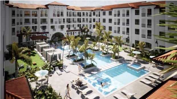
1230 El Mirasol Loop
33-25-27-0000-0053-0000
Agricultural
Multifamilydwelling
COM AT NW COR OF NE 1/4 OF NW 1/4 OF 33-25-27, S00-14-57W 663.04 FT, N89-55-53W 226.86 FT TO POB; CONT N89-55-53W 430.44 FT TO PT ON E R/W LINE OF GOODMAN RD PER MP 1 PGS 92-102, S00-28-38W 92.94 FT, S01-08-1W 391.79 FT TO NON-TAN CURVE, CONC NE, RAD
X
Osceola
12105C0125H
Florida
2024
17.46 AC
2025
ChampionsGate
040812
Orlando
408,876 SF
Orlando-Kissimmee-Sanford, FL
DEMOGRAPHICS near 1230 El Mirasol Loop
1 Mile
3 Mile
5 Mile
2024 Total Population
6,545
51,361
109,740
2029 Population
8,262
64,659
137,460
Pop Growth 2024-2029
+ 26.23%
+ 25.89%
+ 25.26%
Average Age
38
38
38
2024 Total Households
2,698
19,092
39,948
HH Growth 2024-2029
+ 25.87%
+ 25.87%
+ 25.28%
Median Household Inc
$66,534
$70,709
$67,975
Avg Household Size
2.40
2.60
2.70
2024 Avg HH Vehicles
2.00
2.00
2.00
Median Home Value
$316,770
$279,583
$269,119
Median Year Built
2010
2007
2006
Nearby Places
Map Layers
Map Styles
 Street
 Aerial
- Restaurants
- Banks
- Shops
- Fitness
- Groceries
PUBLIC TRANSPORTATION
COMMUTER RAIL
Poinciana (SunRail - Florida Department of Transportation)
DRIVE
WALK
Distance
Poinciana (SunRail - Florida Department of Transportation)
16 min
9.8 mi
AIRPORT
Orlando International
DRIVE
WALK
Distance
Orlando International
38 min
27.5 mi
Freight Ports
Port of Tampa Bay
DRIVE
WALK
Distance
Port of Tampa Bay
73 min
60.9 mi
Nearby Properties
Address
Land Use
TOTAL SIZE
Lot Size
Zoning
Address
Land Use
TOTAL SIZE
Lot Size
Zoning
736,399 SF
23.59 AC
OPD
Address
Land Use
TOTAL SIZE
Lot Size
Zoning
533,192 SF
70.52 AC
OPUD
Address
Land Use
TOTAL SIZE
Lot Size
Zoning
417,544 SF
62.60 AC
Address
Land Use
TOTAL SIZE
Lot Size
Zoning
434,491 SF
27.48 AC
Address
Land Use
TOTAL SIZE
Lot Size
Zoning
295,034 SF
14.25 AC
Address
Land Use
TOTAL SIZE
Lot Size
Zoning
597,078 SF
51.33 AC
Address
Land Use
TOTAL SIZE
Lot Size
Zoning
336,380 SF
19.05 AC
Address
Land Use
TOTAL SIZE
Lot Size
Zoning
380,530 SF
18.92 AC
RC
Address
Land Use
TOTAL SIZE
Lot Size
Zoning
425,752 SF
19.52 AC
Address
Land Use
TOTAL SIZE
Lot Size
Zoning
436,302 SF
27.87 AC
Address
Land Use
TOTAL SIZE
Lot Size
Zoning
480,104 SF
12.37 AC
Address
Land Use
TOTAL SIZE
Lot Size
Zoning
358,576 SF
27.34 AC
OPD
Address
Land Use
TOTAL SIZE
Lot Size
Zoning
322,095 SF
16.88 AC
Address
Land Use
TOTAL SIZE
Lot Size
Zoning
302,226 SF
135.83 AC
Address
Land Use
TOTAL SIZE
Lot Size
Zoning
301,623 SF
20.06 AC
Address
Land Use
TOTAL SIZE
Lot Size
Zoning
412,886 SF
10.72 AC
Address
Land Use
TOTAL SIZE
Lot Size
Zoning
335,536 SF
11.97 AC
Address
Land Use
TOTAL SIZE
Lot Size
Zoning
333,554 SF
19.22 AC
Address
Land Use
TOTAL SIZE
Lot Size
Zoning
354,600 SF
14.93 AC
Address
Land Use
TOTAL SIZE
Lot Size
Zoning
329,700 SF
12.09 AC
Address
Land Use
TOTAL SIZE
Lot Size
Zoning
307,953 SF
16.20 AC
Address
Land Use
TOTAL SIZE
Lot Size
Zoning
360,801 SF
8.24 AC
Address
Land Use
TOTAL SIZE
Lot Size
Zoning
352,892 SF
19.23 AC
Address
Land Use
TOTAL SIZE
Lot Size
Zoning
479,776 SF
20.90 AC
Address
Land Use
TOTAL SIZE
Lot Size
Zoning
360,270 SF
16.97 AC
OPD
Address
Land Use
TOTAL SIZE
Lot Size
Zoning
601,750 SF
32.69 AC
Address
Land Use
TOTAL SIZE
Lot Size
Zoning
256,589 SF
15.37 AC
OPD
Address
Land Use
TOTAL SIZE
Lot Size
Zoning
216,296 SF
16.37 AC
Address
Land Use
TOTAL SIZE
Lot Size
Zoning
236,745 SF
26.56 AC
The World's #1 Commercial Real Estate Marketplace
Connect with us
© 2025 CoStar Group
The information above has been obtained from sources believed reliable. While we do not doubt its accuracy we have not verified it and make no guarantee, warranty or representation about it. It is your responsibility to independently confirm its accuracy and completeness. Any projections, opinions, assumptions, or estimates used are for example only and do not represent the current or future performance of the property. The value of this transaction to you depends on tax and other factors which should be evaluated by your tax, financial, and legal advisors. You and your advisors should conduct a careful, independent investigation of the property to determine to your satisfaction the suitability of the property for your needs.