Property Record
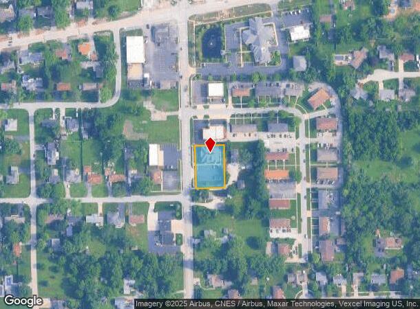
1230 N Cedar Rd, New Lenox, IL 60451


NEARBY LISTINGS FOR SALE OR LEASE
Property Detail
1230 N Cedar Rd
Chicago-Naperville-Elgin, IL-IN-WI
Ft Thof A Acres
15-08-10-301-043
THE W 125 FT OF LOTS 13 14 IN ARTHUR T MCINTOSH CO'S NEW LENOX ACRES (EX FM SD TRACT THE N 115.5 FT THOF) (EX THE S 23 FT
Commercialnec
Will
X
Illinois
17197C0190G
13,14
2024
0.55 AC
2024
Joliet/Central Will
881107
Chicago
DEMOGRAPHICS near 1230 N Cedar Rd
1 Mile
3 Mile
5 Mile
2024 Total Population
4,382
31,427
100,175
2029 Population
4,363
31,416
100,021
Pop Growth 2024-2029
(0.43%)
(0.04%)
(0.15%)
Average Age
41
40
40
2024 Total Households
1,569
11,022
34,427
HH Growth 2024-2029
(0.38%)
(0.06%)
(0.24%)
Median Household Inc
$107,622
$111,670
$105,221
Avg Household Size
2.70
2.80
2.80
2024 Avg HH Vehicles
2.00
2.00
2.00
Median Home Value
$314,460
$328,346
$329,307
Median Year Built
1976
1991
1993
Nearby Places
Map Layers
Map Styles
 Street
 Aerial
- Restaurants
- Banks
- Shops
- Fitness
- Groceries
PUBLIC TRANSPORTATION
COMMUTER RAIL
New Lenox Station (Rock Island District Line - Northeast Illinois Regional Commuter Railroad (Metra))
DRIVE
WALK
Distance
New Lenox Station (Rock Island District Line - Northeast Illinois Regional Commuter Railroad (Metra))
3 min
18 min
1.0 mi
New Lenox Laraway Road (SouthWest Service - Northeast Illinois Regional Commuter Railroad (Metra))
DRIVE
WALK
Distance
New Lenox Laraway Road (SouthWest Service - Northeast Illinois Regional Commuter Railroad (Metra))
9 min
3.8 mi
AIRPORT
Chicago Midway International
DRIVE
WALK
Distance
Chicago Midway International
40 min
29.9 mi
Freight Ports
Port Milwaukee
DRIVE
WALK
Distance
Port Milwaukee
138 min
113.1 mi
Nearby Properties
Address
Land Use
TOTAL SIZE
Lot Size
Zoning
Address
Land Use
TOTAL SIZE
Lot Size
Zoning
53.05 AC
Address
Land Use
TOTAL SIZE
Lot Size
Zoning
45.09 AC
Address
Land Use
TOTAL SIZE
Lot Size
Zoning
26.04 AC
Address
Land Use
TOTAL SIZE
Lot Size
Zoning
Address
Land Use
TOTAL SIZE
Lot Size
Zoning
35.69 AC
Address
Land Use
TOTAL SIZE
Lot Size
Zoning
31.12 AC
Address
Land Use
TOTAL SIZE
Lot Size
Zoning
4.48 AC
Address
Land Use
TOTAL SIZE
Lot Size
Zoning
12.03 AC
Address
Land Use
TOTAL SIZE
Lot Size
Zoning
19.52 AC
Address
Land Use
TOTAL SIZE
Lot Size
Zoning
5.67 AC
Address
Land Use
TOTAL SIZE
Lot Size
Zoning
11.46 AC
Address
Land Use
TOTAL SIZE
Lot Size
Zoning
10.32 AC
Address
Land Use
TOTAL SIZE
Lot Size
Zoning
Address
Land Use
TOTAL SIZE
Lot Size
Zoning
13.14 AC
Address
Land Use
TOTAL SIZE
Lot Size
Zoning
10.28 AC
Address
Land Use
TOTAL SIZE
Lot Size
Zoning
Address
Land Use
TOTAL SIZE
Lot Size
Zoning
4.51 AC
Address
Land Use
TOTAL SIZE
Lot Size
Zoning
16.31 AC
Address
Land Use
TOTAL SIZE
Lot Size
Zoning
Address
Land Use
TOTAL SIZE
Lot Size
Zoning
11.57 AC
Address
Land Use
TOTAL SIZE
Lot Size
Zoning
8.79 AC
Address
Land Use
TOTAL SIZE
Lot Size
Zoning
Address
Land Use
TOTAL SIZE
Lot Size
Zoning
4.65 AC
Address
Land Use
TOTAL SIZE
Lot Size
Zoning
Address
Land Use
TOTAL SIZE
Lot Size
Zoning
7.69 AC
Address
Land Use
TOTAL SIZE
Lot Size
Zoning
Address
Land Use
TOTAL SIZE
Lot Size
Zoning
6.40 AC
Address
Land Use
TOTAL SIZE
Lot Size
Zoning
3.81 AC
Address
Land Use
TOTAL SIZE
Lot Size
Zoning
Address
Land Use
TOTAL SIZE
Lot Size
Zoning
4.26 AC
The World's #1 Commercial Real Estate Marketplace
Connect with us
© 2025 CoStar Group
The information above has been obtained from sources believed reliable. While we do not doubt its accuracy we have not verified it and make no guarantee, warranty or representation about it. It is your responsibility to independently confirm its accuracy and completeness. Any projections, opinions, assumptions, or estimates used are for example only and do not represent the current or future performance of the property. The value of this transaction to you depends on tax and other factors which should be evaluated by your tax, financial, and legal advisors. You and your advisors should conduct a careful, independent investigation of the property to determine to your satisfaction the suitability of the property for your needs.