Property Record
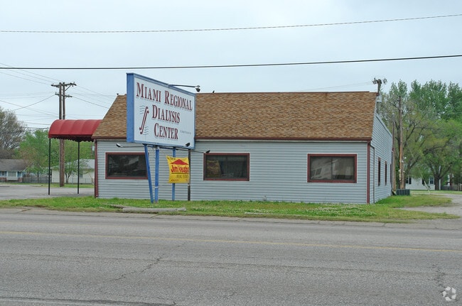
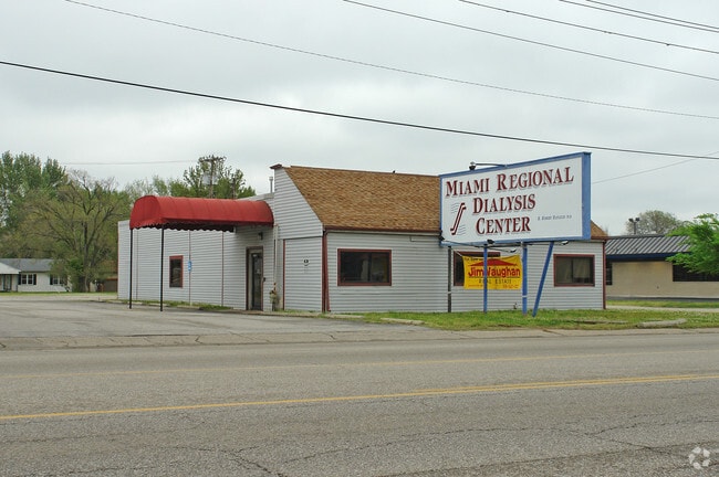
1230 N Main St, Miami, OK 74354

Property Detail
1230 N Main St
Miami, OK
LTS 1 & 2, 3, BLK 6 LIBERTY HEIGHTS ADDN (7 BREW COFFEE)
4400-00-006-001-0-000-00
OTTAWA
Commercialacreage
Oklahoma
B and X Area of moderate flood hazard, usually the area between the limits of the 100-year and 500-year floods.
1-3
2025
0.41 AC
2025
Oklahoma East Area
574300
Other Market Areas
560 SF
NEARBY LISTINGS FOR SALE OR LEASE
-
-
View all Miami listings for sale on LoopNet.com
DEMOGRAPHICS near 1230 N Main St
1 mile
3 mile
5 mile
2025 Total Population
7,598
13,797
17,699
2030 Population
7,606
13,811
17,709
Pop Growth 2025-2030
+ 0.11%
+ 0.10%
+ 0.06%
Average Age
38
39
39
2025 Total Households
2,933
5,403
6,867
HH Growth 2025-2030
+ 0.14%
+ 0.11%
+ 0.03%
Median Household Inc
$41,648
$42,993
$44,815
Avg Household Size
2.30
2.30
2.40
2025 Avg HH Vehicles
2.00
2.00
2.00
Median Home Value
$84,498
$97,332
$105,633
Median Year Built
1956
1960
1964
Nearby Places
Map Layers
Map Styles
 Street
 Aerial
Layers
 Traffic
 Biking
Places
Listings with unknown addresses are not visible on the map
- Restaurants
- Banks
- Shops
- Fitness
- Groceries
Nearby Properties
Address
Land Use
TOTAL SIZE
Lot Size
Zoning
Address
Land Use
TOTAL SIZE
Lot Size
Zoning
7,500 SF
0.28 AC
Address
Land Use
TOTAL SIZE
Lot Size
Zoning
6,204 SF
78.78 AC
Address
Land Use
TOTAL SIZE
Lot Size
Zoning
190,245 SF
19.72 AC
Address
Land Use
TOTAL SIZE
Lot Size
Zoning
88,471 SF
8.02 AC
Address
Land Use
TOTAL SIZE
Lot Size
Zoning
24,248 SF
0.69 AC
Address
Land Use
TOTAL SIZE
Lot Size
Zoning
57,600 SF
8.67 AC
Address
Land Use
TOTAL SIZE
Lot Size
Zoning
1,740 SF
4.40 AC
Address
Land Use
TOTAL SIZE
Lot Size
Zoning
6,930 SF
0.21 AC
Address
Land Use
TOTAL SIZE
Lot Size
Zoning
16,895 SF
1.03 AC
Address
Land Use
TOTAL SIZE
Lot Size
Zoning
18,879 SF
4.21 AC
Address
Land Use
TOTAL SIZE
Lot Size
Zoning
51,750 SF
4.43 AC
Address
Land Use
TOTAL SIZE
Lot Size
Zoning
15,388 SF
3.24 AC
Address
Land Use
TOTAL SIZE
Lot Size
Zoning
23,575 SF
1.66 AC
Address
Land Use
TOTAL SIZE
Lot Size
Zoning
36,113 SF
4.65 AC
Address
Land Use
TOTAL SIZE
Lot Size
Zoning
13,178 SF
2.10 AC
Address
Land Use
TOTAL SIZE
Lot Size
Zoning
30,300 SF
6.72 AC
Address
Land Use
TOTAL SIZE
Lot Size
Zoning
7,872 SF
0.90 AC
Address
Land Use
TOTAL SIZE
Lot Size
Zoning
5,903 SF
19 AC
Address
Land Use
TOTAL SIZE
Lot Size
Zoning
214,200 SF
102.45 AC
Address
Land Use
TOTAL SIZE
Lot Size
Zoning
19,095 SF
1.72 AC
Address
Land Use
TOTAL SIZE
Lot Size
Zoning
4,074 SF
9.77 AC
R2
Address
Land Use
TOTAL SIZE
Lot Size
Zoning
14,322 SF
1.82 AC
Address
Land Use
TOTAL SIZE
Lot Size
Zoning
7,000 SF
1.39 AC
Address
Land Use
TOTAL SIZE
Lot Size
Zoning
9,097 SF
1.10 AC
Address
Land Use
TOTAL SIZE
Lot Size
Zoning
62,200 SF
40 AC
Address
Land Use
TOTAL SIZE
Lot Size
Zoning
10,306 SF
0.21 AC
Address
Land Use
TOTAL SIZE
Lot Size
Zoning
2,949 SF
2.75 AC
Address
Land Use
TOTAL SIZE
Lot Size
Zoning
6,160 SF
0.46 AC
Address
Land Use
TOTAL SIZE
Lot Size
Zoning
3,556 SF
1.54 AC
The World's #1 Commercial Real Estate Marketplace
Connect with us
© 2026 CoStar Group
The information above has been obtained from sources believed reliable. While we do not doubt its accuracy we have not verified it and make no guarantee, warranty or representation about it. It is your responsibility to independently confirm its accuracy and completeness. Any projections, opinions, assumptions, or estimates used are for example only and do not represent the current or future performance of the property. The value of this transaction to you depends on tax and other factors which should be evaluated by your tax, financial, and legal advisors. You and your advisors should conduct a careful, independent investigation of the property to determine to your satisfaction the suitability of the property for your needs.