Property Record
12300 W Route 66, Bellemont, AZ 86015
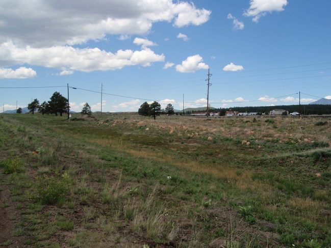

Property Detail
12300 W Route 66
Flagstaff, AZ
SIXTEENTH: NE QUARTER: NW SECTION: 01 TOWNSHIP: 21N RANGE: 05E SIXTEENTH: NW QUARTER: NW SECTION: 01 TOWNSHIP: 21N RANGE: 05E COMM AT THE INTERSECTION OF THE NLY US HWY 66 & THE ELY LINE OF THE BELLEMONT INTERCHANGE; TH S 60-01-33 E 437.33 TPOB; TH S
204-03-005M
COCONINO
Commercialacreage
Arizona
B and X Area of moderate flood hazard, usually the area between the limits of the 100-year and 500-year floods.
6 AC
2024
Flagstaff
2025
Other Market Areas
002201
NEARBY LISTINGS FOR SALE OR LEASE
DEMOGRAPHICS near 12300 W Route 66
1 mile
3 mile
5 mile
2025 Total Population
1,410
1,459
1,753
2030 Population
1,468
1,520
1,812
Pop Growth 2025-2030
+ 4.11%
+ 4.18%
+ 3.37%
Average Age
34
35
36
2025 Total Households
493
511
614
HH Growth 2025-2030
+ 3.45%
+ 3.33%
+ 2.61%
Median Household Inc
$120,950
$120,547
$120,065
Avg Household Size
2.80
2.80
2.80
2025 Avg HH Vehicles
2.00
2.00
2.00
Median Home Value
$512,195
$510,613
$588,908
Median Year Built
2004
2004
2003
Nearby Places
Map Layers
Map Styles
 Street
 Aerial
Layers
 Traffic
 Biking
Places
Listings with unknown addresses are not visible on the map
- Restaurants
- Banks
- Shops
- Fitness
- Groceries
PUBLIC TRANSPORTATION
AIRPORT
Flagstaff Pulliam
Drive
Walk
Distance
Flagstaff Pulliam
19 min
13.9 mi
Nearby Properties
Address
Land Use
TOTAL SIZE
Lot Size
Zoning
Address
Land Use
TOTAL SIZE
Lot Size
Zoning
425,176 SF
25 AC
Address
Land Use
TOTAL SIZE
Lot Size
Zoning
133,176 SF
10 AC
Address
Land Use
TOTAL SIZE
Lot Size
Zoning
43,961 SF
59.67 AC
Address
Land Use
TOTAL SIZE
Lot Size
Zoning
16,162 SF
7.35 AC
Address
Land Use
TOTAL SIZE
Lot Size
Zoning
23,644 SF
4.48 AC
Address
Land Use
TOTAL SIZE
Lot Size
Zoning
22,501 SF
1.30 AC
Address
Land Use
TOTAL SIZE
Lot Size
Zoning
16,008 SF
5.58 AC
Address
Land Use
TOTAL SIZE
Lot Size
Zoning
9,712 SF
3.57 AC
Address
Land Use
TOTAL SIZE
Lot Size
Zoning
17,700 SF
1.42 AC
Address
Land Use
TOTAL SIZE
Lot Size
Zoning
Address
Land Use
TOTAL SIZE
Lot Size
Zoning
5,438 SF
3.65 AC
Address
Land Use
TOTAL SIZE
Lot Size
Zoning
11,505 SF
0.97 AC
Address
Land Use
TOTAL SIZE
Lot Size
Zoning
Address
Land Use
TOTAL SIZE
Lot Size
Zoning
Address
Land Use
TOTAL SIZE
Lot Size
Zoning
Address
Land Use
TOTAL SIZE
Lot Size
Zoning
8,000 SF
1.36 AC
Address
Land Use
TOTAL SIZE
Lot Size
Zoning
4,800 SF
2.03 AC
Address
Land Use
TOTAL SIZE
Lot Size
Zoning
5.66 AC
Address
Land Use
TOTAL SIZE
Lot Size
Zoning
1,056 SF
5.03 AC
Address
Land Use
TOTAL SIZE
Lot Size
Zoning
3,909 SF
5 AC
Address
Land Use
TOTAL SIZE
Lot Size
Zoning
5,947 SF
1.12 AC
Address
Land Use
TOTAL SIZE
Lot Size
Zoning
Address
Land Use
TOTAL SIZE
Lot Size
Zoning
Address
Land Use
TOTAL SIZE
Lot Size
Zoning
2.90 AC
Address
Land Use
TOTAL SIZE
Lot Size
Zoning
Address
Land Use
TOTAL SIZE
Lot Size
Zoning
2,160 SF
4.79 AC
Address
Land Use
TOTAL SIZE
Lot Size
Zoning
4,000 SF
0.96 AC
The World's #1 Commercial Real Estate Marketplace
Connect with us
© 2026 CoStar Group
The information above has been obtained from sources believed reliable. While we do not doubt its accuracy we have not verified it and make no guarantee, warranty or representation about it. It is your responsibility to independently confirm its accuracy and completeness. Any projections, opinions, assumptions, or estimates used are for example only and do not represent the current or future performance of the property. The value of this transaction to you depends on tax and other factors which should be evaluated by your tax, financial, and legal advisors. You and your advisors should conduct a careful, independent investigation of the property to determine to your satisfaction the suitability of the property for your needs.