Property Record
12307 Roxie Dr, Austin, TX 78729
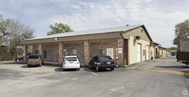

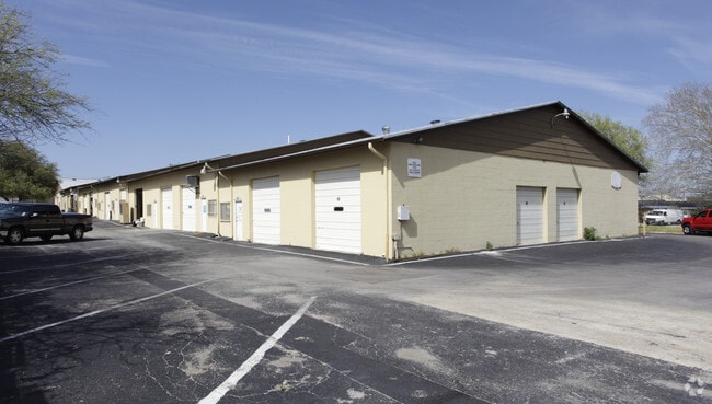

Property Detail
12307 Roxie Dr
R056381
AW0522 RHODES, H. SUR., ACRES 1.410
Commercialnec
Williamson
3-IRR
Texas
B and X Area of moderate flood hazard, usually the area between the limits of the 100-year and 500-year floods.
1.41 AC
2024
Far Northwest
2025
Austin
020406
Austin-Round Rock-San Marcos, TX
20,544 SF
NEARBY LISTINGS FOR SALE OR LEASE
-
-
View all Austin listings for lease on LoopNet.com
DEMOGRAPHICS near 12307 Roxie Dr
1 mile
3 mile
5 mile
2024 Total Population
20,264
106,222
232,098
2029 Population
22,842
116,292
252,514
Pop Growth 2024-2029
+ 12.72%
+ 9.48%
+ 8.80%
Average Age
37
38
38
2024 Total Households
9,555
46,619
99,640
HH Growth 2024-2029
+ 13.55%
+ 10.40%
+ 9.23%
Median Household Inc
$75,208
$104,002
$111,192
Avg Household Size
2.10
2.20
2.30
2024 Avg HH Vehicles
2.00
2.00
2.00
Median Home Value
$541,494
$600,941
$625,147
Median Year Built
1992
1995
1998
Nearby Places
Map Layers
Map Styles
 Street
 Aerial
Transit
 Traffic
 Biking
Places
Listings with unknown addresses are not visible on the map
- Restaurants
- Banks
- Shops
- Fitness
- Groceries
PUBLIC TRANSPORTATION
AIRPORT
Austin-Bergstrom International
Drive
Walk
Distance
Austin-Bergstrom International
38 min
25.6 mi
Freight Ports
Calhoun Port
Drive
Walk
Distance
Calhoun Port
204 min
169.1 mi
SALE & LEASE HISTORY
LISTING DATE
SALE/LEASE

Oct 14, 2016
For Lease
Jul 06, 2017
For Lease
Aug 11, 2017
For Lease
Nearby Properties
Address
Land Use
TOTAL SIZE
Lot Size
Zoning
Address
Land Use
TOTAL SIZE
Lot Size
Zoning
3,601,391 SF
159.61 AC
Address
Land Use
TOTAL SIZE
Lot Size
Zoning
13,523 SF
128.82 AC
Address
Land Use
TOTAL SIZE
Lot Size
Zoning
535,000 SF
24.46 AC
Address
Land Use
TOTAL SIZE
Lot Size
Zoning
830,637 SF
23.22 AC
Address
Land Use
TOTAL SIZE
Lot Size
Zoning
462,651 SF
81.77 AC
Address
Land Use
TOTAL SIZE
Lot Size
Zoning
557,037 SF
29.48 AC
Address
Land Use
TOTAL SIZE
Lot Size
Zoning
492,227 SF
23.59 AC
Address
Land Use
TOTAL SIZE
Lot Size
Zoning
376,081 SF
8.62 AC
Address
Land Use
TOTAL SIZE
Lot Size
Zoning
363,544 SF
8.54 AC
Address
Land Use
TOTAL SIZE
Lot Size
Zoning
381,408 SF
22.17 AC
Address
Land Use
TOTAL SIZE
Lot Size
Zoning
423,057 SF
21.90 AC
4-GRMUCO
Address
Land Use
TOTAL SIZE
Lot Size
Zoning
1,179,402 SF
92.28 AC
Address
Land Use
TOTAL SIZE
Lot Size
Zoning
493,699 SF
28.29 AC
Address
Land Use
TOTAL SIZE
Lot Size
Zoning
385,918 SF
23.61 AC
Address
Land Use
TOTAL SIZE
Lot Size
Zoning
285,120 SF
15.60 AC
Address
Land Use
TOTAL SIZE
Lot Size
Zoning
365,399 SF
11.50 AC
Address
Land Use
TOTAL SIZE
Lot Size
Zoning
370,331 SF
14.10 AC
Address
Land Use
TOTAL SIZE
Lot Size
Zoning
277,020 SF
1.41 AC
Address
Land Use
TOTAL SIZE
Lot Size
Zoning
557,037 SF
32.48 AC
Address
Land Use
TOTAL SIZE
Lot Size
Zoning
687,401 SF
20.47 AC
Address
Land Use
TOTAL SIZE
Lot Size
Zoning
400,536 SF
31.68 AC
Address
Land Use
TOTAL SIZE
Lot Size
Zoning
468,870 SF
22 AC
4-GRMUCO
Address
Land Use
TOTAL SIZE
Lot Size
Zoning
644,443 SF
7.02 AC
Address
Land Use
TOTAL SIZE
Lot Size
Zoning
331,086 SF
17.23 AC
Address
Land Use
TOTAL SIZE
Lot Size
Zoning
306,900 SF
34.50 AC
Address
Land Use
TOTAL SIZE
Lot Size
Zoning
381,556 SF
21.50 AC
Address
Land Use
TOTAL SIZE
Lot Size
Zoning
303,280 SF
16.96 AC
Address
Land Use
TOTAL SIZE
Lot Size
Zoning
408,335 SF
31.16 AC
Address
Land Use
TOTAL SIZE
Lot Size
Zoning
1,152,630 SF
23.29 AC
Address
Land Use
TOTAL SIZE
Lot Size
Zoning
410,378 SF
21.43 AC
The World's #1 Commercial Real Estate Marketplace
Connect with us
© 2026 CoStar Group
The information above has been obtained from sources believed reliable. While we do not doubt its accuracy we have not verified it and make no guarantee, warranty or representation about it. It is your responsibility to independently confirm its accuracy and completeness. Any projections, opinions, assumptions, or estimates used are for example only and do not represent the current or future performance of the property. The value of this transaction to you depends on tax and other factors which should be evaluated by your tax, financial, and legal advisors. You and your advisors should conduct a careful, independent investigation of the property to determine to your satisfaction the suitability of the property for your needs.