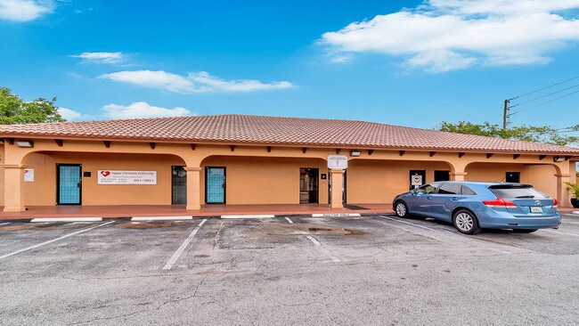
Property Record
1233 45Th St, Mangonia Park, FL 33407

NEARBY LISTINGS FOR SALE OR LEASE
Property Detail
1233 45Th St
West Palm Beach-Boca Raton-Delray Beach, FL
Acreage & Unrec
44-43-43-05-00-006-0080
5-43-43~ N 175 FT OF S 430 FT OF E 207 FT OF W 927.63 FT & N 200 FT OF S 255 FT OF E 182 FT OF W 927.63 FT OF GOV LT 6
Officebuilding
Palm Beach
X
Florida
12099C0389F
6
2024
0.30 AC
2025
North Palm Beach
001402
South Florida
4,784 SF
DEMOGRAPHICS near 1233 45Th St
1 Mile
3 Mile
5 Mile
2024 Total Population
10,815
115,357
228,018
2029 Population
11,572
121,063
239,642
Pop Growth 2024-2029
+ 7.00%
+ 4.95%
+ 5.10%
Average Age
35
38
42
2024 Total Households
3,499
43,951
95,123
HH Growth 2024-2029
+ 6.46%
+ 4.40%
+ 4.94%
Median Household Inc
$45,652
$52,403
$56,925
Avg Household Size
2.90
2.40
2.30
2024 Avg HH Vehicles
1.00
1.00
1.00
Median Home Value
$217,308
$251,930
$294,224
Median Year Built
1977
1984
1982
Nearby Places
Map Layers
Map Styles
 Street
 Aerial
- Restaurants
- Banks
- Shops
- Fitness
- Groceries
PUBLIC TRANSPORTATION
TRANSIT/SUBWAY
Mangonia Park (Tri-County Commuter - South Florida Regional Transportation Authority (Tri-Rail))
DRIVE
WALK
Distance
Mangonia Park (Tri-County Commuter - South Florida Regional Transportation Authority (Tri-Rail))
4 min
15 min
0.8 mi
COMMUTER RAIL
Mangonia Park (Tri-County Commuter - South Florida Regional Transportation Authority (Tri-Rail))
DRIVE
WALK
Distance
Mangonia Park (Tri-County Commuter - South Florida Regional Transportation Authority (Tri-Rail))
4 min
15 min
0.8 mi
West Palm Beach (Tri-County Commuter - South Florida Regional Transportation Authority (Tri-Rail))
DRIVE
WALK
Distance
West Palm Beach (Tri-County Commuter - South Florida Regional Transportation Authority (Tri-Rail))
8 min
3.5 mi
AIRPORT
Palm Beach International
DRIVE
WALK
Distance
Palm Beach International
15 min
7.1 mi
Freight Ports
Port of Palm Beach
DRIVE
WALK
Distance
Port of Palm Beach
7 min
2.8 mi
SALE & LEASE HISTORY
LISTING DATE
SALE/LEASE

Sep 15, 2018
For Sale
Oct 18, 2019
For Lease
Feb 04, 2019
For Sale
Nearby Properties
Address
Land Use
TOTAL SIZE
Lot Size
Zoning
Address
Land Use
TOTAL SIZE
Lot Size
Zoning
492,288 SF
58.55 AC
CPD
Address
Land Use
TOTAL SIZE
Lot Size
Zoning
656,724 SF
4.94 AC
DPD
Address
Land Use
TOTAL SIZE
Lot Size
Zoning
746,972 SF
5.09 AC
CMPD
Address
Land Use
TOTAL SIZE
Lot Size
Zoning
596,079 SF
21.49 AC
RPD
Address
Land Use
TOTAL SIZE
Lot Size
Zoning
31,761 SF
5.76 AC
R-A
Address
Land Use
TOTAL SIZE
Lot Size
Zoning
303,776 SF
27.63 AC
CPD
Address
Land Use
TOTAL SIZE
Lot Size
Zoning
586,386 SF
19.67 AC
RPD
Address
Land Use
TOTAL SIZE
Lot Size
Zoning
739,813 SF
81.18 AC
CSPD
Address
Land Use
TOTAL SIZE
Lot Size
Zoning
546,847 SF
19.50 AC
RPD
Address
Land Use
TOTAL SIZE
Lot Size
Zoning
292,001 SF
1.15 AC
DPD
Address
Land Use
TOTAL SIZE
Lot Size
Zoning
411,080 SF
7.59 AC
CPD
Address
Land Use
TOTAL SIZE
Lot Size
Zoning
292,706 SF
30.75 AC
RPD
Address
Land Use
TOTAL SIZE
Lot Size
Zoning
740,411 SF
12.88 AC
CSPD
Address
Land Use
TOTAL SIZE
Lot Size
Zoning
368,320 SF
23.07 AC
CLIC
Address
Land Use
TOTAL SIZE
Lot Size
Zoning
279,601 SF
2.45 AC
LD-10
Address
Land Use
TOTAL SIZE
Lot Size
Zoning
224,212 SF
141.33 AC
CSPD
Address
Land Use
TOTAL SIZE
Lot Size
Zoning
293,524 SF
11.14 AC
RPD
Address
Land Use
TOTAL SIZE
Lot Size
Zoning
491,790 SF
6.08 AC
DPD
Address
Land Use
TOTAL SIZE
Lot Size
Zoning
297,251 SF
2.54 AC
NWD-2
Address
Land Use
TOTAL SIZE
Lot Size
Zoning
2.23 AC
R-AA
Address
Land Use
TOTAL SIZE
Lot Size
Zoning
232,751 SF
12.67 AC
RPD
Address
Land Use
TOTAL SIZE
Lot Size
Zoning
433,243 SF
40.26 AC
RM-15
Address
Land Use
TOTAL SIZE
Lot Size
Zoning
307,554 SF
6.10 AC
CSPD
Address
Land Use
TOTAL SIZE
Lot Size
Zoning
247,028 SF
14.30 AC
RS
Address
Land Use
TOTAL SIZE
Lot Size
Zoning
177,585 SF
9.90 AC
CPD
Address
Land Use
TOTAL SIZE
Lot Size
Zoning
444,168 SF
2.90 AC
FWD-5
Address
Land Use
TOTAL SIZE
Lot Size
Zoning
219,117 SF
4.15 AC
CPD
Address
Land Use
TOTAL SIZE
Lot Size
Zoning
175,119 SF
6.97 AC
QBD-10
Address
Land Use
TOTAL SIZE
Lot Size
Zoning
169,799 SF
2.76 AC
QGD-10
Address
Land Use
TOTAL SIZE
Lot Size
Zoning
5.81 AC
CMPD
The World's #1 Commercial Real Estate Marketplace
Connect with us
© 2026 CoStar Group
The information above has been obtained from sources believed reliable. While we do not doubt its accuracy we have not verified it and make no guarantee, warranty or representation about it. It is your responsibility to independently confirm its accuracy and completeness. Any projections, opinions, assumptions, or estimates used are for example only and do not represent the current or future performance of the property. The value of this transaction to you depends on tax and other factors which should be evaluated by your tax, financial, and legal advisors. You and your advisors should conduct a careful, independent investigation of the property to determine to your satisfaction the suitability of the property for your needs.