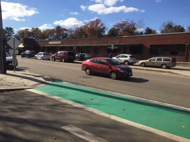
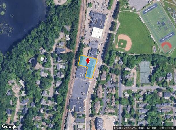
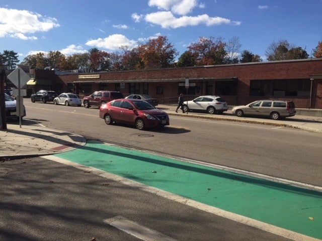
Property Record
1233 Highland Ave, Needham, MA 02492

Current Lease Availabilities
Property Detail
1233 Highland Ave
Officebuilding
NORFOLK
BUS
Massachusetts
B and X Area of moderate flood hazard, usually the area between the limits of the 100-year and 500-year floods.
0.55 AC
2025
Wellesley/Needham
2025
Boston
457200
Boston-Cambridge-Newton, MA-NH
17,051 SF
NEED-000052-000002
NEARBY LISTINGS FOR SALE OR LEASE
DEMOGRAPHICS near 1233 Highland Ave
1 mile
3 mile
5 mile
2025 Total Population
17,373
69,163
208,374
2030 Population
17,832
71,533
214,860
Pop Growth 2025-2030
+ 2.64%
+ 3.43%
+ 3.11%
Average Age
41
42
42
2025 Total Households
6,082
23,986
75,158
HH Growth 2025-2030
+ 2.86%
+ 3.71%
+ 3.27%
Median Household Inc
$220,272
$215,917
$184,414
Avg Household Size
2.80
2.70
2.60
2025 Avg HH Vehicles
2.00
2.00
2.00
Median Home Value
$1,093,147
$1,095,688
$1,050,200
Median Year Built
1956
1958
1953
Nearby Places
Map Layers
Map Styles
 Street
 Aerial
Transit
 Traffic
 Biking
Places
Listings with unknown addresses are not visible on the map
- Restaurants
- Banks
- Shops
- Fitness
- Groceries
PUBLIC TRANSPORTATION
TRANSIT/SUBWAY
Needham Center (Needham Line - Massachusetts Bay Transportation Authority Commuter Rail (Purple Line))
Drive
Walk
Distance
Needham Center (Needham Line - Massachusetts Bay Transportation Authority Commuter Rail (Purple Line))
1 min
8 min
0.4 mi
Needham Heights (Needham Line - Massachusetts Bay Transportation Authority Commuter Rail (Purple Line))
Drive
Walk
Distance
Needham Heights (Needham Line - Massachusetts Bay Transportation Authority Commuter Rail (Purple Line))
1 min
12 min
0.6 mi
Needham Junction (Needham Line - Massachusetts Bay Transportation Authority Commuter Rail (Purple Line))
Drive
Walk
Distance
Needham Junction (Needham Line - Massachusetts Bay Transportation Authority Commuter Rail (Purple Line))
2 min
17 min
0.9 mi
COMMUTER RAIL
Needham Center (Needham Line - Massachusetts Bay Transportation Authority Commuter Rail (Purple Line))
Drive
Walk
Distance
Needham Center (Needham Line - Massachusetts Bay Transportation Authority Commuter Rail (Purple Line))
1 min
7 min
0.4 mi
Needham Heights (Needham Line - Massachusetts Bay Transportation Authority Commuter Rail (Purple Line))
Drive
Walk
Distance
Needham Heights (Needham Line - Massachusetts Bay Transportation Authority Commuter Rail (Purple Line))
1 min
12 min
0.6 mi
AIRPORT
General Edward Lawrence Logan International
Drive
Walk
Distance
General Edward Lawrence Logan International
29 min
16.4 mi
Worcester Regional
Drive
Walk
Distance
Worcester Regional
61 min
35.8 mi
Freight Ports
Port of Boston
Drive
Walk
Distance
Port of Boston
28 min
14.8 mi
Nearby Properties
Address
Land Use
TOTAL SIZE
Lot Size
Zoning
Address
Land Use
TOTAL SIZE
Lot Size
Zoning
30,845 SF
50.36 AC
SR1
Address
Land Use
TOTAL SIZE
Lot Size
Zoning
387,550 SF
7.99 AC
MU1
Address
Land Use
TOTAL SIZE
Lot Size
Zoning
412,208 SF
7.93 AC
I
Address
Land Use
TOTAL SIZE
Lot Size
Zoning
522,600 SF
59.54 AC
A2
Address
Land Use
TOTAL SIZE
Lot Size
Zoning
4.74 AC
NEBC
Address
Land Use
TOTAL SIZE
Lot Size
Zoning
76,800 SF
22.65 AC
MU1
Address
Land Use
TOTAL SIZE
Lot Size
Zoning
15,974 SF
2.45 AC
ED
Address
Land Use
TOTAL SIZE
Lot Size
Zoning
151,232 SF
8.27 AC
PUB
Address
Land Use
TOTAL SIZE
Lot Size
Zoning
220,500 SF
1.96 AC
NEBC
Address
Land Use
TOTAL SIZE
Lot Size
Zoning
208,500 SF
13.98 AC
I
Address
Land Use
TOTAL SIZE
Lot Size
Zoning
59.94 AC
PUB
Address
Land Use
TOTAL SIZE
Lot Size
Zoning
Address
Land Use
TOTAL SIZE
Lot Size
Zoning
Address
Land Use
TOTAL SIZE
Lot Size
Zoning
264,014 SF
10.64 AC
NEBC
Address
Land Use
TOTAL SIZE
Lot Size
Zoning
15.08 AC
SR10
Address
Land Use
TOTAL SIZE
Lot Size
Zoning
408,199 SF
23.35 AC
NEBC
Address
Land Use
TOTAL SIZE
Lot Size
Zoning
96,167 SF
8.04 AC
PUB
Address
Land Use
TOTAL SIZE
Lot Size
Zoning
4,216 SF
6.02 AC
SRA
Address
Land Use
TOTAL SIZE
Lot Size
Zoning
260,552 SF
12.80 AC
LMD
Address
Land Use
TOTAL SIZE
Lot Size
Zoning
211,500 SF
12.09 AC
I
Address
Land Use
TOTAL SIZE
Lot Size
Zoning
Address
Land Use
TOTAL SIZE
Lot Size
Zoning
15 AC
Address
Land Use
TOTAL SIZE
Lot Size
Zoning
121,141 SF
19.58 AC
SR1
Address
Land Use
TOTAL SIZE
Lot Size
Zoning
224,517 SF
14 AC
B
Address
Land Use
TOTAL SIZE
Lot Size
Zoning
3.80 AC
Address
Land Use
TOTAL SIZE
Lot Size
Zoning
13,244 SF
12.72 AC
SR10
Address
Land Use
TOTAL SIZE
Lot Size
Zoning
140,920 SF
4.44 AC
CS
Address
Land Use
TOTAL SIZE
Lot Size
Zoning
100,963 SF
17.69 AC
A
Address
Land Use
TOTAL SIZE
Lot Size
Zoning
94.34 AC
E
Address
Land Use
TOTAL SIZE
Lot Size
Zoning
65,866 SF
1.98 AC
PUB
The World's #1 Commercial Real Estate Marketplace
Connect with us
© 2026 CoStar Group
The information above has been obtained from sources believed reliable. While we do not doubt its accuracy we have not verified it and make no guarantee, warranty or representation about it. It is your responsibility to independently confirm its accuracy and completeness. Any projections, opinions, assumptions, or estimates used are for example only and do not represent the current or future performance of the property. The value of this transaction to you depends on tax and other factors which should be evaluated by your tax, financial, and legal advisors. You and your advisors should conduct a careful, independent investigation of the property to determine to your satisfaction the suitability of the property for your needs.