Property Record
1234 Round Table Dr, Dallas, TX 75247
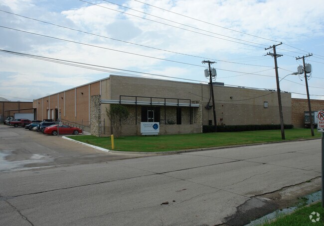

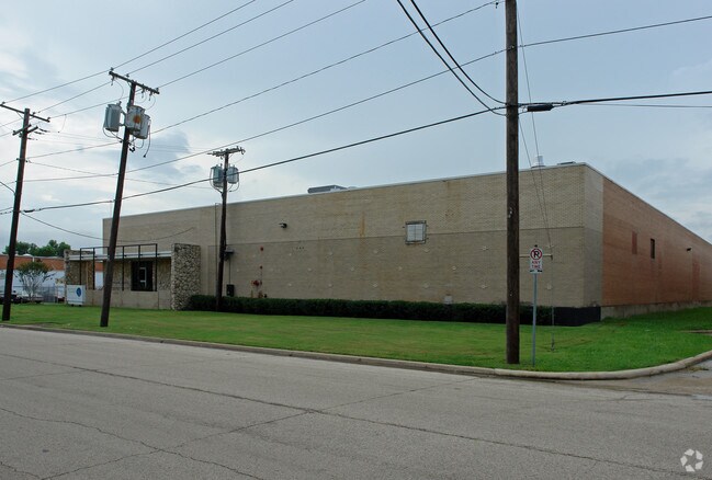

Property Detail
1234 Round Table Dr
Dallas-Fort Worth-Arlington, TX
KINGS ROW INDUSTRIAL DIST 1 BLK 2/7941 LT 3 & ABND DART SPUR ACS 1.3084 INT201000096840 DD04192010 CO-DC 7941 002 00300 2007941 002
00000779791000000
DALLAS
Warehouse
Texas
Z116
3
2024
1.31 AC
2025
West Brookhollow
010003
Dallas/Ft Worth
24,381 SF
NEARBY LISTINGS FOR SALE OR LEASE
DEMOGRAPHICS near 1234 Round Table Dr
1 mile
3 mile
5 mile
2025 Total Population
128
58,895
263,369
2030 Population
132
61,010
273,355
Pop Growth 2025-2030
+ 3.13%
+ 3.59%
+ 3.79%
Average Age
35
34
37
2025 Total Households
73
21,026
106,796
HH Growth 2025-2030
+ 4.11%
+ 3.80%
+ 4.03%
Median Household Inc
$72,655
$60,002
$80,965
Avg Household Size
1.60
2.70
2.40
2025 Avg HH Vehicles
1.00
2.00
2.00
Median Home Value
$99,999
$287,332
$408,038
Median Year Built
2010
1979
1984
Nearby Places
Map Layers
Map Styles
 Street
 Aerial
Transit
 Traffic
 Biking
Places
Listings with unknown addresses are not visible on the map
- Restaurants
- Banks
- Shops
- Fitness
- Groceries
PUBLIC TRANSPORTATION
COMMUTER RAIL
Drive
Walk
Distance
7 min
3.7 mi
Drive
Walk
Distance
10 min
5.8 mi
AIRPORT
Dallas Love Field
Drive
Walk
Distance
Dallas Love Field
12 min
4.7 mi
Dallas-Fort Worth International
Drive
Walk
Distance
Dallas-Fort Worth International
19 min
14.2 mi
Nearby Properties
Address
Land Use
TOTAL SIZE
Lot Size
Zoning
Address
Land Use
TOTAL SIZE
Lot Size
Zoning
2,476 SF
1,203.03 AC
Z116
Address
Land Use
TOTAL SIZE
Lot Size
Zoning
2,271,924 SF
Address
Land Use
TOTAL SIZE
Lot Size
Zoning
4,407,366 SF
1,300 AC
IR
Address
Land Use
TOTAL SIZE
Lot Size
Zoning
1,228,418 SF
24.51 AC
Z151
Address
Land Use
TOTAL SIZE
Lot Size
Zoning
584,652 SF
22.90 AC
Z150
Address
Land Use
TOTAL SIZE
Lot Size
Zoning
30,000 SF
78.01 AC
Z392
Address
Land Use
TOTAL SIZE
Lot Size
Zoning
1,898,977 SF
42.38 AC
Z239
Address
Land Use
TOTAL SIZE
Lot Size
Zoning
618,535 SF
1,300 AC
IR
Address
Land Use
TOTAL SIZE
Lot Size
Zoning
641,711 SF
5.38 AC
Z239
Address
Land Use
TOTAL SIZE
Lot Size
Zoning
260,521 SF
30.07 AC
Z150
Address
Land Use
TOTAL SIZE
Lot Size
Zoning
152,036 SF
3.23 AC
Z239
Address
Land Use
TOTAL SIZE
Lot Size
Zoning
253,580 SF
188.04 AC
Z393
Address
Land Use
TOTAL SIZE
Lot Size
Zoning
507,008 SF
5.07 AC
Z239
Address
Land Use
TOTAL SIZE
Lot Size
Zoning
533,342 SF
5.86 AC
Z239
Address
Land Use
TOTAL SIZE
Lot Size
Zoning
1,478,720 SF
6.79 AC
Z239
Address
Land Use
TOTAL SIZE
Lot Size
Zoning
1,333,090 SF
19.81 AC
Z150
Address
Land Use
TOTAL SIZE
Lot Size
Zoning
586,073 SF
6 AC
Z239
Address
Land Use
TOTAL SIZE
Lot Size
Zoning
272,424 SF
3.69 AC
Z151
Address
Land Use
TOTAL SIZE
Lot Size
Zoning
174,728 SF
223.82 AC
Z298
Address
Land Use
TOTAL SIZE
Lot Size
Zoning
399,655 SF
6.01 AC
Z116
Address
Land Use
TOTAL SIZE
Lot Size
Zoning
100 SF
33.22 AC
Z151
Address
Land Use
TOTAL SIZE
Lot Size
Zoning
100 SF
29.74 AC
Z150
Address
Land Use
TOTAL SIZE
Lot Size
Zoning
343,192 SF
14.99 AC
Z151
Address
Land Use
TOTAL SIZE
Lot Size
Zoning
443,319 SF
7.82 AC
Z115
Address
Land Use
TOTAL SIZE
Lot Size
Zoning
310,154 SF
10.33 AC
Z393
Address
Land Use
TOTAL SIZE
Lot Size
Zoning
348,013 SF
11.09 AC
Z243
Address
Land Use
TOTAL SIZE
Lot Size
Zoning
431,962 SF
6.42 AC
Z115
Address
Land Use
TOTAL SIZE
Lot Size
Zoning
468,318 SF
3.32 AC
Z151
Address
Land Use
TOTAL SIZE
Lot Size
Zoning
429,201 SF
3.80 AC
Z116
Address
Land Use
TOTAL SIZE
Lot Size
Zoning
317,836 SF
2.52 AC
Z115
The World's #1 Commercial Real Estate Marketplace
Connect with us
© 2026 CoStar Group
The information above has been obtained from sources believed reliable. While we do not doubt its accuracy we have not verified it and make no guarantee, warranty or representation about it. It is your responsibility to independently confirm its accuracy and completeness. Any projections, opinions, assumptions, or estimates used are for example only and do not represent the current or future performance of the property. The value of this transaction to you depends on tax and other factors which should be evaluated by your tax, financial, and legal advisors. You and your advisors should conduct a careful, independent investigation of the property to determine to your satisfaction the suitability of the property for your needs.