Property Record
12345 S 193Rd East Ave, Broken Arrow, OK 74014

NEARBY LISTINGS FOR SALE OR LEASE
Property Detail
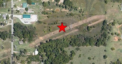
12345 S 193Rd East Ave
730009824
Indian Base & Meridian
Privateutilityelectricwatergasnuclearsolarwindetc
06-17-15 BEG PT W LINE OF 6-17-15 SD PT BEING 548.5' N OF SW COR OF L5 -N 548.5' -E 1293.34' TO E LINE OF L5 -S 549.4'-W1292.
X
Wagoner
40143C0457M
Oklahoma
2024
15.20 AC
2025
Wagoner County
030601
Tulsa
6,000 SF
Tulsa, OK
DEMOGRAPHICS near 12345 S 193Rd East Ave
1 Mile
3 Mile
5 Mile
2024 Total Population
1,452
21,712
67,514
2029 Population
1,585
23,186
72,174
Pop Growth 2024-2029
+ 9.16%
+ 6.79%
+ 6.90%
Average Age
41
40
39
2024 Total Households
523
8,201
25,285
HH Growth 2024-2029
+ 8.99%
+ 6.60%
+ 6.76%
Median Household Inc
$97,916
$85,622
$79,133
Avg Household Size
2.70
2.60
2.60
2024 Avg HH Vehicles
2.00
2.00
2.00
Median Home Value
$293,356
$230,673
$213,422
Median Year Built
1996
1987
1987
Nearby Places
Map Layers
Map Styles
 Street
 Aerial
- Restaurants
- Banks
- Shops
- Fitness
- Groceries
PUBLIC TRANSPORTATION
AIRPORT
Tulsa International
DRIVE
WALK
Distance
Tulsa International
33 min
23.3 mi
Freight Ports
Tulsa Port of Inola
DRIVE
WALK
Distance
Tulsa Port of Inola
35 min
28.4 mi
SALE & LEASE HISTORY
LISTING DATE
SALE/LEASE

Sep 24, 2016
For Sale
Jun 07, 2017
For Sale
Jun 03, 2017
For Sale
Jul 28, 2017
For Sale
Jan 05, 2017
For Sale
Aug 02, 2017
For Sale
Apr 25, 2017
For Sale
Apr 10, 2017
For Sale
Apr 07, 2017
For Sale
Apr 05, 2017
For Sale
Nearby Properties
Address
Land Use
TOTAL SIZE
Lot Size
Zoning
Address
Land Use
TOTAL SIZE
Lot Size
Zoning
37.23 AC
A1
Address
Land Use
TOTAL SIZE
Lot Size
Zoning
35,954 SF
27.97 AC
CN
Address
Land Use
TOTAL SIZE
Lot Size
Zoning
245,436 SF
12.21 AC
RM
Address
Land Use
TOTAL SIZE
Lot Size
Zoning
3,300 SF
40 AC
A1
Address
Land Use
TOTAL SIZE
Lot Size
Zoning
11,800 SF
2.45 AC
A1
Address
Land Use
TOTAL SIZE
Lot Size
Zoning
222,536 SF
11.31 AC
CN
Address
Land Use
TOTAL SIZE
Lot Size
Zoning
27,531 SF
4.46 AC
R2
Address
Land Use
TOTAL SIZE
Lot Size
Zoning
Address
Land Use
TOTAL SIZE
Lot Size
Zoning
33,181 SF
4.54 AC
R1
Address
Land Use
TOTAL SIZE
Lot Size
Zoning
210,976 SF
22.52 AC
CG
Address
Land Use
TOTAL SIZE
Lot Size
Zoning
25,615 SF
4.62 AC
A1
Address
Land Use
TOTAL SIZE
Lot Size
Zoning
103,411 SF
24.39 AC
CN
Address
Land Use
TOTAL SIZE
Lot Size
Zoning
18,488 SF
4.43 AC
A1
Address
Land Use
TOTAL SIZE
Lot Size
Zoning
7,961 SF
9.10 AC
Address
Land Use
TOTAL SIZE
Lot Size
Zoning
112,420 SF
4.07 AC
IL
Address
Land Use
TOTAL SIZE
Lot Size
Zoning
60,575 SF
2.77 AC
CH
Address
Land Use
TOTAL SIZE
Lot Size
Zoning
1,560 SF
290 AC
Address
Land Use
TOTAL SIZE
Lot Size
Zoning
11,919 SF
16.77 AC
R2
Address
Land Use
TOTAL SIZE
Lot Size
Zoning
2,380 SF
1.06 AC
A1
Address
Land Use
TOTAL SIZE
Lot Size
Zoning
45,838 SF
8.83 AC
CG
Address
Land Use
TOTAL SIZE
Lot Size
Zoning
6,400 SF
14.96 AC
Address
Land Use
TOTAL SIZE
Lot Size
Zoning
11.34 AC
A1
Address
Land Use
TOTAL SIZE
Lot Size
Zoning
6,414 SF
11.91 AC
R2
Address
Land Use
TOTAL SIZE
Lot Size
Zoning
127,319 SF
10.57 AC
IL
Address
Land Use
TOTAL SIZE
Lot Size
Zoning
12,335 SF
4.62 AC
A1
Address
Land Use
TOTAL SIZE
Lot Size
Zoning
100,930 SF
6.88 AC
RM
Address
Land Use
TOTAL SIZE
Lot Size
Zoning
4,400 SF
0.39 AC
ON
Address
Land Use
TOTAL SIZE
Lot Size
Zoning
4,638 SF
0.86 AC
CG
Address
Land Use
TOTAL SIZE
Lot Size
Zoning
75,303 SF
4.93 AC
RM
Address
Land Use
TOTAL SIZE
Lot Size
Zoning
4,732 SF
4.47 AC
A1
The World's #1 Commercial Real Estate Marketplace
Connect with us
© 2026 CoStar Group
The information above has been obtained from sources believed reliable. While we do not doubt its accuracy we have not verified it and make no guarantee, warranty or representation about it. It is your responsibility to independently confirm its accuracy and completeness. Any projections, opinions, assumptions, or estimates used are for example only and do not represent the current or future performance of the property. The value of this transaction to you depends on tax and other factors which should be evaluated by your tax, financial, and legal advisors. You and your advisors should conduct a careful, independent investigation of the property to determine to your satisfaction the suitability of the property for your needs.