Property Record
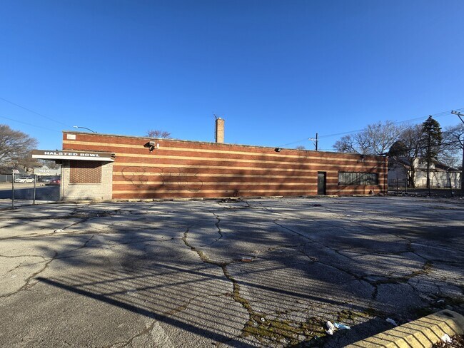
12341 S Halsted St, Chicago, IL 60628


NEARBY LISTINGS FOR SALE OR LEASE
Property Detail
12341 S Halsted St
Chicago-Naperville-Elgin, IL-IN-WI
Second Add To West Pullman
25-28-300-043-0000
(SECOND) ADD TO (WEST) (PULLMAN) BEING PT OF WH SW SEC 28-37-14
Bowlingalley
Cook
X
Illinois
17031C0645J
27,28
2023
0.37 AC
2024
South Chicago
491000
Chicago
15,608 SF
DEMOGRAPHICS near 12341 S Halsted St
1 Mile
3 Mile
5 Mile
2024 Total Population
20,560
140,422
358,173
2029 Population
20,069
137,276
349,847
Pop Growth 2024-2029
(2.39%)
(2.24%)
(2.32%)
Average Age
41
40
40
2024 Total Households
7,608
52,756
133,755
HH Growth 2024-2029
(2.79%)
(2.59%)
(2.68%)
Median Household Inc
$56,332
$47,194
$53,805
Avg Household Size
2.60
2.60
2.60
2024 Avg HH Vehicles
1.00
1.00
1.00
Median Home Value
$127,901
$144,468
$165,831
Median Year Built
1954
1952
1955
Nearby Places
Map Layers
Map Styles
 Street
 Aerial
- Restaurants
- Banks
- Shops
- Fitness
- Groceries
PUBLIC TRANSPORTATION
TRANSIT/SUBWAY
West Pullman Station (Metra Electric Line - Northeast Illinois Regional Commuter Railroad (Metra))
DRIVE
WALK
Distance
West Pullman Station (Metra Electric Line - Northeast Illinois Regional Commuter Railroad (Metra))
2 min
8 min
0.4 mi
Racine Avenue Station (Metra Electric Line - Northeast Illinois Regional Commuter Railroad (Metra))
DRIVE
WALK
Distance
Racine Avenue Station (Metra Electric Line - Northeast Illinois Regional Commuter Railroad (Metra))
4 min
19 min
1.0 mi
COMMUTER RAIL
West Pullman Station (Metra Electric Line - Northeast Illinois Regional Commuter Railroad (Metra))
DRIVE
WALK
Distance
West Pullman Station (Metra Electric Line - Northeast Illinois Regional Commuter Railroad (Metra))
2 min
8 min
0.4 mi
Stewart Ridge Station (Metra Electric Line - Northeast Illinois Regional Commuter Railroad (Metra))
DRIVE
WALK
Distance
Stewart Ridge Station (Metra Electric Line - Northeast Illinois Regional Commuter Railroad (Metra))
5 min
16 min
0.8 mi
AIRPORT
Chicago Midway International
DRIVE
WALK
Distance
Chicago Midway International
27 min
15.2 mi
Chicago O'Hare International
DRIVE
WALK
Distance
Chicago O'Hare International
53 min
33.4 mi
SALE & LEASE HISTORY
LISTING DATE
SALE/LEASE

May 02, 2017
For Sale
Jun 04, 2020
For Sale
Aug 01, 2017
For Lease
Apr 18, 2024
For Sale
Nearby Properties
Address
Land Use
TOTAL SIZE
Lot Size
Zoning
Address
Land Use
TOTAL SIZE
Lot Size
Zoning
8 AC
PD 1168
Address
Land Use
TOTAL SIZE
Lot Size
Zoning
0.51 AC
PD 1168
Address
Land Use
TOTAL SIZE
Lot Size
Zoning
1.08 AC
PD 1168
Address
Land Use
TOTAL SIZE
Lot Size
Zoning
11 AC
PD 1168
Address
Land Use
TOTAL SIZE
Lot Size
Zoning
307,335 SF
24.17 AC
PD 770
Address
Land Use
TOTAL SIZE
Lot Size
Zoning
63,930 SF
3.49 AC
PD 181
Address
Land Use
TOTAL SIZE
Lot Size
Zoning
162,000 SF
20.94 AC
PD 1167
Address
Land Use
TOTAL SIZE
Lot Size
Zoning
Address
Land Use
TOTAL SIZE
Lot Size
Zoning
83,005 SF
3.11 AC
Address
Land Use
TOTAL SIZE
Lot Size
Zoning
380,924 SF
19.13 AC
Address
Land Use
TOTAL SIZE
Lot Size
Zoning
129,837 SF
10.44 AC
PD 770
Address
Land Use
TOTAL SIZE
Lot Size
Zoning
Address
Land Use
TOTAL SIZE
Lot Size
Zoning
1 AC
RS-3
Address
Land Use
TOTAL SIZE
Lot Size
Zoning
162,379 SF
10.59 AC
Address
Land Use
TOTAL SIZE
Lot Size
Zoning
155,765 SF
8.75 AC
PD 1167
Address
Land Use
TOTAL SIZE
Lot Size
Zoning
451,400 SF
26.59 AC
M3-3
Address
Land Use
TOTAL SIZE
Lot Size
Zoning
1.71 AC
PD 1168
Address
Land Use
TOTAL SIZE
Lot Size
Zoning
63,700 SF
0.74 AC
C1-1
Address
Land Use
TOTAL SIZE
Lot Size
Zoning
Address
Land Use
TOTAL SIZE
Lot Size
Zoning
67,348 SF
6.33 AC
PD 131
Address
Land Use
TOTAL SIZE
Lot Size
Zoning
216,386 SF
16.84 AC
PD 42
Address
Land Use
TOTAL SIZE
Lot Size
Zoning
440,257 SF
18.83 AC
M3-3
Address
Land Use
TOTAL SIZE
Lot Size
Zoning
1.38 AC
PD 1168
Address
Land Use
TOTAL SIZE
Lot Size
Zoning
7.13 AC
PD 1167
Address
Land Use
TOTAL SIZE
Lot Size
Zoning
15,600 SF
7.77 AC
PMD 10
Address
Land Use
TOTAL SIZE
Lot Size
Zoning
204,900 SF
26.56 AC
M3-3
Address
Land Use
TOTAL SIZE
Lot Size
Zoning
93,739 SF
1.11 AC
RS-3
Address
Land Use
TOTAL SIZE
Lot Size
Zoning
170,680 SF
15.28 AC
M3-3
Address
Land Use
TOTAL SIZE
Lot Size
Zoning
2,888 SF
16.72 AC
PD 1091
Address
Land Use
TOTAL SIZE
Lot Size
Zoning
164,858 SF
47.80 AC
M3-3
The World's #1 Commercial Real Estate Marketplace
Connect with us
© 2025 CoStar Group
The information above has been obtained from sources believed reliable. While we do not doubt its accuracy we have not verified it and make no guarantee, warranty or representation about it. It is your responsibility to independently confirm its accuracy and completeness. Any projections, opinions, assumptions, or estimates used are for example only and do not represent the current or future performance of the property. The value of this transaction to you depends on tax and other factors which should be evaluated by your tax, financial, and legal advisors. You and your advisors should conduct a careful, independent investigation of the property to determine to your satisfaction the suitability of the property for your needs.