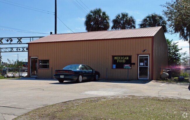
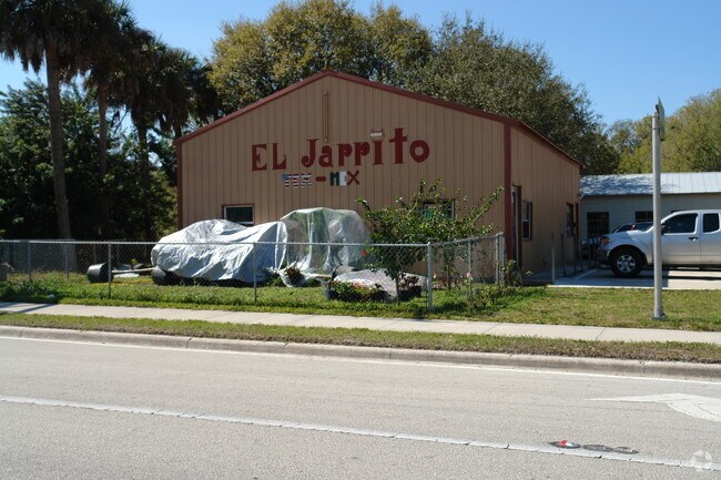
Property Record
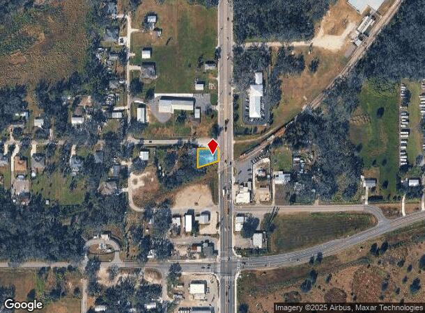
12348 Us Highway 301 N, Parrish, FL 34219
NEARBY LISTINGS FOR SALE OR LEASE
-
-
View all Parrish listings for sale on LoopNet.com
Property Detail
12348 Us Highway 301 N
North Port-Sarasota-Bradenton, FL
John Parrish Addition To Parrish
4114-0000-5
BEG AT NE COR OF LOT 25 JOHN PARRISH ADD, THENCE W 100 FT, S TO RR, ELY ON R/W TO E BDRY OF SAID LOT, N TO BEGIN LESS H/W R/W, LESS THE E 2 FT OF THE W 89.58 FT FOR RD R/W P-23
Storemultistory
Manatee
X
Florida
12081C0183F
25
2023
0.18 AC
2025
Manatee
001913
Tampa/St Petersburg
1,320 SF
DEMOGRAPHICS near 12348 Us Highway 301 N
1 Mile
3 Mile
5 Mile
2024 Total Population
1,866
17,230
42,327
2029 Population
2,224
20,294
49,940
Pop Growth 2024-2029
+ 19.19%
+ 17.78%
+ 17.99%
Average Age
39
42
45
2024 Total Households
630
6,225
16,143
HH Growth 2024-2029
+ 18.25%
+ 16.77%
+ 17.04%
Median Household Inc
$115,163
$105,803
$92,022
Avg Household Size
2.90
2.70
2.50
2024 Avg HH Vehicles
2.00
2.00
2.00
Median Home Value
$354,729
$315,459
$326,156
Median Year Built
2010
2009
2007
Nearby Places
Map Layers
Map Styles
 Street
 Aerial
- Restaurants
- Banks
- Shops
- Fitness
- Groceries
PUBLIC TRANSPORTATION
AIRPORT
Sarasota/Bradenton International
DRIVE
WALK
Distance
Sarasota/Bradenton International
38 min
20.6 mi
St Pete-Clearwater International
DRIVE
WALK
Distance
St Pete-Clearwater International
57 min
39.6 mi
Tampa International
DRIVE
WALK
Distance
Tampa International
62 min
41.4 mi
Freight Ports
Port Manatee
DRIVE
WALK
Distance
Port Manatee
19 min
10.7 mi
SALE & LEASE HISTORY
LISTING DATE
SALE/LEASE

Aug 17, 2018
For Sale
Nearby Properties
Address
Land Use
TOTAL SIZE
Lot Size
Zoning
Address
Land Use
TOTAL SIZE
Lot Size
Zoning
137.34 AC
Address
Land Use
TOTAL SIZE
Lot Size
Zoning
165.96 AC
Address
Land Use
TOTAL SIZE
Lot Size
Zoning
96.72 AC
Address
Land Use
TOTAL SIZE
Lot Size
Zoning
47.43 AC
Address
Land Use
TOTAL SIZE
Lot Size
Zoning
221.01 AC
Address
Land Use
TOTAL SIZE
Lot Size
Zoning
Address
Land Use
TOTAL SIZE
Lot Size
Zoning
50.26 AC
Address
Land Use
TOTAL SIZE
Lot Size
Zoning
19,260 SF
140.65 AC
A GENERAL
Address
Land Use
TOTAL SIZE
Lot Size
Zoning
58,569 SF
19.67 AC
A GENERAL
Address
Land Use
TOTAL SIZE
Lot Size
Zoning
66,063 SF
9.24 AC
PD-C
Address
Land Use
TOTAL SIZE
Lot Size
Zoning
158.58 AC
Address
Land Use
TOTAL SIZE
Lot Size
Zoning
43,464 SF
14.47 AC
VIL VILLAG
Address
Land Use
TOTAL SIZE
Lot Size
Zoning
43.81 AC
Address
Land Use
TOTAL SIZE
Lot Size
Zoning
50,580 SF
5.97 AC
Address
Land Use
TOTAL SIZE
Lot Size
Zoning
53,851 SF
6.32 AC
Address
Land Use
TOTAL SIZE
Lot Size
Zoning
30,101 SF
13.44 AC
PD-C
Address
Land Use
TOTAL SIZE
Lot Size
Zoning
76.98 AC
Address
Land Use
TOTAL SIZE
Lot Size
Zoning
36,700 SF
17 AC
A-1 SUBURB
Address
Land Use
TOTAL SIZE
Lot Size
Zoning
109.06 AC
Address
Land Use
TOTAL SIZE
Lot Size
Zoning
3.11 AC
Address
Land Use
TOTAL SIZE
Lot Size
Zoning
4.07 AC
Address
Land Use
TOTAL SIZE
Lot Size
Zoning
53,448 SF
3 AC
PD-C
Address
Land Use
TOTAL SIZE
Lot Size
Zoning
86.71 AC
Address
Land Use
TOTAL SIZE
Lot Size
Zoning
Address
Land Use
TOTAL SIZE
Lot Size
Zoning
27.01 AC
Address
Land Use
TOTAL SIZE
Lot Size
Zoning
25,842 SF
3.92 AC
Address
Land Use
TOTAL SIZE
Lot Size
Zoning
9,806 SF
4.04 AC
VIL VILLAG
Address
Land Use
TOTAL SIZE
Lot Size
Zoning
17,677 SF
9.52 AC
A-1 SUBURB
Address
Land Use
TOTAL SIZE
Lot Size
Zoning
113.80 AC
Address
Land Use
TOTAL SIZE
Lot Size
Zoning
The World's #1 Commercial Real Estate Marketplace
Connect with us
© 2025 CoStar Group
The information above has been obtained from sources believed reliable. While we do not doubt its accuracy we have not verified it and make no guarantee, warranty or representation about it. It is your responsibility to independently confirm its accuracy and completeness. Any projections, opinions, assumptions, or estimates used are for example only and do not represent the current or future performance of the property. The value of this transaction to you depends on tax and other factors which should be evaluated by your tax, financial, and legal advisors. You and your advisors should conduct a careful, independent investigation of the property to determine to your satisfaction the suitability of the property for your needs.