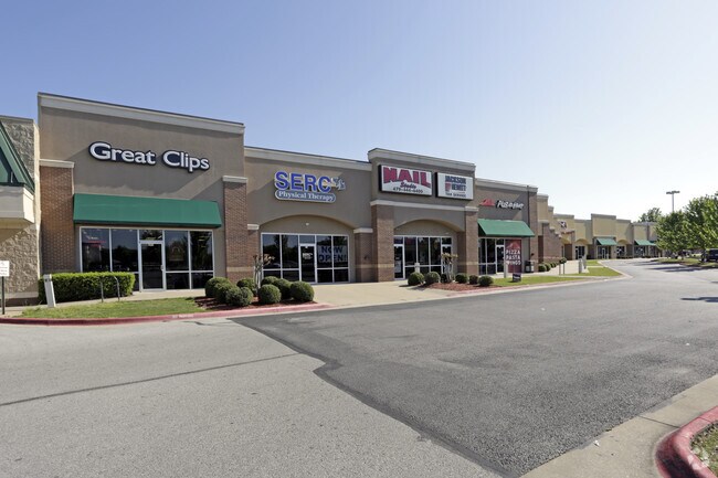
Property Record
1235 N Steamboat Dr, Fayetteville, AR 72704

NEARBY LISTINGS FOR SALE OR LEASE
Property Detail
1235 N Steamboat Dr
Fayetteville-Springdale-Rogers, AR-MO
Wedington Place Addition
765-21701-001
TRACT A LOT 3RB & PT LOT 3RA 6.446A PER PROPERTY LINE ADJ PLAT TRACTS A & B (23-220) LOT 3RB PT OF LOT 3R PER REPLAT OF LOTS
Commercialnec
Washington
X
Arkansas
05143C0204G
8
2025
6.45 AC
2025
Greater Fayetteville
010516
Fayetteville/Springdale/Rogers
56,534 SF
DEMOGRAPHICS near 1235 N Steamboat Dr
1 Mile
3 Mile
5 Mile
2024 Total Population
10,830
66,712
107,073
2029 Population
11,879
73,011
117,184
Pop Growth 2024-2029
+ 9.69%
+ 9.44%
+ 9.44%
Average Age
32
31
34
2024 Total Households
5,169
27,166
44,445
HH Growth 2024-2029
+ 9.89%
+ 10.36%
+ 10.08%
Median Household Inc
$64,980
$55,074
$61,321
Avg Household Size
2.10
2.10
2.20
2024 Avg HH Vehicles
2.00
2.00
2.00
Median Home Value
$202,018
$251,448
$266,717
Median Year Built
2000
1997
1995
Nearby Places
Map Layers
Map Styles
 Street
 Aerial
- Restaurants
- Banks
- Shops
- Fitness
- Groceries
PUBLIC TRANSPORTATION
AIRPORT
Northwest Arkansas Ntl
DRIVE
WALK
Distance
Northwest Arkansas Ntl
39 min
20.5 mi
Freight Ports
Tulsa Port of Inola
DRIVE
WALK
Distance
Tulsa Port of Inola
105 min
87.9 mi
SALE & LEASE HISTORY
LISTING DATE
SALE/LEASE

Sep 25, 2016
For Lease
Nearby Properties
Address
Land Use
TOTAL SIZE
Lot Size
Zoning
Address
Land Use
TOTAL SIZE
Lot Size
Zoning
92,872 SF
15.37 AC
Address
Land Use
TOTAL SIZE
Lot Size
Zoning
27,060 SF
26.31 AC
Address
Land Use
TOTAL SIZE
Lot Size
Zoning
316,846 SF
2.31 AC
I1
Address
Land Use
TOTAL SIZE
Lot Size
Zoning
63,080 SF
3.42 AC
Address
Land Use
TOTAL SIZE
Lot Size
Zoning
42,327 SF
13.28 AC
I1
Address
Land Use
TOTAL SIZE
Lot Size
Zoning
45,300 SF
16.38 AC
Address
Land Use
TOTAL SIZE
Lot Size
Zoning
226,792 SF
26.66 AC
Address
Land Use
TOTAL SIZE
Lot Size
Zoning
145,586 SF
2.18 AC
R3
Address
Land Use
TOTAL SIZE
Lot Size
Zoning
19,544 SF
18.79 AC
Address
Land Use
TOTAL SIZE
Lot Size
Zoning
193,590 SF
8.67 AC
I1
Address
Land Use
TOTAL SIZE
Lot Size
Zoning
16,409 SF
17.40 AC
C1
Address
Land Use
TOTAL SIZE
Lot Size
Zoning
371,436 SF
29.18 AC
I2
Address
Land Use
TOTAL SIZE
Lot Size
Zoning
176,747 SF
4.98 AC
Address
Land Use
TOTAL SIZE
Lot Size
Zoning
36,104 SF
8.36 AC
I1
Address
Land Use
TOTAL SIZE
Lot Size
Zoning
191,928 SF
0.81 AC
C4
Address
Land Use
TOTAL SIZE
Lot Size
Zoning
62,644 SF
0.49 AC
R3
Address
Land Use
TOTAL SIZE
Lot Size
Zoning
40,964 SF
10.59 AC
F
Address
Land Use
TOTAL SIZE
Lot Size
Zoning
305,272 SF
9.66 AC
R2
Address
Land Use
TOTAL SIZE
Lot Size
Zoning
121,758 SF
20.54 AC
Address
Land Use
TOTAL SIZE
Lot Size
Zoning
48,120 SF
0.53 AC
R3
Address
Land Use
TOTAL SIZE
Lot Size
Zoning
91,380 SF
9.53 AC
Address
Land Use
TOTAL SIZE
Lot Size
Zoning
13,012 SF
10.36 AC
I2
Address
Land Use
TOTAL SIZE
Lot Size
Zoning
122,309 SF
9.64 AC
Address
Land Use
TOTAL SIZE
Lot Size
Zoning
73,886 SF
6.59 AC
C2
Address
Land Use
TOTAL SIZE
Lot Size
Zoning
86,794 SF
0.33 AC
Address
Land Use
TOTAL SIZE
Lot Size
Zoning
78,284 SF
0.43 AC
Address
Land Use
TOTAL SIZE
Lot Size
Zoning
171,828 SF
9.95 AC
R2
Address
Land Use
TOTAL SIZE
Lot Size
Zoning
254,783 SF
26.49 AC
C2
Address
Land Use
TOTAL SIZE
Lot Size
Zoning
22,208 SF
5.22 AC
Address
Land Use
TOTAL SIZE
Lot Size
Zoning
259,706 SF
5.31 AC
C2
The World's #1 Commercial Real Estate Marketplace
Connect with us
© 2025 CoStar Group
The information above has been obtained from sources believed reliable. While we do not doubt its accuracy we have not verified it and make no guarantee, warranty or representation about it. It is your responsibility to independently confirm its accuracy and completeness. Any projections, opinions, assumptions, or estimates used are for example only and do not represent the current or future performance of the property. The value of this transaction to you depends on tax and other factors which should be evaluated by your tax, financial, and legal advisors. You and your advisors should conduct a careful, independent investigation of the property to determine to your satisfaction the suitability of the property for your needs.