Property Record
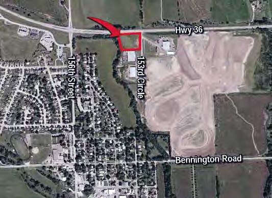
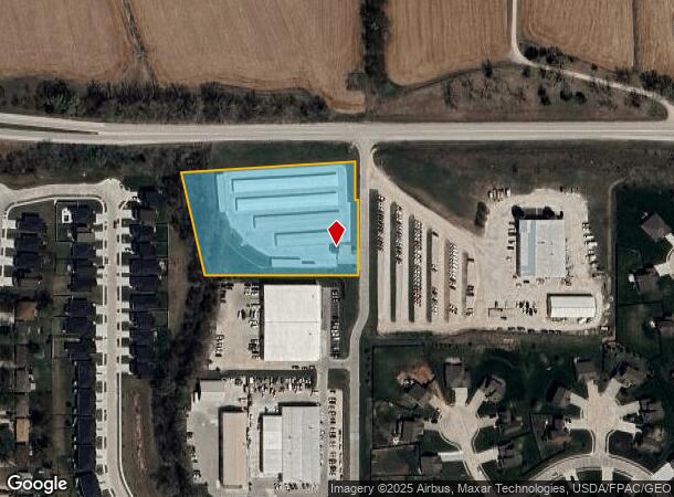
12350 N 153Rd Cir, Bennington, NE 68007
NEARBY LISTINGS FOR SALE OR LEASE
Property Detail
12350 N 153Rd Cir
Omaha-Council Bluffs, NE-IA
Bennington Industrial Park
0943-5040-06
BENNINGTON INDUSTRIAL PARK LOT 1 BLOCK 0 IRREG 2.89AC
Publicstorage
Douglas
X
Nebraska
31055C0182H
1
2024
2.89 AC
2025
Northwest Omaha
007317
Omaha/Council Bluffs
32,360 SF
DEMOGRAPHICS near 12350 N 153Rd Cir
1 Mile
3 Mile
5 Mile
2024 Total Population
2,114
12,786
44,634
2029 Population
2,153
13,250
46,083
Pop Growth 2024-2029
+ 1.84%
+ 3.63%
+ 3.25%
Average Age
38
34
37
2024 Total Households
735
4,054
15,706
HH Growth 2024-2029
+ 1.77%
+ 3.48%
+ 3.09%
Median Household Inc
$111,538
$115,941
$115,423
Avg Household Size
2.90
3.10
2.80
2024 Avg HH Vehicles
2.00
2.00
2.00
Median Home Value
$310,968
$323,556
$304,532
Median Year Built
2003
2009
2007
Nearby Places
Map Layers
Map Styles
 Street
 Aerial
- Restaurants
- Banks
- Shops
- Fitness
- Groceries
PUBLIC TRANSPORTATION
AIRPORT
Eppley Airfield
DRIVE
WALK
Distance
Eppley Airfield
30 min
17.0 mi
Freight Ports
Tulsa Port Of Catoosa
DRIVE
WALK
Distance
Tulsa Port Of Catoosa
485 min
436.5 mi
Nearby Properties
Address
Land Use
TOTAL SIZE
Lot Size
Zoning
Address
Land Use
TOTAL SIZE
Lot Size
Zoning
228,963 SF
7.36 AC
Address
Land Use
TOTAL SIZE
Lot Size
Zoning
149,081 SF
9.01 AC
Address
Land Use
TOTAL SIZE
Lot Size
Zoning
106,465 SF
11.11 AC
Address
Land Use
TOTAL SIZE
Lot Size
Zoning
20,099 SF
3.80 AC
MU
Address
Land Use
TOTAL SIZE
Lot Size
Zoning
38,925 SF
45.48 AC
AG
Address
Land Use
TOTAL SIZE
Lot Size
Zoning
15,244 SF
1.83 AC
MU
Address
Land Use
TOTAL SIZE
Lot Size
Zoning
17,940 SF
3.47 AC
Address
Land Use
TOTAL SIZE
Lot Size
Zoning
27,500 SF
1.80 AC
Address
Land Use
TOTAL SIZE
Lot Size
Zoning
11,379 SF
2.16 AC
Address
Land Use
TOTAL SIZE
Lot Size
Zoning
12,556 SF
1.84 AC
MU
Address
Land Use
TOTAL SIZE
Lot Size
Zoning
10,980 SF
1.30 AC
Address
Land Use
TOTAL SIZE
Lot Size
Zoning
19,848 SF
1.17 AC
Address
Land Use
TOTAL SIZE
Lot Size
Zoning
25,200 SF
2.70 AC
Address
Land Use
TOTAL SIZE
Lot Size
Zoning
18,000 SF
1.38 AC
Address
Land Use
TOTAL SIZE
Lot Size
Zoning
10,080 SF
1.39 AC
Address
Land Use
TOTAL SIZE
Lot Size
Zoning
200.44 AC
Address
Land Use
TOTAL SIZE
Lot Size
Zoning
30,000 SF
2.58 AC
Address
Land Use
TOTAL SIZE
Lot Size
Zoning
18,000 SF
1.33 AC
Address
Land Use
TOTAL SIZE
Lot Size
Zoning
26,880 SF
3.33 AC
Address
Land Use
TOTAL SIZE
Lot Size
Zoning
11,075 SF
3.66 AC
LC
Address
Land Use
TOTAL SIZE
Lot Size
Zoning
2,356 SF
150.55 AC
AG
Address
Land Use
TOTAL SIZE
Lot Size
Zoning
19,996 SF
0.66 AC
Address
Land Use
TOTAL SIZE
Lot Size
Zoning
15,176 SF
0.87 AC
BENNINGTON
Address
Land Use
TOTAL SIZE
Lot Size
Zoning
7,500 SF
0.55 AC
BENNINGTON
Address
Land Use
TOTAL SIZE
Lot Size
Zoning
13,288 SF
1.06 AC
Address
Land Use
TOTAL SIZE
Lot Size
Zoning
6,250 SF
1.01 AC
Address
Land Use
TOTAL SIZE
Lot Size
Zoning
12,000 SF
4.11 AC
Address
Land Use
TOTAL SIZE
Lot Size
Zoning
10,560 SF
0.22 AC
The World's #1 Commercial Real Estate Marketplace
Connect with us
© 2025 CoStar Group
The information above has been obtained from sources believed reliable. While we do not doubt its accuracy we have not verified it and make no guarantee, warranty or representation about it. It is your responsibility to independently confirm its accuracy and completeness. Any projections, opinions, assumptions, or estimates used are for example only and do not represent the current or future performance of the property. The value of this transaction to you depends on tax and other factors which should be evaluated by your tax, financial, and legal advisors. You and your advisors should conduct a careful, independent investigation of the property to determine to your satisfaction the suitability of the property for your needs.