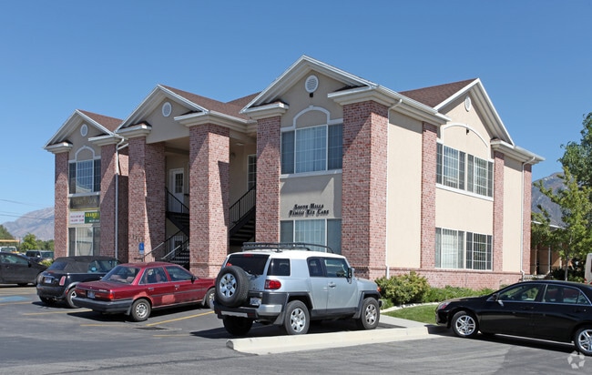
Property Record
12357 S 450 E, Draper, UT 84020

Property Detail
12357 S 450 E
28-30-455-005-0000
LOT 1B, DRAPER PLAZA COMMERCIAL SUB AMENDED. 8268-8175 8488-8494 9241-8662
Officebuilding
Salt Lake
CC
Utah
B and X Area of moderate flood hazard, usually the area between the limits of the 100-year and 500-year floods.
1b
2024
0.36 AC
2025
Draper
112828
Salt Lake City
2,660 SF
Salt Lake City-Murray, UT
NEARBY LISTINGS FOR SALE OR LEASE
DEMOGRAPHICS near 12357 S 450 E
1 mile
3 mile
5 mile
2025 Total Population
10,237
87,084
205,869
2030 Population
10,559
89,555
210,849
Pop Growth 2025-2030
+ 3.15%
+ 2.84%
+ 2.42%
Average Age
37
38
38
2025 Total Households
3,376
26,850
65,290
HH Growth 2025-2030
+ 3.35%
+ 3.09%
+ 2.61%
Median Household Inc
$117,772
$121,459
$119,642
Avg Household Size
3.00
3.10
3.10
2025 Avg HH Vehicles
2.00
2.00
2.00
Median Home Value
$756,030
$754,261
$714,471
Median Year Built
2001
1997
1996
Nearby Places
Map Layers
Map Styles
 Street
 Aerial
Transit
 Traffic
 Biking
Places
Listings with unknown addresses are not visible on the map
- Restaurants
- Banks
- Shops
- Fitness
- Groceries
PUBLIC TRANSPORTATION
COMMUTER RAIL
Drive
Walk
Distance
6 min
2.5 mi
Drive
Walk
Distance
6 min
3.6 mi
AIRPORT
Salt Lake City International
Drive
Walk
Distance
Salt Lake City International
28 min
22.4 mi
Provo Municipal
Drive
Walk
Distance
Provo Municipal
36 min
29.4 mi
Nearby Properties
Address
Land Use
TOTAL SIZE
Lot Size
Zoning
Address
Land Use
TOTAL SIZE
Lot Size
Zoning
161,466 SF
624.79 AC
M-1
Address
Land Use
TOTAL SIZE
Lot Size
Zoning
40,495 SF
33.28 AC
RM-1
Address
Land Use
TOTAL SIZE
Lot Size
Zoning
774,515 SF
87.50 AC
M-1
Address
Land Use
TOTAL SIZE
Lot Size
Zoning
1,055,572 SF
8.31 AC
CR
Address
Land Use
TOTAL SIZE
Lot Size
Zoning
210,421 SF
6.87 AC
CR
Address
Land Use
TOTAL SIZE
Lot Size
Zoning
458,458 SF
6.05 AC
MU
Address
Land Use
TOTAL SIZE
Lot Size
Zoning
398,320 SF
40 AC
1110
Address
Land Use
TOTAL SIZE
Lot Size
Zoning
392,144 SF
30.63 AC
1113
Address
Land Use
TOTAL SIZE
Lot Size
Zoning
423,208 SF
8.07 AC
CSD-H
Address
Land Use
TOTAL SIZE
Lot Size
Zoning
186,651 SF
35.87 AC
C-R
Address
Land Use
TOTAL SIZE
Lot Size
Zoning
81,865 SF
19.46 AC
Z-C-FF
Address
Land Use
TOTAL SIZE
Lot Size
Zoning
277,938 SF
13.90 AC
CSD-DD
Address
Land Use
TOTAL SIZE
Lot Size
Zoning
359,628 SF
4.53 AC
TSD
Address
Land Use
TOTAL SIZE
Lot Size
Zoning
197,645 SF
19.51 AC
1122
Address
Land Use
TOTAL SIZE
Lot Size
Zoning
34,872 SF
11.59 AC
c-f
Address
Land Use
TOTAL SIZE
Lot Size
Zoning
379,911 SF
5.78 AC
mu
Address
Land Use
TOTAL SIZE
Lot Size
Zoning
192,626 SF
5.72 AC
CF
Address
Land Use
TOTAL SIZE
Lot Size
Zoning
126,531 SF
11.50 AC
1244
Address
Land Use
TOTAL SIZE
Lot Size
Zoning
311,202 SF
0.01 AC
4180
Address
Land Use
TOTAL SIZE
Lot Size
Zoning
391,078 SF
5.78 AC
IC
Address
Land Use
TOTAL SIZE
Lot Size
Zoning
416,562 SF
7.48 AC
CSDDPM
Address
Land Use
TOTAL SIZE
Lot Size
Zoning
101,790 SF
5.69 AC
PUD(16
Address
Land Use
TOTAL SIZE
Lot Size
Zoning
115,637 SF
36.38 AC
TSD
Address
Land Use
TOTAL SIZE
Lot Size
Zoning
374,097 SF
6.87 AC
CSDDPM
Address
Land Use
TOTAL SIZE
Lot Size
Zoning
200,922 SF
3.82 AC
2000
Address
Land Use
TOTAL SIZE
Lot Size
Zoning
130,809 SF
16.13 AC
RM 1
Address
Land Use
TOTAL SIZE
Lot Size
Zoning
265,332 SF
8.94 AC
C-C
Address
Land Use
TOTAL SIZE
Lot Size
Zoning
279,829 SF
18.28 AC
CSD-LP
Address
Land Use
TOTAL SIZE
Lot Size
Zoning
247,899 SF
9.20 AC
TSD
Address
Land Use
TOTAL SIZE
Lot Size
Zoning
296,237 SF
6.45 AC
TSD
The World's #1 Commercial Real Estate Marketplace
Connect with us
© 2026 CoStar Group
The information above has been obtained from sources believed reliable. While we do not doubt its accuracy we have not verified it and make no guarantee, warranty or representation about it. It is your responsibility to independently confirm its accuracy and completeness. Any projections, opinions, assumptions, or estimates used are for example only and do not represent the current or future performance of the property. The value of this transaction to you depends on tax and other factors which should be evaluated by your tax, financial, and legal advisors. You and your advisors should conduct a careful, independent investigation of the property to determine to your satisfaction the suitability of the property for your needs.