Property Record
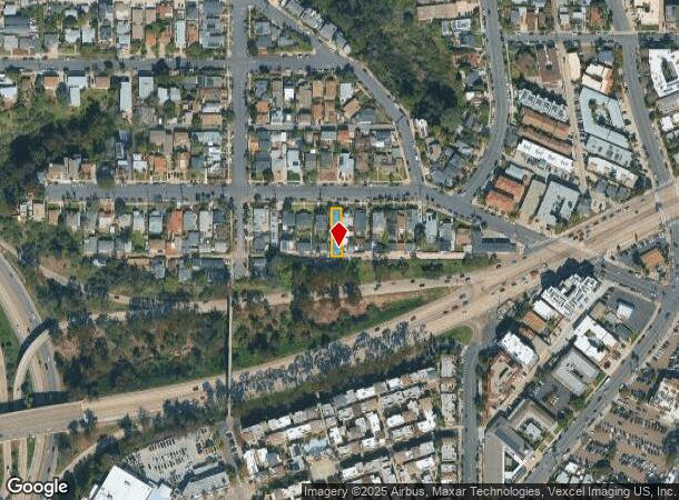
1237 Lincoln Ave, San Diego, CA 92103
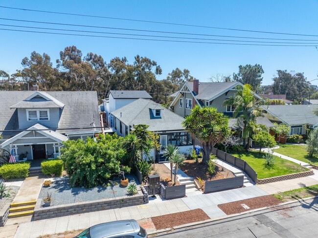
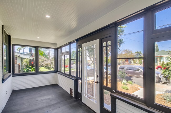
This Property Is For Sale
NEARBY LISTINGS FOR SALE OR LEASE
Property Detail
1237 Lincoln Ave
San Diego-Carlsbad, CA
University Heights
445-480-08
BLK 180 LOT 10 E 5 FT LOT 9 & TR LP0008PG036
Multifamilydwelling
San Diego
X
California
06073C1619G
10,9
2024
0.95 AC
2025
Uptown San Diego
000600
San Diego
1,293 SF
DEMOGRAPHICS near 1237 Lincoln Ave
1 Mile
3 Mile
5 Mile
2024 Total Population
36,532
248,994
547,713
2029 Population
36,544
249,236
546,959
Pop Growth 2024-2029
+ 0.03%
+ 0.10%
(0.14%)
Average Age
41
40
38
2024 Total Households
21,020
120,982
224,327
HH Growth 2024-2029
(0.16%)
+ 0.07%
(0.14%)
Median Household Inc
$96,953
$97,092
$93,338
Avg Household Size
1.70
1.90
2.20
2024 Avg HH Vehicles
1.00
1.00
2.00
Median Home Value
$890,403
$889,728
$868,212
Median Year Built
1974
1978
1974
Nearby Places
Map Layers
Map Styles
 Street
 Aerial
- Restaurants
- Banks
- Shops
- Fitness
- Groceries
PUBLIC TRANSPORTATION
COMMUTER RAIL
San Diego (Santa Fe Depot) (Coaster - San Diego North County Transit District (Coaster/Sprinter/Breeze))
DRIVE
WALK
Distance
San Diego (Santa Fe Depot) (Coaster - San Diego North County Transit District (Coaster/Sprinter/Breeze))
6 min
3.6 mi
Old Town Transit Center (Coaster - San Diego North County Transit District (Coaster/Sprinter/Breeze))
DRIVE
WALK
Distance
Old Town Transit Center (Coaster - San Diego North County Transit District (Coaster/Sprinter/Breeze))
7 min
3.8 mi
AIRPORT
San Diego International
DRIVE
WALK
Distance
San Diego International
7 min
3.0 mi
Freight Ports
Port of San Diego
DRIVE
WALK
Distance
Port of San Diego
10 min
5.1 mi
Nearby Properties
Address
Land Use
TOTAL SIZE
Lot Size
Zoning
Address
Land Use
TOTAL SIZE
Lot Size
Zoning
8.75 AC
60
Address
Land Use
TOTAL SIZE
Lot Size
Zoning
30,000 SF
62.51 AC
MVPD-MV-CR
Address
Land Use
TOTAL SIZE
Lot Size
Zoning
5.99 AC
C
Address
Land Use
TOTAL SIZE
Lot Size
Zoning
3.24 AC
C
Address
Land Use
TOTAL SIZE
Lot Size
Zoning
0.33 AC
CCPD-NC
Address
Land Use
TOTAL SIZE
Lot Size
Zoning
1.38 AC
CCPD-R
Address
Land Use
TOTAL SIZE
Lot Size
Zoning
11.59 AC
CO-3-1
Address
Land Use
TOTAL SIZE
Lot Size
Zoning
12.97 AC
RM-3-7
Address
Land Use
TOTAL SIZE
Lot Size
Zoning
9,999 SF
1.18 AC
C
Address
Land Use
TOTAL SIZE
Lot Size
Zoning
107.28 AC
UNZONED
Address
Land Use
TOTAL SIZE
Lot Size
Zoning
1.14 AC
CCPD-NC
Address
Land Use
TOTAL SIZE
Lot Size
Zoning
496,552 SF
27.12 AC
M
Address
Land Use
TOTAL SIZE
Lot Size
Zoning
0.21 AC
CCPD-R
Address
Land Use
TOTAL SIZE
Lot Size
Zoning
10,000 SF
0.21 AC
CCPD-NC
Address
Land Use
TOTAL SIZE
Lot Size
Zoning
1.38 AC
CCPD-CORE
Address
Land Use
TOTAL SIZE
Lot Size
Zoning
2.53 AC
EMX-1
Address
Land Use
TOTAL SIZE
Lot Size
Zoning
CCPD-ER
Address
Land Use
TOTAL SIZE
Lot Size
Zoning
1.51 AC
CC-3-9
Address
Land Use
TOTAL SIZE
Lot Size
Zoning
0.57 AC
CCPD-NC
Address
Land Use
TOTAL SIZE
Lot Size
Zoning
0.77 AC
CCPD-NC
Address
Land Use
TOTAL SIZE
Lot Size
Zoning
1.38 AC
CCPD-R
Address
Land Use
TOTAL SIZE
Lot Size
Zoning
RM-4-10
Address
Land Use
TOTAL SIZE
Lot Size
Zoning
6.96 AC
MVPD-MVR-4
Address
Land Use
TOTAL SIZE
Lot Size
Zoning
19.25 AC
CC-3-5
Address
Land Use
TOTAL SIZE
Lot Size
Zoning
15.37 AC
CC-3-8
Address
Land Use
TOTAL SIZE
Lot Size
Zoning
1.38 AC
CCPD-NC
Address
Land Use
TOTAL SIZE
Lot Size
Zoning
0.24 AC
CCPD-CORE
Address
Land Use
TOTAL SIZE
Lot Size
Zoning
CCPD-PC
Address
Land Use
TOTAL SIZE
Lot Size
Zoning
2.50 AC
MVPD-MV-CO
Address
Land Use
TOTAL SIZE
Lot Size
Zoning
5.35 AC
MVPD-MV-CR
The World's #1 Commercial Real Estate Marketplace
Connect with us
© 2025 CoStar Group
The information above has been obtained from sources believed reliable. While we do not doubt its accuracy we have not verified it and make no guarantee, warranty or representation about it. It is your responsibility to independently confirm its accuracy and completeness. Any projections, opinions, assumptions, or estimates used are for example only and do not represent the current or future performance of the property. The value of this transaction to you depends on tax and other factors which should be evaluated by your tax, financial, and legal advisors. You and your advisors should conduct a careful, independent investigation of the property to determine to your satisfaction the suitability of the property for your needs.