Property Record
1237 Pond Rd, Wildwood, MO 63038
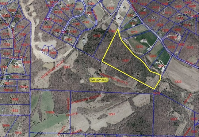


Property Detail
1237 Pond Rd
22W-42-0013
SURVEY 385-45-3
Farms
ST. LOUIS
107NU
Missouri
AE The base floodplain where base flood elevations are provided. AE Zones are now used on new format FIRMs instead of A1-A30 Zones.
31.22 AC
2024
West County
2025
St. Louis
221621
St. Louis, MO-IL
NEARBY LISTINGS FOR SALE OR LEASE
DEMOGRAPHICS near 1237 Pond Rd
1 mile
3 mile
5 mile
2025 Total Population
805
18,560
47,670
2030 Population
815
18,460
47,189
Pop Growth 2025-2030
+ 1.24%
(0.54%)
(1.01%)
Average Age
45
42
43
2025 Total Households
287
6,663
17,224
HH Growth 2025-2030
+ 1.05%
(0.51%)
(1.03%)
Median Household Inc
$191,476
$154,494
$161,403
Avg Household Size
2.70
2.70
2.70
2025 Avg HH Vehicles
3.00
2.00
2.00
Median Home Value
$662,500
$468,777
$488,302
Median Year Built
1989
1991
1990
Nearby Places
Map Layers
Map Styles
 Street
 Aerial
Layers
 Traffic
 Biking
Places
Listings with unknown addresses are not visible on the map
- Restaurants
- Banks
- Shops
- Fitness
- Groceries
PUBLIC TRANSPORTATION
AIRPORT
St Louis Lambert International
Drive
Walk
Distance
St Louis Lambert International
50 min
32.8 mi
Freight Ports
Tulsa Port of Inola
Drive
Walk
Distance
Tulsa Port of Inola
405 min
361.5 mi
Nearby Properties
Address
Land Use
TOTAL SIZE
Lot Size
Zoning
Address
Land Use
TOTAL SIZE
Lot Size
Zoning
62,362 SF
2,133.73 AC
PS
Address
Land Use
TOTAL SIZE
Lot Size
Zoning
51.20 AC
NU
Address
Land Use
TOTAL SIZE
Lot Size
Zoning
5,675 SF
1,382.01 AC
PS
Address
Land Use
TOTAL SIZE
Lot Size
Zoning
85,946 SF
60.44 AC
NU
Address
Land Use
TOTAL SIZE
Lot Size
Zoning
138,056 SF
17.42 AC
NU
Address
Land Use
TOTAL SIZE
Lot Size
Zoning
68.69 AC
107NU
Address
Land Use
TOTAL SIZE
Lot Size
Zoning
30 AC
107NU
Address
Land Use
TOTAL SIZE
Lot Size
Zoning
16.80 AC
NU
Address
Land Use
TOTAL SIZE
Lot Size
Zoning
4,464 SF
12.30 AC
107NU
Address
Land Use
TOTAL SIZE
Lot Size
Zoning
84.04 AC
107PS
Address
Land Use
TOTAL SIZE
Lot Size
Zoning
109,550 SF
14.21 AC
107R6A
Address
Land Use
TOTAL SIZE
Lot Size
Zoning
7,208 SF
29.36 AC
107NU
Address
Land Use
TOTAL SIZE
Lot Size
Zoning
72.37 AC
107PS
Address
Land Use
TOTAL SIZE
Lot Size
Zoning
11.91 AC
107R3
Address
Land Use
TOTAL SIZE
Lot Size
Zoning
73,053 SF
1.65 AC
107NU
Address
Land Use
TOTAL SIZE
Lot Size
Zoning
50,846 SF
6.52 AC
107NU
Address
Land Use
TOTAL SIZE
Lot Size
Zoning
15.82 AC
107NU
Address
Land Use
TOTAL SIZE
Lot Size
Zoning
26,917 SF
5.37 AC
107NU
Address
Land Use
TOTAL SIZE
Lot Size
Zoning
1,836 SF
14.46 AC
107NU
Address
Land Use
TOTAL SIZE
Lot Size
Zoning
62,214 SF
4.13 AC
19C-4
Address
Land Use
TOTAL SIZE
Lot Size
Zoning
13.09 AC
107NU
Address
Land Use
TOTAL SIZE
Lot Size
Zoning
10.32 AC
FPNU
Address
Land Use
TOTAL SIZE
Lot Size
Zoning
21.44 AC
107PS
Address
Land Use
TOTAL SIZE
Lot Size
Zoning
35.82 AC
107NU
Address
Land Use
TOTAL SIZE
Lot Size
Zoning
96,750 SF
1.14 AC
107NU
Address
Land Use
TOTAL SIZE
Lot Size
Zoning
35,905 SF
2.09 AC
107C8
Address
Land Use
TOTAL SIZE
Lot Size
Zoning
177.77 AC
NU
Address
Land Use
TOTAL SIZE
Lot Size
Zoning
6.11 AC
NU
Address
Land Use
TOTAL SIZE
Lot Size
Zoning
39,456 SF
1.67 AC
107NU
Address
Land Use
TOTAL SIZE
Lot Size
Zoning
20.23 AC
PS
The World's #1 Commercial Real Estate Marketplace
Connect with us
© 2026 CoStar Group
The information above has been obtained from sources believed reliable. While we do not doubt its accuracy we have not verified it and make no guarantee, warranty or representation about it. It is your responsibility to independently confirm its accuracy and completeness. Any projections, opinions, assumptions, or estimates used are for example only and do not represent the current or future performance of the property. The value of this transaction to you depends on tax and other factors which should be evaluated by your tax, financial, and legal advisors. You and your advisors should conduct a careful, independent investigation of the property to determine to your satisfaction the suitability of the property for your needs.