Property Record
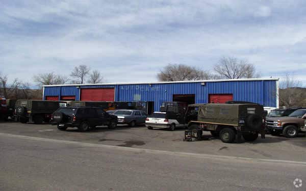
1237 Rogers St, Golden, CO 80401

Save to a Folder
{{folder.Name}}
{{folder.ListingIds.length}} Properties
{{folder.ListingIds.length}} Property
Create a New Folder
Property Detail
1237 Rogers St
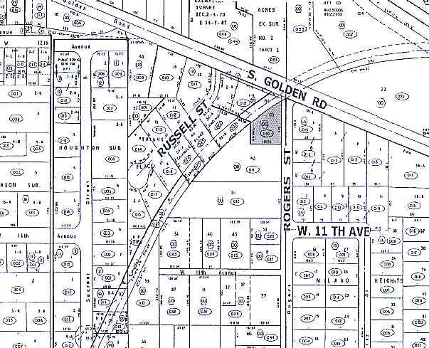
40-021-00-010
SECTION 02 TOWNSHIP 04 RANGE 70 QTR NE SIZE: 13547 VALUE: .311 KEY=093
Commercialnec
JEFFERSON
RC
Colorado
B and X Area of moderate flood hazard, usually the area between the limits of the 100-year and 500-year floods.
0.31 AC
2025
West Denver
2025
Denver
010100
Denver-Aurora-Centennial, CO
3,480 SF
NEARBY LISTINGS FOR SALE OR LEASE
DEMOGRAPHICS near 1237 Rogers St
1 mile
3 mile
5 mile
2025 Total Population
6,040
47,558
126,013
2030 Population
6,039
47,670
125,939
Pop Growth 2025-2030
(0.02%)
+ 0.24%
(0.06%)
Average Age
39
40
42
2025 Total Households
2,434
19,858
52,650
HH Growth 2025-2030
(0.16%)
+ 0.24%
(0.07%)
Median Household Inc
$85,398
$95,094
$100,525
Avg Household Size
2.20
2.20
2.30
2025 Avg HH Vehicles
2.00
2.00
2.00
Median Home Value
$540,304
$726,513
$736,018
Median Year Built
1979
1979
1977
Nearby Places
Map Layers
Map Styles
 Street
 Aerial
Layers
 Traffic
 Biking
Places
Listings with unknown addresses are not visible on the map
- Restaurants
- Banks
- Shops
- Fitness
- Groceries
PUBLIC TRANSPORTATION
COMMUTER RAIL
Drive
Walk
Distance
12 min
7.1 mi
Drive
Walk
Distance
12 min
8.2 mi
AIRPORT
Denver International
Drive
Walk
Distance
Denver International
46 min
35.7 mi
Nearby Properties
Address
Land Use
TOTAL SIZE
Lot Size
Zoning
Address
Land Use
TOTAL SIZE
Lot Size
Zoning
Address
Land Use
TOTAL SIZE
Lot Size
Zoning
367,452 SF
38.94 AC
Address
Land Use
TOTAL SIZE
Lot Size
Zoning
2,710,724 SF
32.87 AC
Address
Land Use
TOTAL SIZE
Lot Size
Zoning
94,560 SF
6.03 AC
Address
Land Use
TOTAL SIZE
Lot Size
Zoning
1,193,158 SF
68.86 AC
Address
Land Use
TOTAL SIZE
Lot Size
Zoning
420,482 SF
66.03 AC
Address
Land Use
TOTAL SIZE
Lot Size
Zoning
25,925 SF
7.12 AC
Address
Land Use
TOTAL SIZE
Lot Size
Zoning
103,076 SF
1.28 AC
Address
Land Use
TOTAL SIZE
Lot Size
Zoning
966,836 SF
84.74 AC
I2
Address
Land Use
TOTAL SIZE
Lot Size
Zoning
352,259 SF
17.94 AC
Address
Land Use
TOTAL SIZE
Lot Size
Zoning
117,036 SF
1.38 AC
Address
Land Use
TOTAL SIZE
Lot Size
Zoning
90,776 SF
5 AC
Address
Land Use
TOTAL SIZE
Lot Size
Zoning
52,103 SF
2.44 AC
Address
Land Use
TOTAL SIZE
Lot Size
Zoning
Address
Land Use
TOTAL SIZE
Lot Size
Zoning
135,113 SF
2.58 AC
Address
Land Use
TOTAL SIZE
Lot Size
Zoning
42,684 SF
2.53 AC
Address
Land Use
TOTAL SIZE
Lot Size
Zoning
615,195 SF
23.48 AC
Address
Land Use
TOTAL SIZE
Lot Size
Zoning
322,105 SF
136.23 AC
Address
Land Use
TOTAL SIZE
Lot Size
Zoning
104,088 SF
1.31 AC
Address
Land Use
TOTAL SIZE
Lot Size
Zoning
162,271 SF
8.20 AC
Address
Land Use
TOTAL SIZE
Lot Size
Zoning
353,286 SF
14.49 AC
Address
Land Use
TOTAL SIZE
Lot Size
Zoning
282,190 SF
6.42 AC
PD
Address
Land Use
TOTAL SIZE
Lot Size
Zoning
229,819 SF
29.97 AC
Address
Land Use
TOTAL SIZE
Lot Size
Zoning
188,554 SF
33.28 AC
Address
Land Use
TOTAL SIZE
Lot Size
Zoning
484,918 SF
58.36 AC
Address
Land Use
TOTAL SIZE
Lot Size
Zoning
282,265 SF
80.48 AC
I2
Address
Land Use
TOTAL SIZE
Lot Size
Zoning
39,374 SF
1.20 AC
Address
Land Use
TOTAL SIZE
Lot Size
Zoning
198,147 SF
2.55 AC
Address
Land Use
TOTAL SIZE
Lot Size
Zoning
118,522 SF
7.07 AC
PD
Address
Land Use
TOTAL SIZE
Lot Size
Zoning
55,030 SF
4.94 AC
The World's #1 Commercial Real Estate Marketplace
Connect with us
© 2026 CoStar Group
The information above has been obtained from sources believed reliable. While we do not doubt its accuracy we have not verified it and make no guarantee, warranty or representation about it. It is your responsibility to independently confirm its accuracy and completeness. Any projections, opinions, assumptions, or estimates used are for example only and do not represent the current or future performance of the property. The value of this transaction to you depends on tax and other factors which should be evaluated by your tax, financial, and legal advisors. You and your advisors should conduct a careful, independent investigation of the property to determine to your satisfaction the suitability of the property for your needs.