Property Record
1238 E 3500 N, Lehi, UT 84043
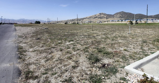

Property Detail
1238 E 3500 N
Provo-Orem-Lehi, UT
LOT 1, CENTER POINTE @ LEHI AMENDED SUBDV. AREA 1.751 AC.
65-304-0001
UTAH
Financialbuilding
Utah
2024
1
2025
1.75 AC
010216
Utah County
4,048 SF
Salt Lake City
NEARBY LISTINGS FOR SALE OR LEASE
DEMOGRAPHICS near 1238 E 3500 N
1 mile
3 mile
5 mile
2025 Total Population
5,752
68,273
183,314
2030 Population
6,258
75,117
201,786
Pop Growth 2025-2030
+ 8.80%
+ 10.02%
+ 10.08%
Average Age
34
33
33
2025 Total Households
1,405
17,975
50,684
HH Growth 2025-2030
+ 9.68%
+ 10.64%
+ 10.76%
Median Household Inc
$165,384
$146,086
$135,349
Avg Household Size
4.10
3.80
3.60
2025 Avg HH Vehicles
3.00
3.00
3.00
Median Home Value
$791,048
$751,101
$717,734
Median Year Built
2005
2005
2006
Nearby Places
Map Layers
Map Styles
 Street
 Aerial
Layers
 Traffic
 Biking
Places
Listings with unknown addresses are not visible on the map
- Restaurants
- Banks
- Shops
- Fitness
- Groceries
PUBLIC TRANSPORTATION
AIRPORT
Salt Lake City International
Drive
Walk
Distance
Salt Lake City International
33 min
32.4 mi
Freight Ports
Port of Long Beach
Drive
Walk
Distance
Port of Long Beach
1 min
578.3 mi
Nearby Properties
Address
Land Use
TOTAL SIZE
Lot Size
Zoning
Address
Land Use
TOTAL SIZE
Lot Size
Zoning
2,586,860 SF
99.85 AC
Address
Land Use
TOTAL SIZE
Lot Size
Zoning
264,805 SF
16.20 AC
Address
Land Use
TOTAL SIZE
Lot Size
Zoning
130,480 SF
27.19 AC
Address
Land Use
TOTAL SIZE
Lot Size
Zoning
313,847 SF
35.44 AC
Address
Land Use
TOTAL SIZE
Lot Size
Zoning
130,480 SF
25.12 AC
Address
Land Use
TOTAL SIZE
Lot Size
Zoning
376,499 SF
5.22 AC
Address
Land Use
TOTAL SIZE
Lot Size
Zoning
330,039 SF
10.08 AC
Address
Land Use
TOTAL SIZE
Lot Size
Zoning
386,065 SF
26.62 AC
Address
Land Use
TOTAL SIZE
Lot Size
Zoning
301,411 SF
13.27 AC
Address
Land Use
TOTAL SIZE
Lot Size
Zoning
166,233 SF
8.70 AC
Address
Land Use
TOTAL SIZE
Lot Size
Zoning
118,569 SF
23.63 AC
Address
Land Use
TOTAL SIZE
Lot Size
Zoning
374,937 SF
18.37 AC
Address
Land Use
TOTAL SIZE
Lot Size
Zoning
545,572 SF
182.84 AC
Address
Land Use
TOTAL SIZE
Lot Size
Zoning
281,215 SF
15.30 AC
Address
Land Use
TOTAL SIZE
Lot Size
Zoning
186,256 SF
4.19 AC
Address
Land Use
TOTAL SIZE
Lot Size
Zoning
131,961 SF
7.57 AC
Address
Land Use
TOTAL SIZE
Lot Size
Zoning
194,033 SF
7.76 AC
Address
Land Use
TOTAL SIZE
Lot Size
Zoning
214,607 SF
7.31 AC
Address
Land Use
TOTAL SIZE
Lot Size
Zoning
194,767 SF
7.35 AC
Address
Land Use
TOTAL SIZE
Lot Size
Zoning
216,478 SF
7.38 AC
Address
Land Use
TOTAL SIZE
Lot Size
Zoning
206,456 SF
6.55 AC
Address
Land Use
TOTAL SIZE
Lot Size
Zoning
215,516 SF
4.93 AC
Address
Land Use
TOTAL SIZE
Lot Size
Zoning
181,908 SF
1.43 AC
Address
Land Use
TOTAL SIZE
Lot Size
Zoning
147,368 SF
6.91 AC
Address
Land Use
TOTAL SIZE
Lot Size
Zoning
304,991 SF
7.05 AC
Address
Land Use
TOTAL SIZE
Lot Size
Zoning
149,591 SF
7.07 AC
Address
Land Use
TOTAL SIZE
Lot Size
Zoning
9.80 AC
Address
Land Use
TOTAL SIZE
Lot Size
Zoning
165,821 SF
12.29 AC
Address
Land Use
TOTAL SIZE
Lot Size
Zoning
150,068 SF
5.05 AC
Address
Land Use
TOTAL SIZE
Lot Size
Zoning
5,040 SF
9.85 AC
The World's #1 Commercial Real Estate Marketplace
Connect with us
© 2026 CoStar Group
The information above has been obtained from sources believed reliable. While we do not doubt its accuracy we have not verified it and make no guarantee, warranty or representation about it. It is your responsibility to independently confirm its accuracy and completeness. Any projections, opinions, assumptions, or estimates used are for example only and do not represent the current or future performance of the property. The value of this transaction to you depends on tax and other factors which should be evaluated by your tax, financial, and legal advisors. You and your advisors should conduct a careful, independent investigation of the property to determine to your satisfaction the suitability of the property for your needs.