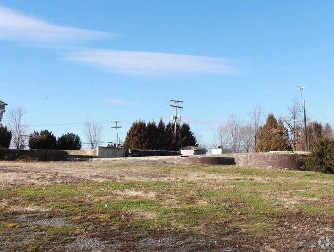
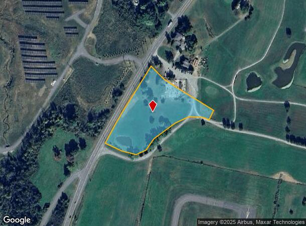
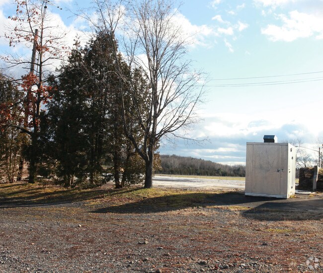
Property Record
1238 State Route 9H, Ghent, NY 12075
NEARBY LISTINGS FOR SALE OR LEASE
Property Detail
1238 State Route 9H
Hudson, NY
Columbia
103889-091-000-0001-007-200-0000
New York
Storebuilding
7.200
2025
3.25 AC
2024
Columbia County
000700
Albany/Schenectady/Troy
DEMOGRAPHICS near 1238 State Route 9H
1 Mile
3 Mile
5 Mile
2024 Total Population
244
3,979
14,096
2029 Population
242
3,894
13,874
Pop Growth 2024-2029
(0.82%)
(2.14%)
(1.57%)
Average Age
49
45
45
2024 Total Households
86
1,605
6,045
HH Growth 2024-2029
(1.16%)
(2.18%)
(1.59%)
Median Household Inc
$102,083
$71,187
$70,489
Avg Household Size
2.50
2.40
2.20
2024 Avg HH Vehicles
2.00
2.00
2.00
Median Home Value
$214,286
$228,918
$215,636
Median Year Built
1982
1971
1968
Nearby Places
- Restaurants
- Banks
- Shops
- Fitness
- Groceries
PUBLIC TRANSPORTATION
COMMUTER RAIL
Hudson Amtrak Station (Adirondack - Amtrak, Empire Service - Amtrak, Ethan Allen Express - Amtrak, Maple Leaf - Amtrak)
DRIVE
WALK
Distance
Hudson Amtrak Station (Adirondack - Amtrak, Empire Service - Amtrak, Ethan Allen Express - Amtrak, Maple Leaf - Amtrak)
12 min
6.9 mi
Hudson (Toronto - New York - VIA Rail)
DRIVE
WALK
Distance
Hudson (Toronto - New York - VIA Rail)
13 min
7.1 mi
Freight Ports
Albany, NY Port
DRIVE
WALK
Distance
Albany, NY Port
41 min
29.6 mi
Nearby Properties
Address
Land Use
TOTAL SIZE
Lot Size
Zoning
Address
Land Use
TOTAL SIZE
Lot Size
Zoning
153,801 SF
24.87 AC
0402
Address
Land Use
TOTAL SIZE
Lot Size
Zoning
107,088 SF
11.90 AC
BP C
Address
Land Use
TOTAL SIZE
Lot Size
Zoning
102,761 SF
10.07 AC
0402
Address
Land Use
TOTAL SIZE
Lot Size
Zoning
19,896 SF
3.90 AC
07 - MIXED
Address
Land Use
TOTAL SIZE
Lot Size
Zoning
64,000 SF
5.89 AC
0402
Address
Land Use
TOTAL SIZE
Lot Size
Zoning
92,322 SF
19.76 AC
0401
Address
Land Use
TOTAL SIZE
Lot Size
Zoning
52,223 SF
17.86 AC
402
Address
Land Use
TOTAL SIZE
Lot Size
Zoning
107.60 AC
07 - MIXED
Address
Land Use
TOTAL SIZE
Lot Size
Zoning
2,628 SF
79.50 AC
07 - MIXED
Address
Land Use
TOTAL SIZE
Lot Size
Zoning
56,244 SF
10.14 AC
07 - MIXED
Address
Land Use
TOTAL SIZE
Lot Size
Zoning
28,000 SF
26.74 AC
01 - NOT Z
Address
Land Use
TOTAL SIZE
Lot Size
Zoning
12,800 SF
25.60 AC
HC1
Address
Land Use
TOTAL SIZE
Lot Size
Zoning
37,500 SF
9 AC
0401
Address
Land Use
TOTAL SIZE
Lot Size
Zoning
14,445 SF
80.22 AC
07 - MIXED
Address
Land Use
TOTAL SIZE
Lot Size
Zoning
8,550 SF
79.64 AC
01 - NOT Z
Address
Land Use
TOTAL SIZE
Lot Size
Zoning
32,976 SF
10 AC
PCD
Address
Land Use
TOTAL SIZE
Lot Size
Zoning
3,528 SF
28.10 AC
07 - MIXED
Address
Land Use
TOTAL SIZE
Lot Size
Zoning
61.74 AC
RA1
Address
Land Use
TOTAL SIZE
Lot Size
Zoning
17,600 SF
10 AC
03 - MULTI
Address
Land Use
TOTAL SIZE
Lot Size
Zoning
2,506 SF
116 AC
RA1 C
Address
Land Use
TOTAL SIZE
Lot Size
Zoning
840 SF
15.83 AC
07 - MIXED
Address
Land Use
TOTAL SIZE
Lot Size
Zoning
728 SF
14.16 AC
07 - MIXED
Address
Land Use
TOTAL SIZE
Lot Size
Zoning
57.10 AC
07 - MIXED
Address
Land Use
TOTAL SIZE
Lot Size
Zoning
17,200 SF
10.81 AC
03 - MULTI
Address
Land Use
TOTAL SIZE
Lot Size
Zoning
98.74 AC
RA 1
Address
Land Use
TOTAL SIZE
Lot Size
Zoning
10,000 SF
1.60 AC
PD
Address
Land Use
TOTAL SIZE
Lot Size
Zoning
16,000 SF
4.90 AC
07 - MIXED
Address
Land Use
TOTAL SIZE
Lot Size
Zoning
3,024 SF
27.50 AC
RA 1
Address
Land Use
TOTAL SIZE
Lot Size
Zoning
19,280 SF
4.80 AC
03 - MULTI
Address
Land Use
TOTAL SIZE
Lot Size
Zoning
3,895 SF
2.40 AC
01 - NOT Z
The World's #1 Commercial Real Estate Marketplace
Connect with us
© 2025 CoStar Group
The information above has been obtained from sources believed reliable. While we do not doubt its accuracy we have not verified it and make no guarantee, warranty or representation about it. It is your responsibility to independently confirm its accuracy and completeness. Any projections, opinions, assumptions, or estimates used are for example only and do not represent the current or future performance of the property. The value of this transaction to you depends on tax and other factors which should be evaluated by your tax, financial, and legal advisors. You and your advisors should conduct a careful, independent investigation of the property to determine to your satisfaction the suitability of the property for your needs.