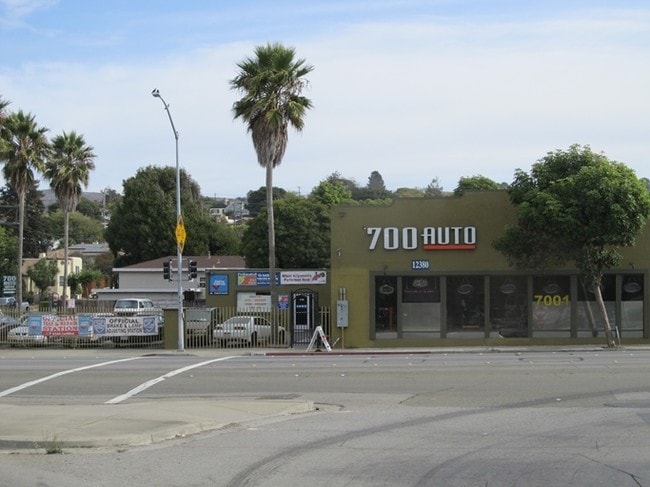
Property Record
12380 San Pablo Ave, Richmond, CA 94805

NEARBY LISTINGS FOR SALE OR LEASE
Property Detail
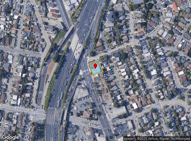
12380 San Pablo Ave
Oakland-Hayward-Berkeley, CA
Richmond Traffic Center
519-200-016-3
RICHMOND TRAFFIC CENTER POR 2
Autorepair
Contra Costa
X
California
06013C0237G
1-8,4
2024
0.27 AC
2025
Richmond/San Pablo
370000
East Bay/Oakland
5,650 SF
DEMOGRAPHICS near 12380 San Pablo Ave
1 Mile
3 Mile
5 Mile
2024 Total Population
29,240
167,312
276,206
2029 Population
28,936
165,868
272,619
Pop Growth 2024-2029
(1.04%)
(0.86%)
(1.30%)
Average Age
41
39
41
2024 Total Households
10,155
55,417
96,172
HH Growth 2024-2029
(1.12%)
(0.89%)
(1.42%)
Median Household Inc
$95,038
$82,668
$95,973
Avg Household Size
2.80
2.90
2.80
2024 Avg HH Vehicles
2.00
2.00
2.00
Median Home Value
$749,465
$717,309
$818,294
Median Year Built
1952
1959
1959
Nearby Places
Map Layers
Map Styles
 Street
 Aerial
- Restaurants
- Banks
- Shops
- Fitness
- Groceries
PUBLIC TRANSPORTATION
TRANSIT/SUBWAY
El Cerrito Del Norte Station (Fremont - Richmond - Bay Area Rapid Transit (BART), Richmond - Millbrae - Bay Area Rapid Transit (BART))
DRIVE
WALK
Distance
El Cerrito Del Norte Station (Fremont - Richmond - Bay Area Rapid Transit (BART), Richmond - Millbrae - Bay Area Rapid Transit (BART))
3 min
19 min
1.0 mi
COMMUTER RAIL
DRIVE
WALK
Distance
5 min
2.0 mi
DRIVE
WALK
Distance
9 min
6.2 mi
AIRPORT
Metro Oakland International
DRIVE
WALK
Distance
Metro Oakland International
29 min
20.6 mi
San Francisco International
DRIVE
WALK
Distance
San Francisco International
41 min
28.2 mi
Freight Ports
Port of Richmond
DRIVE
WALK
Distance
Port of Richmond
14 min
6.3 mi
SALE & LEASE HISTORY
LISTING DATE
SALE/LEASE

Feb 16, 2017
For Lease
Nearby Properties
Address
Land Use
TOTAL SIZE
Lot Size
Zoning
Address
Land Use
TOTAL SIZE
Lot Size
Zoning
820,000 SF
6.36 AC
Address
Land Use
TOTAL SIZE
Lot Size
Zoning
68,400 SF
5.13 AC
CM
Address
Land Use
TOTAL SIZE
Lot Size
Zoning
476,200 SF
22.92 AC
Address
Land Use
TOTAL SIZE
Lot Size
Zoning
581,157 SF
10.52 AC
Address
Land Use
TOTAL SIZE
Lot Size
Zoning
195,281 SF
0.96 AC
Address
Land Use
TOTAL SIZE
Lot Size
Zoning
139,846 SF
0.76 AC
Address
Land Use
TOTAL SIZE
Lot Size
Zoning
3,950 SF
11.47 AC
Address
Land Use
TOTAL SIZE
Lot Size
Zoning
19,308 SF
40.39 AC
Address
Land Use
TOTAL SIZE
Lot Size
Zoning
105,704 SF
10.85 AC
M3
Address
Land Use
TOTAL SIZE
Lot Size
Zoning
35.94 AC
Address
Land Use
TOTAL SIZE
Lot Size
Zoning
22.06 AC
Address
Land Use
TOTAL SIZE
Lot Size
Zoning
16,800 SF
11.62 AC
Address
Land Use
TOTAL SIZE
Lot Size
Zoning
4,550 SF
24.81 AC
Address
Land Use
TOTAL SIZE
Lot Size
Zoning
245,894 SF
12.67 AC
M2
Address
Land Use
TOTAL SIZE
Lot Size
Zoning
190,471 SF
11.32 AC
Address
Land Use
TOTAL SIZE
Lot Size
Zoning
202,811 SF
10.98 AC
Address
Land Use
TOTAL SIZE
Lot Size
Zoning
135,904 SF
7.12 AC
Address
Land Use
TOTAL SIZE
Lot Size
Zoning
191,800 SF
1.09 AC
Address
Land Use
TOTAL SIZE
Lot Size
Zoning
124,257 SF
2.72 AC
Address
Land Use
TOTAL SIZE
Lot Size
Zoning
149,502 SF
7.94 AC
Address
Land Use
TOTAL SIZE
Lot Size
Zoning
69,949 SF
0.65 AC
C2 CD
Address
Land Use
TOTAL SIZE
Lot Size
Zoning
182,408 SF
10.55 AC
Address
Land Use
TOTAL SIZE
Lot Size
Zoning
81,352 SF
5.06 AC
C2
Address
Land Use
TOTAL SIZE
Lot Size
Zoning
96,440 SF
4.73 AC
Address
Land Use
TOTAL SIZE
Lot Size
Zoning
118,658 SF
8.57 AC
Address
Land Use
TOTAL SIZE
Lot Size
Zoning
404,098 SF
24.03 AC
MSL1RD
Address
Land Use
TOTAL SIZE
Lot Size
Zoning
131,400 SF
8.93 AC
M-1
Address
Land Use
TOTAL SIZE
Lot Size
Zoning
54,728 SF
0.96 AC
Address
Land Use
TOTAL SIZE
Lot Size
Zoning
147,500 SF
9.84 AC
Address
Land Use
TOTAL SIZE
Lot Size
Zoning
14.93 AC
The World's #1 Commercial Real Estate Marketplace
Connect with us
© 2025 CoStar Group
The information above has been obtained from sources believed reliable. While we do not doubt its accuracy we have not verified it and make no guarantee, warranty or representation about it. It is your responsibility to independently confirm its accuracy and completeness. Any projections, opinions, assumptions, or estimates used are for example only and do not represent the current or future performance of the property. The value of this transaction to you depends on tax and other factors which should be evaluated by your tax, financial, and legal advisors. You and your advisors should conduct a careful, independent investigation of the property to determine to your satisfaction the suitability of the property for your needs.