Property Record
124 Bernard E Saint Jean, East Falmouth, MA 02536

NEARBY LISTINGS FOR SALE OR LEASE
Property Detail
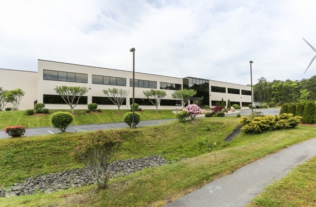
124 Bernard E Saint Jean
FALM-000016-000001-000004-000070
Barnstable
Scientificpharmaceuticalmedicalresearchfacility
Massachusetts
X
70
25001C0726J
8.06 AC
2025
Cape Cod
2025
Other Market Areas
014402
Barnstable Town, MA
83,825 SF
DEMOGRAPHICS near 124 Bernard E Saint Jean
1 Mile
3 Mile
5 Mile
2024 Total Population
670
14,643
37,783
2029 Population
683
14,917
39,184
Pop Growth 2024-2029
+ 1.94%
+ 1.87%
+ 3.71%
Average Age
47
49
50
2024 Total Households
276
6,266
17,183
HH Growth 2024-2029
+ 1.81%
+ 1.66%
+ 3.56%
Median Household Inc
$96,323
$90,354
$82,834
Avg Household Size
2.40
2.30
2.10
2024 Avg HH Vehicles
2.00
2.00
2.00
Median Home Value
$466,071
$503,029
$514,810
Median Year Built
1977
1979
1976
Nearby Places
Map Layers
Map Styles
 Street
 Aerial
- Restaurants
- Banks
- Shops
- Fitness
- Groceries
PUBLIC TRANSPORTATION
AIRPORT
Martha's Vineyard
DRIVE
WALK
Distance
Martha's Vineyard
79 min
23.3 mi
Freight Ports
Port of New Bedford Harbor
DRIVE
WALK
Distance
Port of New Bedford Harbor
53 min
37.9 mi
Nearby Properties
Address
Land Use
TOTAL SIZE
Lot Size
Zoning
Address
Land Use
TOTAL SIZE
Lot Size
Zoning
191,993 SF
21.60 AC
RB
Address
Land Use
TOTAL SIZE
Lot Size
Zoning
5,067 SF
314.59 AC
PU
Address
Land Use
TOTAL SIZE
Lot Size
Zoning
53,202 SF
29.20 AC
PU
Address
Land Use
TOTAL SIZE
Lot Size
Zoning
33,157 SF
39.23 AC
PU
Address
Land Use
TOTAL SIZE
Lot Size
Zoning
56,592 SF
16.62 AC
PU
Address
Land Use
TOTAL SIZE
Lot Size
Zoning
61,751 SF
9.87 AC
Address
Land Use
TOTAL SIZE
Lot Size
Zoning
15,546 SF
86.40 AC
PU
Address
Land Use
TOTAL SIZE
Lot Size
Zoning
11,276 SF
1.69 AC
RB
Address
Land Use
TOTAL SIZE
Lot Size
Zoning
29.40 AC
PU
Address
Land Use
TOTAL SIZE
Lot Size
Zoning
3,000 SF
260.39 AC
PU
Address
Land Use
TOTAL SIZE
Lot Size
Zoning
6,516 SF
88.49 AC
AGAA
Address
Land Use
TOTAL SIZE
Lot Size
Zoning
100.93 AC
PU
Address
Land Use
TOTAL SIZE
Lot Size
Zoning
59,250 SF
4.78 AC
LIB
Address
Land Use
TOTAL SIZE
Lot Size
Zoning
21,711 SF
157.40 AC
AGAA
Address
Land Use
TOTAL SIZE
Lot Size
Zoning
57,806 SF
14.39 AC
LIA
Address
Land Use
TOTAL SIZE
Lot Size
Zoning
88,720 SF
4.20 AC
LIA
Address
Land Use
TOTAL SIZE
Lot Size
Zoning
37,008 SF
8.13 AC
AGB
Address
Land Use
TOTAL SIZE
Lot Size
Zoning
6,081 SF
1.74 AC
RB
Address
Land Use
TOTAL SIZE
Lot Size
Zoning
90,200 SF
4.08 AC
AGB
Address
Land Use
TOTAL SIZE
Lot Size
Zoning
65.92 AC
AGA
Address
Land Use
TOTAL SIZE
Lot Size
Zoning
6,912 SF
1.95 AC
RB
Address
Land Use
TOTAL SIZE
Lot Size
Zoning
8,282 SF
12.72 AC
PU
Address
Land Use
TOTAL SIZE
Lot Size
Zoning
16.76 AC
PU
Address
Land Use
TOTAL SIZE
Lot Size
Zoning
6,168 SF
8.13 AC
AGB
Address
Land Use
TOTAL SIZE
Lot Size
Zoning
10,000 SF
80.22 AC
AGAA
Address
Land Use
TOTAL SIZE
Lot Size
Zoning
7,432 SF
3.74 AC
RB
Address
Land Use
TOTAL SIZE
Lot Size
Zoning
17,112 SF
35.57 AC
PU
Address
Land Use
TOTAL SIZE
Lot Size
Zoning
31,696 SF
6.33 AC
LA
Address
Land Use
TOTAL SIZE
Lot Size
Zoning
54,066 SF
3.97 AC
AGB
The World's #1 Commercial Real Estate Marketplace
Connect with us
© 2026 CoStar Group
The information above has been obtained from sources believed reliable. While we do not doubt its accuracy we have not verified it and make no guarantee, warranty or representation about it. It is your responsibility to independently confirm its accuracy and completeness. Any projections, opinions, assumptions, or estimates used are for example only and do not represent the current or future performance of the property. The value of this transaction to you depends on tax and other factors which should be evaluated by your tax, financial, and legal advisors. You and your advisors should conduct a careful, independent investigation of the property to determine to your satisfaction the suitability of the property for your needs.