Property Record
1742 Maple St, Wakita, OK 73771
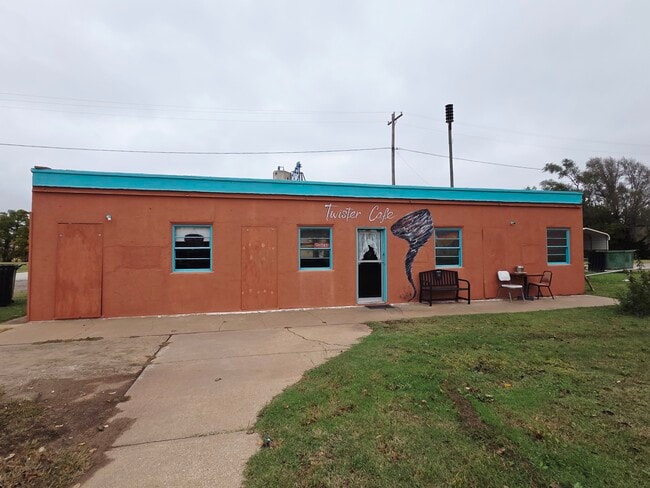
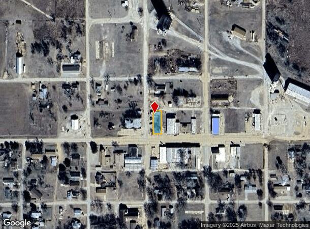
This Property Is For Sale
NEARBY LISTINGS FOR SALE OR LEASE
-
-
View all Wakita listings for sale on LoopNet.com
Property Detail
1742 Maple St
Other Market Areas
Wakita Original Town
0020-00-010-017-0-120-00
LOTS 17& 18 BLOCK 10 ORIG. TOWN WAKITA 50X140
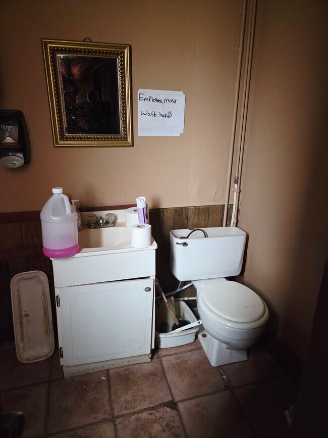
Restaurantbuilding
Grant
2024
Oklahoma
2025
17,18
956500
0.16 AC
1,250 SF
Oklahoma West Area
DEMOGRAPHICS near 1742 Maple St
1 Mile
3 Mile
5 Mile
2024 Total Population
306
322
382
2029 Population
312
329
390
Pop Growth 2024-2029
+ 1.96%
+ 2.17%
+ 2.09%
Average Age
46
47
46
2024 Total Households
134
142
168
HH Growth 2024-2029
+ 2.24%
+ 2.11%
+ 2.38%
Median Household Inc
$46,904
$46,704
$46,442
Avg Household Size
2.20
2.10
2.20
2024 Avg HH Vehicles
2.00
2.00
2.00
Median Home Value
$88,392
$88,135
$87,856
Median Year Built
1965
1964
1964
Nearby Places
- Restaurants
- Banks
- Shops
- Fitness
- Groceries
Nearby Properties
Address
Land Use
TOTAL SIZE
Lot Size
Zoning
Address
Land Use
TOTAL SIZE
Lot Size
Zoning
7,470 SF
0.49 AC
C1
Address
Land Use
TOTAL SIZE
Lot Size
Zoning
1,692 SF
0.88 AC
C1
Address
Land Use
TOTAL SIZE
Lot Size
Zoning
160 AC
CR
Address
Land Use
TOTAL SIZE
Lot Size
Zoning
968 SF
0.30 AC
C1
Address
Land Use
TOTAL SIZE
Lot Size
Zoning
10 AC
NP
Address
Land Use
TOTAL SIZE
Lot Size
Zoning
4,800 SF
0.56 AC
C1
Address
Land Use
TOTAL SIZE
Lot Size
Zoning
1,880 SF
96.90 AC
R1
Address
Land Use
TOTAL SIZE
Lot Size
Zoning
2.36 AC
C1
Address
Land Use
TOTAL SIZE
Lot Size
Zoning
160 AC
NP
Address
Land Use
TOTAL SIZE
Lot Size
Zoning
146 AC
NP
Address
Land Use
TOTAL SIZE
Lot Size
Zoning
153.40 AC
NP
Address
Land Use
TOTAL SIZE
Lot Size
Zoning
5,084 SF
0.31 AC
C1
Address
Land Use
TOTAL SIZE
Lot Size
Zoning
3,200 SF
0.61 AC
C1
Address
Land Use
TOTAL SIZE
Lot Size
Zoning
880 SF
0.14 AC
C1
Address
Land Use
TOTAL SIZE
Lot Size
Zoning
1,584 SF
0.09 AC
C1
Address
Land Use
TOTAL SIZE
Lot Size
Zoning
990 SF
0.10 AC
C1
Address
Land Use
TOTAL SIZE
Lot Size
Zoning
1,000 SF
0.11 AC
C1
Address
Land Use
TOTAL SIZE
Lot Size
Zoning
3.44 AC
CR
Address
Land Use
TOTAL SIZE
Lot Size
Zoning
6,000 SF
0.18 AC
C1
Address
Land Use
TOTAL SIZE
Lot Size
Zoning
0.24 AC
R1
Address
Land Use
TOTAL SIZE
Lot Size
Zoning
3,636 SF
0.24 AC
R1
Address
Land Use
TOTAL SIZE
Lot Size
Zoning
2,250 SF
0.08 AC
C1
Address
Land Use
TOTAL SIZE
Lot Size
Zoning
0.31 AC
C1
Address
Land Use
TOTAL SIZE
Lot Size
Zoning
1,586 SF
0.16 AC
C1
Address
Land Use
TOTAL SIZE
Lot Size
Zoning
1,120 SF
0.28 AC
R1
Address
Land Use
TOTAL SIZE
Lot Size
Zoning
14 AC
R1
Address
Land Use
TOTAL SIZE
Lot Size
Zoning
0.26 AC
R1
Address
Land Use
TOTAL SIZE
Lot Size
Zoning
1,064 SF
2.22 AC
R1
Address
Land Use
TOTAL SIZE
Lot Size
Zoning
0.45 AC
C1
The World's #1 Commercial Real Estate Marketplace
Connect with us
© 2025 CoStar Group
The information above has been obtained from sources believed reliable. While we do not doubt its accuracy we have not verified it and make no guarantee, warranty or representation about it. It is your responsibility to independently confirm its accuracy and completeness. Any projections, opinions, assumptions, or estimates used are for example only and do not represent the current or future performance of the property. The value of this transaction to you depends on tax and other factors which should be evaluated by your tax, financial, and legal advisors. You and your advisors should conduct a careful, independent investigation of the property to determine to your satisfaction the suitability of the property for your needs.