Property Record
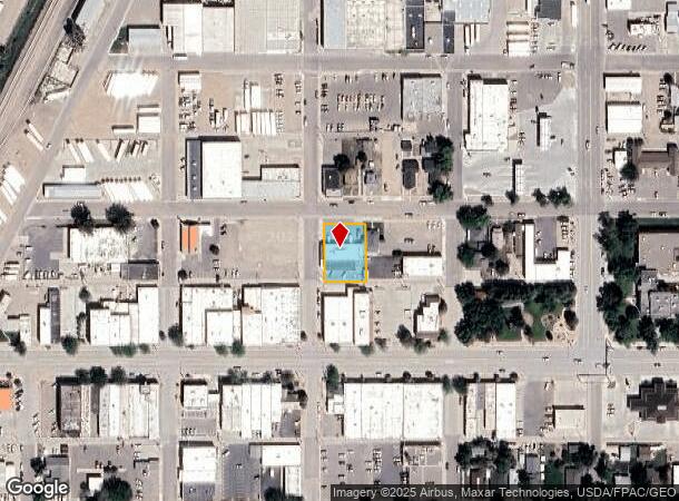
124 N 8Th St, Worland, WY 82401

NEARBY LISTINGS FOR SALE OR LEASE
-
-
View all Worland listings for sale on LoopNet.com
Property Detail
124 N 8Th St
Other Market Areas
First Addn
47502514500500
B: 3 L: 5 FIRST ADDN. B: 3 L: 6 FIRST ADDN.
Warehouse
Washakie
2024
Wyoming
2025
5,6
000301
0.32 AC
10,476 SF
Wyoming Area
DEMOGRAPHICS near 124 N 8Th St
1 Mile
3 Mile
5 Mile
2024 Total Population
4,214
5,987
6,489
2029 Population
4,242
6,006
6,493
Pop Growth 2024-2029
+ 0.66%
+ 0.32%
+ 0.06%
Average Age
42
42
43
2024 Total Households
1,828
2,587
2,772
HH Growth 2024-2029
+ 0.66%
+ 0.31%
+ 0.07%
Median Household Inc
$63,311
$62,463
$62,958
Avg Household Size
2.20
2.30
2.30
2024 Avg HH Vehicles
2.00
2.00
2.00
Median Home Value
$171,716
$181,271
$185,193
Median Year Built
1958
1965
1967
Nearby Places
Map Layers
Map Styles
 Street
 Aerial
- Restaurants
- Banks
- Shops
- Fitness
- Groceries
Nearby Properties
Address
Land Use
TOTAL SIZE
Lot Size
Zoning
Address
Land Use
TOTAL SIZE
Lot Size
Zoning
1 SF
46.61 AC
Address
Land Use
TOTAL SIZE
Lot Size
Zoning
140,000 SF
3.38 AC
Address
Land Use
TOTAL SIZE
Lot Size
Zoning
35,816 SF
4.80 AC
Address
Land Use
TOTAL SIZE
Lot Size
Zoning
Address
Land Use
TOTAL SIZE
Lot Size
Zoning
22,640 SF
5.48 AC
Address
Land Use
TOTAL SIZE
Lot Size
Zoning
6,888 SF
0.72 AC
Address
Land Use
TOTAL SIZE
Lot Size
Zoning
28,391 SF
1.78 AC
Address
Land Use
TOTAL SIZE
Lot Size
Zoning
7,500 SF
373.74 AC
Address
Land Use
TOTAL SIZE
Lot Size
Zoning
41,389 SF
4.19 AC
Address
Land Use
TOTAL SIZE
Lot Size
Zoning
3,526 SF
1,048.51 AC
Address
Land Use
TOTAL SIZE
Lot Size
Zoning
13,976 SF
0.32 AC
Address
Land Use
TOTAL SIZE
Lot Size
Zoning
7,818 SF
272.48 AC
Address
Land Use
TOTAL SIZE
Lot Size
Zoning
33,894 SF
3.15 AC
Address
Land Use
TOTAL SIZE
Lot Size
Zoning
18,192 SF
1.99 AC
Address
Land Use
TOTAL SIZE
Lot Size
Zoning
26,225 SF
0.48 AC
Address
Land Use
TOTAL SIZE
Lot Size
Zoning
21,280 SF
3.33 AC
Address
Land Use
TOTAL SIZE
Lot Size
Zoning
15,600 SF
Address
Land Use
TOTAL SIZE
Lot Size
Zoning
7,295 SF
283.22 AC
Address
Land Use
TOTAL SIZE
Lot Size
Zoning
32,500 SF
2.29 AC
Address
Land Use
TOTAL SIZE
Lot Size
Zoning
2,414 SF
436.34 AC
Address
Land Use
TOTAL SIZE
Lot Size
Zoning
13,540 SF
1.65 AC
Address
Land Use
TOTAL SIZE
Lot Size
Zoning
3,597 SF
0.32 AC
Address
Land Use
TOTAL SIZE
Lot Size
Zoning
4,784 SF
0.69 AC
Address
Land Use
TOTAL SIZE
Lot Size
Zoning
20,160 SF
1.95 AC
Address
Land Use
TOTAL SIZE
Lot Size
Zoning
14,706 SF
2.71 AC
Address
Land Use
TOTAL SIZE
Lot Size
Zoning
1 SF
8.03 AC
Address
Land Use
TOTAL SIZE
Lot Size
Zoning
6,500 SF
0.48 AC
Address
Land Use
TOTAL SIZE
Lot Size
Zoning
21,129 SF
1.51 AC
Address
Land Use
TOTAL SIZE
Lot Size
Zoning
7,379 SF
106.69 AC
Address
Land Use
TOTAL SIZE
Lot Size
Zoning
2,288 SF
289.90 AC
The World's #1 Commercial Real Estate Marketplace
Connect with us
© 2025 CoStar Group
The information above has been obtained from sources believed reliable. While we do not doubt its accuracy we have not verified it and make no guarantee, warranty or representation about it. It is your responsibility to independently confirm its accuracy and completeness. Any projections, opinions, assumptions, or estimates used are for example only and do not represent the current or future performance of the property. The value of this transaction to you depends on tax and other factors which should be evaluated by your tax, financial, and legal advisors. You and your advisors should conduct a careful, independent investigation of the property to determine to your satisfaction the suitability of the property for your needs.