Property Record
124 Park Ave, Lyndhurst, NJ 07071

Save to a Folder
{{folder.Name}}
{{folder.ListingIds.length}} Properties
{{folder.ListingIds.length}} Property
Create a New Folder
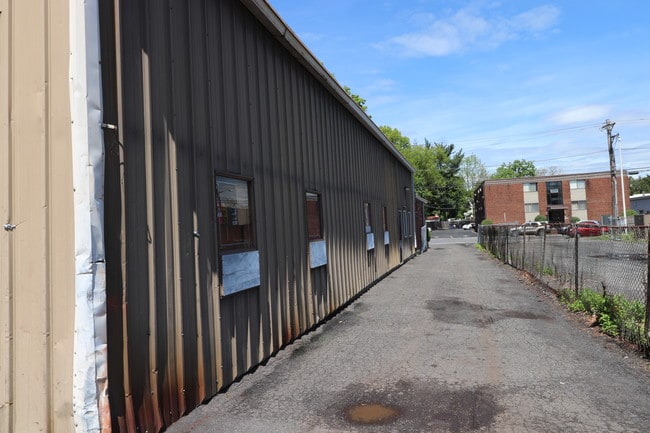
Property Detail
124 Park Ave
New York-Jersey City-White Plains, NY-NJ
42X200
32-00007-0000-00013-02
Bergen
Commercialnec
New Jersey
AE The base floodplain where base flood elevations are provided. AE Zones are now used on new format FIRMs instead of A1-A30 Zones.
13.2
2025
0.19 AC
2026
Lyndhurst/Harrison
031200
Northern New Jersey
2,790 SF
NEARBY LISTINGS FOR SALE OR LEASE
DEMOGRAPHICS near 124 Park Ave
1 mile
3 mile
5 mile
2025 Total Population
25,496
206,708
601,544
2030 Population
25,857
211,181
615,141
Pop Growth 2025-2030
+ 1.42%
+ 2.16%
+ 2.26%
Average Age
42
40
40
2025 Total Households
9,727
76,573
219,965
HH Growth 2025-2030
+ 1.39%
+ 2.17%
+ 2.40%
Median Household Inc
$117,275
$103,317
$90,709
Avg Household Size
2.50
2.60
2.60
2025 Avg HH Vehicles
2.00
2.00
2.00
Median Home Value
$568,303
$485,384
$484,082
Median Year Built
1951
1951
1953
Nearby Places
Map Layers
Map Styles
 Street
 Aerial
Layers
 Traffic
 Biking
Places
Listings with unknown addresses are not visible on the map
- Restaurants
- Banks
- Shops
- Fitness
- Groceries
PUBLIC TRANSPORTATION
TRANSIT/SUBWAY
Lyndhurst (Main/Port Jervis Line - NJ Transit Commuter Rail (NJ Transit))
Drive
Walk
Distance
Lyndhurst (Main/Port Jervis Line - NJ Transit Commuter Rail (NJ Transit))
3 min
8 min
0.4 mi
Kingsland (Main/Port Jervis Line - NJ Transit Commuter Rail (NJ Transit))
Drive
Walk
Distance
Kingsland (Main/Port Jervis Line - NJ Transit Commuter Rail (NJ Transit))
2 min
19 min
1.0 mi
COMMUTER RAIL
Lyndhurst (Main/Port Jervis Line - NJ Transit Commuter Rail (NJ Transit))
Drive
Walk
Distance
Lyndhurst (Main/Port Jervis Line - NJ Transit Commuter Rail (NJ Transit))
3 min
7 min
0.4 mi
Kingsland (Main/Port Jervis Line - NJ Transit Commuter Rail (NJ Transit))
Drive
Walk
Distance
Kingsland (Main/Port Jervis Line - NJ Transit Commuter Rail (NJ Transit))
2 min
19 min
1.0 mi
AIRPORT
Newark Liberty International
Drive
Walk
Distance
Newark Liberty International
15 min
12.5 mi
LaGuardia
Drive
Walk
Distance
LaGuardia
35 min
19.0 mi
John F Kennedy International
Drive
Walk
Distance
John F Kennedy International
44 min
27.1 mi
Freight Ports
Maher Terminal
Drive
Walk
Distance
Maher Terminal
23 min
12.4 mi
SALE & LEASE HISTORY
LISTING DATE
SALE/LEASE

May 09, 2019
For Sale
Nearby Properties
Address
Land Use
TOTAL SIZE
Lot Size
Zoning
Address
Land Use
TOTAL SIZE
Lot Size
Zoning
Address
Land Use
TOTAL SIZE
Lot Size
Zoning
612 AC
SEA
Address
Land Use
TOTAL SIZE
Lot Size
Zoning
Address
Land Use
TOTAL SIZE
Lot Size
Zoning
4,014 SF
21 AC
Address
Land Use
TOTAL SIZE
Lot Size
Zoning
9.57 AC
I2
Address
Land Use
TOTAL SIZE
Lot Size
Zoning
3,956 SF
250 AC
C2
Address
Land Use
TOTAL SIZE
Lot Size
Zoning
602,220 SF
25.91 AC
Address
Land Use
TOTAL SIZE
Lot Size
Zoning
Address
Land Use
TOTAL SIZE
Lot Size
Zoning
5.80 AC
CGI
Address
Land Use
TOTAL SIZE
Lot Size
Zoning
433,716 SF
10.49 AC
Address
Land Use
TOTAL SIZE
Lot Size
Zoning
8.88 AC
ORD
Address
Land Use
TOTAL SIZE
Lot Size
Zoning
1,218 SF
41.30 AC
RB
Address
Land Use
TOTAL SIZE
Lot Size
Zoning
7.29 AC
Address
Land Use
TOTAL SIZE
Lot Size
Zoning
1.12 AC
M-O
Address
Land Use
TOTAL SIZE
Lot Size
Zoning
100,014 SF
8.80 AC
M2
Address
Land Use
TOTAL SIZE
Lot Size
Zoning
18.30 AC
Address
Land Use
TOTAL SIZE
Lot Size
Zoning
Address
Land Use
TOTAL SIZE
Lot Size
Zoning
2.42 AC
Address
Land Use
TOTAL SIZE
Lot Size
Zoning
71,634 SF
12.31 AC
M1
Address
Land Use
TOTAL SIZE
Lot Size
Zoning
24.29 AC
Address
Land Use
TOTAL SIZE
Lot Size
Zoning
Address
Land Use
TOTAL SIZE
Lot Size
Zoning
87,032 SF
6.67 AC
Address
Land Use
TOTAL SIZE
Lot Size
Zoning
860 SF
0.96 AC
R100
Address
Land Use
TOTAL SIZE
Lot Size
Zoning
148,918 SF
4.17 AC
B
Address
Land Use
TOTAL SIZE
Lot Size
Zoning
Address
Land Use
TOTAL SIZE
Lot Size
Zoning
11.30 AC
Address
Land Use
TOTAL SIZE
Lot Size
Zoning
154,842 SF
5.29 AC
Address
Land Use
TOTAL SIZE
Lot Size
Zoning
13.80 AC
Address
Land Use
TOTAL SIZE
Lot Size
Zoning
329,464 SF
15.82 AC
Address
Land Use
TOTAL SIZE
Lot Size
Zoning
177,672 SF
7.51 AC
IA
The World's #1 Commercial Real Estate Marketplace
Connect with us
© 2026 CoStar Group
The information above has been obtained from sources believed reliable. While we do not doubt its accuracy we have not verified it and make no guarantee, warranty or representation about it. It is your responsibility to independently confirm its accuracy and completeness. Any projections, opinions, assumptions, or estimates used are for example only and do not represent the current or future performance of the property. The value of this transaction to you depends on tax and other factors which should be evaluated by your tax, financial, and legal advisors. You and your advisors should conduct a careful, independent investigation of the property to determine to your satisfaction the suitability of the property for your needs.