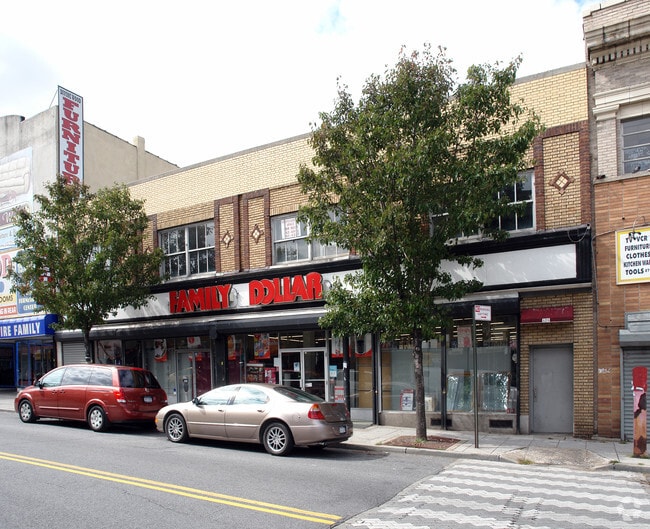
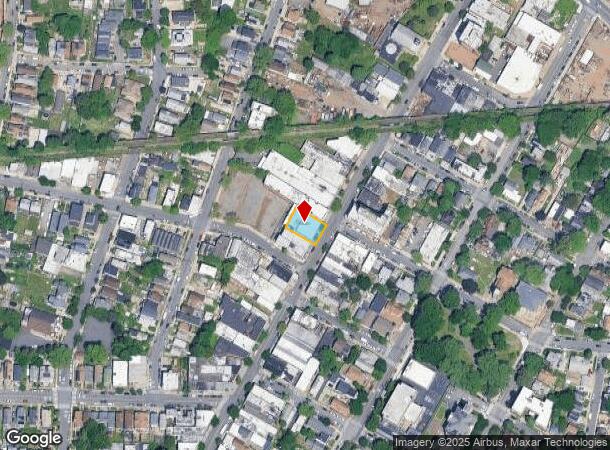
Property Record
168 White Sands Way, Far Rockaway, NY 11692
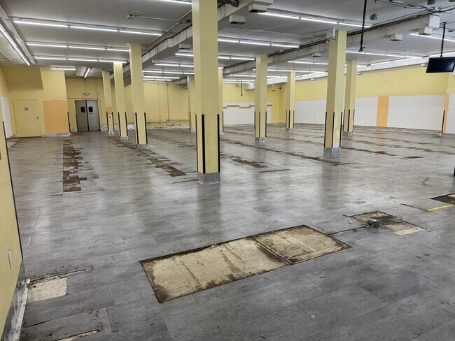
Current Lease Availabilities
NEARBY LISTINGS FOR SALE OR LEASE
Property Detail
168 White Sands Way
01073-0117
Staten Island
Storebuilding
New York
X
117
3604970169F
0.16 AC
2024
Staten Island
2025
Long Island (New York)
021300
New York-Jersey City-White Plains, NY-NJ
9,000 SF
DEMOGRAPHICS near 168 White Sands Way
1 Mile
3 Mile
5 Mile
2024 Total Population
39,257
245,545
503,831
2029 Population
37,944
239,886
490,708
Pop Growth 2024-2029
(3.34%)
(2.30%)
(2.60%)
Average Age
37
39
40
2024 Total Households
12,948
85,574
175,575
HH Growth 2024-2029
(3.65%)
(2.46%)
(2.72%)
Median Household Inc
$63,661
$76,877
$72,391
Avg Household Size
2.90
2.70
2.80
2024 Avg HH Vehicles
1.00
1.00
1.00
Median Home Value
$448,544
$546,761
$554,996
Median Year Built
1952
1961
1965
Nearby Places
- Restaurants
- Banks
- Shops
- Fitness
- Groceries
PUBLIC TRANSPORTATION
COMMUTER RAIL
Elizabeth (North Jersey Coast Line - NJ Transit Commuter Rail (NJ Transit), Northeast Corridor Line - NJ Transit Commuter Rail (NJ Transit))
DRIVE
WALK
Distance
Elizabeth (North Jersey Coast Line - NJ Transit Commuter Rail (NJ Transit), Northeast Corridor Line - NJ Transit Commuter Rail (NJ Transit))
19 min
8.0 mi
AIRPORT
Newark Liberty International
DRIVE
WALK
Distance
Newark Liberty International
22 min
11.3 mi
LaGuardia
DRIVE
WALK
Distance
LaGuardia
39 min
27.1 mi
John F Kennedy International
DRIVE
WALK
Distance
John F Kennedy International
44 min
29.6 mi
Nearby Properties
Address
Land Use
TOTAL SIZE
Lot Size
Zoning
Address
Land Use
TOTAL SIZE
Lot Size
Zoning
113.19 AC
Address
Land Use
TOTAL SIZE
Lot Size
Zoning
633,280 SF
202.90 AC
R3-2
Address
Land Use
TOTAL SIZE
Lot Size
Zoning
Address
Land Use
TOTAL SIZE
Lot Size
Zoning
4,450,000 SF
95.24 AC
Address
Land Use
TOTAL SIZE
Lot Size
Zoning
22.49 AC
HC
Address
Land Use
TOTAL SIZE
Lot Size
Zoning
686,130 SF
189.62 AC
R3-2
Address
Land Use
TOTAL SIZE
Lot Size
Zoning
70.39 AC
Address
Land Use
TOTAL SIZE
Lot Size
Zoning
16.63 AC
Address
Land Use
TOTAL SIZE
Lot Size
Zoning
2.21 AC
Address
Land Use
TOTAL SIZE
Lot Size
Zoning
1.01 AC
Address
Land Use
TOTAL SIZE
Lot Size
Zoning
51.62 AC
Address
Land Use
TOTAL SIZE
Lot Size
Zoning
91,760 SF
210.43 AC
M3-1
Address
Land Use
TOTAL SIZE
Lot Size
Zoning
3.27 AC
Address
Land Use
TOTAL SIZE
Lot Size
Zoning
17.60 AC
Address
Land Use
TOTAL SIZE
Lot Size
Zoning
51.61 AC
Address
Land Use
TOTAL SIZE
Lot Size
Zoning
39.64 AC
Address
Land Use
TOTAL SIZE
Lot Size
Zoning
566,000 SF
103.31 AC
R3-2
Address
Land Use
TOTAL SIZE
Lot Size
Zoning
28.47 AC
I-H
Address
Land Use
TOTAL SIZE
Lot Size
Zoning
6,188,000 SF
8.18 AC
Address
Land Use
TOTAL SIZE
Lot Size
Zoning
11.96 AC
Address
Land Use
TOTAL SIZE
Lot Size
Zoning
1 SF
20 AC
Address
Land Use
TOTAL SIZE
Lot Size
Zoning
115.33 AC
IH
Address
Land Use
TOTAL SIZE
Lot Size
Zoning
74.35 AC
TDD
Address
Land Use
TOTAL SIZE
Lot Size
Zoning
30.70 AC
Address
Land Use
TOTAL SIZE
Lot Size
Zoning
Address
Land Use
TOTAL SIZE
Lot Size
Zoning
10.86 AC
R-2
Address
Land Use
TOTAL SIZE
Lot Size
Zoning
1,502 SF
0.69 AC
C-1
Address
Land Use
TOTAL SIZE
Lot Size
Zoning
Address
Land Use
TOTAL SIZE
Lot Size
Zoning
23.73 AC
Address
Land Use
TOTAL SIZE
Lot Size
Zoning
73.86 AC
IH
The World's #1 Commercial Real Estate Marketplace
Connect with us
© 2025 CoStar Group
The information above has been obtained from sources believed reliable. While we do not doubt its accuracy we have not verified it and make no guarantee, warranty or representation about it. It is your responsibility to independently confirm its accuracy and completeness. Any projections, opinions, assumptions, or estimates used are for example only and do not represent the current or future performance of the property. The value of this transaction to you depends on tax and other factors which should be evaluated by your tax, financial, and legal advisors. You and your advisors should conduct a careful, independent investigation of the property to determine to your satisfaction the suitability of the property for your needs.