Property Record
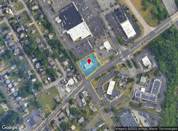
1240 Bristol Pike, Croydon, PA 19021


NEARBY LISTINGS FOR SALE OR LEASE
Property Detail
1240 Bristol Pike
02-030-009-002
LOT NS US13 1946 FT W T31 2
Restaurantdrivein
Bucks
X
Pennsylvania
34005C0104F
0.99 AC
2024
Lower Bucks County
2025
Philadelphia
100302
Philadelphia-Camden-Wilmington, PA-NJ-DE-MD
3,903 SF
DEMOGRAPHICS near 1240 Bristol Pike
1 Mile
3 Mile
5 Mile
2024 Total Population
11,164
106,924
326,082
2029 Population
10,892
104,623
318,300
Pop Growth 2024-2029
(2.44%)
(2.15%)
(2.39%)
Average Age
42
41
41
2024 Total Households
4,336
42,361
125,224
HH Growth 2024-2029
(2.38%)
(2.37%)
(2.60%)
Median Household Inc
$78,371
$72,374
$70,570
Avg Household Size
2.50
2.50
2.50
2024 Avg HH Vehicles
2.00
2.00
2.00
Median Home Value
$268,707
$247,648
$252,268
Median Year Built
1965
1965
1965
Nearby Places
Map Layers
Map Styles
 Street
 Aerial
- Restaurants
- Banks
- Shops
- Fitness
- Groceries
PUBLIC TRANSPORTATION
COMMUTER RAIL
Cornwells Heights (R7 - Southeastern Pennsylvania Transportation Authority Regional Rail (SEPTA Regional Rail))
DRIVE
WALK
Distance
Cornwells Heights (R7 - Southeastern Pennsylvania Transportation Authority Regional Rail (SEPTA Regional Rail))
5 min
1.5 mi
Torresdale (R7 - Southeastern Pennsylvania Transportation Authority Regional Rail (SEPTA Regional Rail))
DRIVE
WALK
Distance
Torresdale (R7 - Southeastern Pennsylvania Transportation Authority Regional Rail (SEPTA Regional Rail))
5 min
2.2 mi
AIRPORT
Trenton Mercer
DRIVE
WALK
Distance
Trenton Mercer
32 min
18.8 mi
Philadelphia International
DRIVE
WALK
Distance
Philadelphia International
39 min
25.1 mi
Freight Ports
Port of Philadelphia
DRIVE
WALK
Distance
Port of Philadelphia
18 min
11.5 mi
Nearby Properties
Address
Land Use
TOTAL SIZE
Lot Size
Zoning
Address
Land Use
TOTAL SIZE
Lot Size
Zoning
34,350 SF
336 AC
SPPOA
Address
Land Use
TOTAL SIZE
Lot Size
Zoning
6,290 SF
177.73 AC
RSA4
Address
Land Use
TOTAL SIZE
Lot Size
Zoning
1,015,495 SF
70.51 AC
I1
Address
Land Use
TOTAL SIZE
Lot Size
Zoning
1,615,457 SF
119.41 AC
CA2
Address
Land Use
TOTAL SIZE
Lot Size
Zoning
597,188 SF
120.50 AC
RM2
Address
Land Use
TOTAL SIZE
Lot Size
Zoning
96 AC
SPPOA
Address
Land Use
TOTAL SIZE
Lot Size
Zoning
95,280 SF
117.33 AC
I3
Address
Land Use
TOTAL SIZE
Lot Size
Zoning
432,175 SF
16.70 AC
I2
Address
Land Use
TOTAL SIZE
Lot Size
Zoning
464,814 SF
23.90 AC
I1
Address
Land Use
TOTAL SIZE
Lot Size
Zoning
2,550 SF
63.76 AC
SPPOA
Address
Land Use
TOTAL SIZE
Lot Size
Zoning
438,910 SF
24.42 AC
RSA4
Address
Land Use
TOTAL SIZE
Lot Size
Zoning
282,736 SF
21.32 AC
I1
Address
Land Use
TOTAL SIZE
Lot Size
Zoning
404,000 SF
1.08 AC
RM2
Address
Land Use
TOTAL SIZE
Lot Size
Zoning
233,520 SF
14.03 AC
I1
Address
Land Use
TOTAL SIZE
Lot Size
Zoning
459,320 SF
18 AC
RM2
Address
Land Use
TOTAL SIZE
Lot Size
Zoning
453,038 SF
34.79 AC
I1
Address
Land Use
TOTAL SIZE
Lot Size
Zoning
41.25 AC
RSA1
Address
Land Use
TOTAL SIZE
Lot Size
Zoning
5.70 AC
R2
Address
Land Use
TOTAL SIZE
Lot Size
Zoning
300,700 SF
30.41 AC
I1
Address
Land Use
TOTAL SIZE
Lot Size
Zoning
203,573 SF
9.94 AC
I1
Address
Land Use
TOTAL SIZE
Lot Size
Zoning
222,500 SF
14.58 AC
I1
Address
Land Use
TOTAL SIZE
Lot Size
Zoning
237,425 SF
15.30 AC
I1
Address
Land Use
TOTAL SIZE
Lot Size
Zoning
207,500 SF
16.18 AC
I1
Address
Land Use
TOTAL SIZE
Lot Size
Zoning
241,392 SF
24.15 AC
I1
Address
Land Use
TOTAL SIZE
Lot Size
Zoning
179,868 SF
11.70 AC
CA2
Address
Land Use
TOTAL SIZE
Lot Size
Zoning
166,815 SF
23.47 AC
I1
Address
Land Use
TOTAL SIZE
Lot Size
Zoning
386,320 SF
21.41 AC
I1
Address
Land Use
TOTAL SIZE
Lot Size
Zoning
248,178 SF
19.36 AC
I1
Address
Land Use
TOTAL SIZE
Lot Size
Zoning
444,322 SF
27.43 AC
SPINS
Address
Land Use
TOTAL SIZE
Lot Size
Zoning
507,587 SF
36.98 AC
I1
The World's #1 Commercial Real Estate Marketplace
Connect with us
© 2026 CoStar Group
The information above has been obtained from sources believed reliable. While we do not doubt its accuracy we have not verified it and make no guarantee, warranty or representation about it. It is your responsibility to independently confirm its accuracy and completeness. Any projections, opinions, assumptions, or estimates used are for example only and do not represent the current or future performance of the property. The value of this transaction to you depends on tax and other factors which should be evaluated by your tax, financial, and legal advisors. You and your advisors should conduct a careful, independent investigation of the property to determine to your satisfaction the suitability of the property for your needs.