Property Record
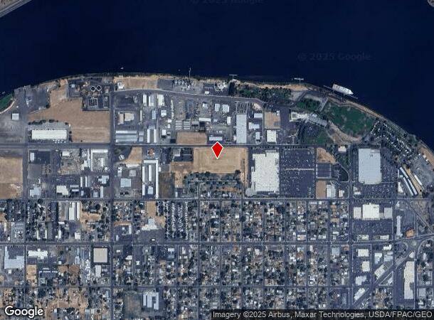
1240 Fair St, Clarkston, WA 99403

NEARBY LISTINGS FOR SALE OR LEASE
Property Detail
1240 Fair St
Coeur D'Alene
Port Drive Commons Short Plat
Lewiston, ID-WA
UNPLATTED CLARKSTON PT NW S21 T11 R46
6-132-00-091-0001-0000
Asotin
Vacantlandnec
Washington
2024
6.09 AC
2023
Asotin
960300
DEMOGRAPHICS near 1240 Fair St
1 mile
3 mile
5 mile
2024 Total Population
5,285
31,986
47,521
2029 Population
5,438
33,351
49,700
Pop Growth 2024-2029
+ 2.89%
+ 4.27%
+ 4.59%
Average Age
40
41
42
2024 Total Households
2,268
13,264
19,913
HH Growth 2024-2029
+ 2.82%
+ 4.24%
+ 4.62%
Median Household Inc
$43,428
$57,653
$59,805
Avg Household Size
2.30
2.30
2.30
2024 Avg HH Vehicles
2.00
2.00
2.00
Median Home Value
$180,608
$259,309
$267,885
Median Year Built
1954
1967
1971
Nearby Places
Map Layers
Map Styles
 Street
 Aerial
Transit
 Traffic
 Biking
Places
Listings with unknown addresses are not visible on the map
- Restaurants
- Banks
- Shops
- Fitness
- Groceries
PUBLIC TRANSPORTATION
AIRPORT
Lewiston/Nez Perce County
Drive
Walk
Distance
Lewiston/Nez Perce County
18 min
7.8 mi
Pullman/Moscow Regional
Drive
Walk
Distance
Pullman/Moscow Regional
60 min
42.3 mi
SALE & LEASE HISTORY
LISTING DATE
SALE/LEASE

Nov 23, 2021
For Sale
Feb 02, 2018
For Sale
Nearby Properties
Address
Land Use
TOTAL SIZE
Lot Size
Zoning
Address
Land Use
TOTAL SIZE
Lot Size
Zoning
296,259 SF
2.47 AC
NHMU
Address
Land Use
TOTAL SIZE
Lot Size
Zoning
0.48 AC
Address
Land Use
TOTAL SIZE
Lot Size
Zoning
18.85 AC
11
Address
Land Use
TOTAL SIZE
Lot Size
Zoning
22.44 AC
1
Address
Land Use
TOTAL SIZE
Lot Size
Zoning
156,391 SF
7.14 AC
C6
Address
Land Use
TOTAL SIZE
Lot Size
Zoning
44,800 SF
5 AC
P
Address
Land Use
TOTAL SIZE
Lot Size
Zoning
160,676 SF
8.24 AC
1
Address
Land Use
TOTAL SIZE
Lot Size
Zoning
25,810 SF
2.21 AC
Address
Land Use
TOTAL SIZE
Lot Size
Zoning
51,272 SF
7.02 AC
P
Address
Land Use
TOTAL SIZE
Lot Size
Zoning
2.24 AC
Address
Land Use
TOTAL SIZE
Lot Size
Zoning
35,000 SF
5.81 AC
P
Address
Land Use
TOTAL SIZE
Lot Size
Zoning
97,896 SF
4.88 AC
C6
Address
Land Use
TOTAL SIZE
Lot Size
Zoning
54,459 SF
4.06 AC
R3
Address
Land Use
TOTAL SIZE
Lot Size
Zoning
47,750 SF
8.37 AC
C4
Address
Land Use
TOTAL SIZE
Lot Size
Zoning
75,600 SF
2.96 AC
R4
Address
Land Use
TOTAL SIZE
Lot Size
Zoning
59,704 SF
6.20 AC
C6
Address
Land Use
TOTAL SIZE
Lot Size
Zoning
10,375 SF
2.80 AC
R3
Address
Land Use
TOTAL SIZE
Lot Size
Zoning
93,679 SF
10.72 AC
C6
Address
Land Use
TOTAL SIZE
Lot Size
Zoning
6.83 AC
Address
Land Use
TOTAL SIZE
Lot Size
Zoning
7.08 AC
Address
Land Use
TOTAL SIZE
Lot Size
Zoning
2.44 AC
Address
Land Use
TOTAL SIZE
Lot Size
Zoning
27,552 SF
5.31 AC
C6
Address
Land Use
TOTAL SIZE
Lot Size
Zoning
24,577 SF
1.10 AC
C6
Address
Land Use
TOTAL SIZE
Lot Size
Zoning
214,202 SF
15 AC
C6
Address
Land Use
TOTAL SIZE
Lot Size
Zoning
41,940 SF
1.68 AC
Address
Land Use
TOTAL SIZE
Lot Size
Zoning
19,850 SF
4.84 AC
M1
Address
Land Use
TOTAL SIZE
Lot Size
Zoning
28,709 SF
2.58 AC
C6
Address
Land Use
TOTAL SIZE
Lot Size
Zoning
6,089 SF
2.23 AC
R3
Address
Land Use
TOTAL SIZE
Lot Size
Zoning
12,640 SF
7.23 AC
P
Address
Land Use
TOTAL SIZE
Lot Size
Zoning
26,002 SF
0.46 AC
C4
The World's #1 Commercial Real Estate Marketplace
Connect with us
© 2026 CoStar Group
The information above has been obtained from sources believed reliable. While we do not doubt its accuracy we have not verified it and make no guarantee, warranty or representation about it. It is your responsibility to independently confirm its accuracy and completeness. Any projections, opinions, assumptions, or estimates used are for example only and do not represent the current or future performance of the property. The value of this transaction to you depends on tax and other factors which should be evaluated by your tax, financial, and legal advisors. You and your advisors should conduct a careful, independent investigation of the property to determine to your satisfaction the suitability of the property for your needs.