Property Record
1240 Research Frst, Macedon, NY 14502
NEARBY LISTINGS FOR SALE OR LEASE
-
-
View all Macedon listings for sale on LoopNet.com
Property Detail
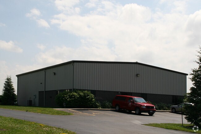
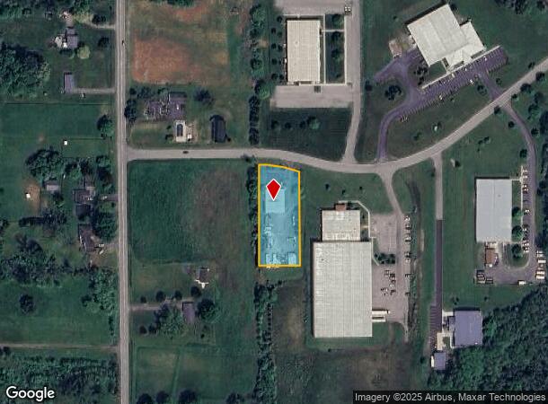
1240 Research Frst
Rochester, NY
30113-00-350741
543000-062-113-0000-378-749-0000
Wayne
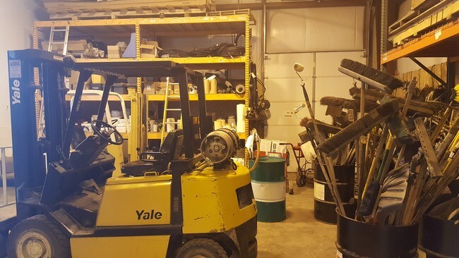
Warehouse
New York
2025
378.749
2024
1 AC
020302
Wayne County
4,500 SF
Rochester
DEMOGRAPHICS near 1240 Research Frst
1 Mile
3 Mile
5 Mile
2024 Total Population
2,521
9,603
22,394
2029 Population
2,489
9,470
22,089
Pop Growth 2024-2029
(1.27%)
(1.38%)
(1.36%)
Average Age
40
40
42
2024 Total Households
973
3,677
8,673
HH Growth 2024-2029
(1.34%)
(1.44%)
(1.41%)
Median Household Inc
$80,469
$84,722
$93,104
Avg Household Size
2.60
2.60
2.50
2024 Avg HH Vehicles
2.00
2.00
2.00
Median Home Value
$179,147
$182,302
$195,667
Median Year Built
1987
1985
1984
Nearby Places
- Restaurants
- Banks
- Shops
- Fitness
- Groceries
PUBLIC TRANSPORTATION
AIRPORT
Frederick Douglass/Greater Rochester International
DRIVE
WALK
Distance
Frederick Douglass/Greater Rochester International
37 min
20.2 mi
SALE & LEASE HISTORY
LISTING DATE
SALE/LEASE

Sep 23, 2016
For Sale
Jan 25, 2017
For Sale
Apr 12, 2017
For Sale
Apr 04, 2017
For Sale
Apr 03, 2018
For Sale
Nearby Properties
Address
Land Use
TOTAL SIZE
Lot Size
Zoning
Address
Land Use
TOTAL SIZE
Lot Size
Zoning
30.50 AC
Address
Land Use
TOTAL SIZE
Lot Size
Zoning
2,972 SF
3 AC
CON
Address
Land Use
TOTAL SIZE
Lot Size
Zoning
2.73 AC
Address
Land Use
TOTAL SIZE
Lot Size
Zoning
49,174 SF
6.96 AC
CON
Address
Land Use
TOTAL SIZE
Lot Size
Zoning
122,916 SF
23.40 AC
CON
Address
Land Use
TOTAL SIZE
Lot Size
Zoning
83,853 SF
11.60 AC
CON
Address
Land Use
TOTAL SIZE
Lot Size
Zoning
39,560 SF
38.51 AC
05 - COMME
Address
Land Use
TOTAL SIZE
Lot Size
Zoning
58,430 SF
4.71 AC
CON
Address
Land Use
TOTAL SIZE
Lot Size
Zoning
105,949 SF
5.02 AC
06 - INDUS
Address
Land Use
TOTAL SIZE
Lot Size
Zoning
4.71 AC
CON
Address
Land Use
TOTAL SIZE
Lot Size
Zoning
6,312 SF
8.80 AC
NCD
Address
Land Use
TOTAL SIZE
Lot Size
Zoning
44.80 AC
Address
Land Use
TOTAL SIZE
Lot Size
Zoning
6,312 SF
10.12 AC
NCD
Address
Land Use
TOTAL SIZE
Lot Size
Zoning
70,390 SF
41.69 AC
CON
Address
Land Use
TOTAL SIZE
Lot Size
Zoning
91,745 SF
14.81 AC
06 - INDUS
Address
Land Use
TOTAL SIZE
Lot Size
Zoning
66,000 SF
9.36 AC
NCD
Address
Land Use
TOTAL SIZE
Lot Size
Zoning
8,676 SF
57.93 AC
CON
Address
Land Use
TOTAL SIZE
Lot Size
Zoning
18,938 SF
58.50 AC
ORM
Address
Land Use
TOTAL SIZE
Lot Size
Zoning
15,232 SF
20.41 AC
RA-2
Address
Land Use
TOTAL SIZE
Lot Size
Zoning
19,000 SF
7.27 AC
Address
Land Use
TOTAL SIZE
Lot Size
Zoning
2,600 SF
142.18 AC
05 - COMME
Address
Land Use
TOTAL SIZE
Lot Size
Zoning
14,000 SF
144.14 AC
05 - COMME
Address
Land Use
TOTAL SIZE
Lot Size
Zoning
5,600 SF
283.30 AC
CON
Address
Land Use
TOTAL SIZE
Lot Size
Zoning
15,632 SF
5.15 AC
CON
Address
Land Use
TOTAL SIZE
Lot Size
Zoning
8,000 SF
12.84 AC
CON
Address
Land Use
TOTAL SIZE
Lot Size
Zoning
16,512 SF
1.92 AC
CON
Address
Land Use
TOTAL SIZE
Lot Size
Zoning
1,008 SF
21.59 AC
Address
Land Use
TOTAL SIZE
Lot Size
Zoning
22,832 SF
4.80 AC
Address
Land Use
TOTAL SIZE
Lot Size
Zoning
2,958 SF
300.60 AC
Address
Land Use
TOTAL SIZE
Lot Size
Zoning
59,200 SF
5.38 AC
06 - INDUS
The World's #1 Commercial Real Estate Marketplace
Connect with us
© 2025 CoStar Group
The information above has been obtained from sources believed reliable. While we do not doubt its accuracy we have not verified it and make no guarantee, warranty or representation about it. It is your responsibility to independently confirm its accuracy and completeness. Any projections, opinions, assumptions, or estimates used are for example only and do not represent the current or future performance of the property. The value of this transaction to you depends on tax and other factors which should be evaluated by your tax, financial, and legal advisors. You and your advisors should conduct a careful, independent investigation of the property to determine to your satisfaction the suitability of the property for your needs.