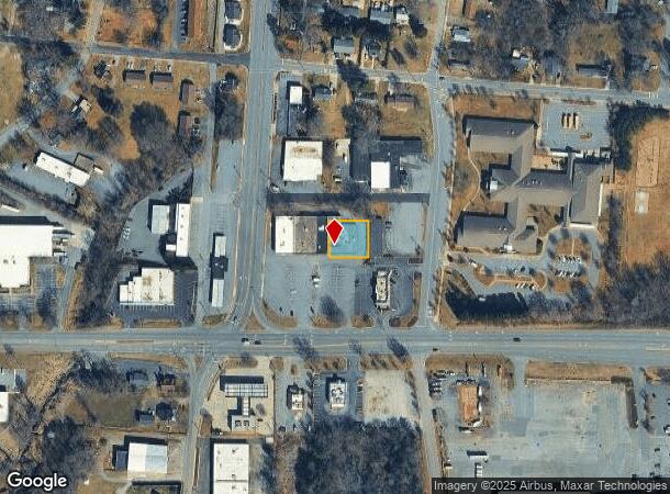
Property Record
1234 Us Highway 70 Sw, Hickory, NC 28602

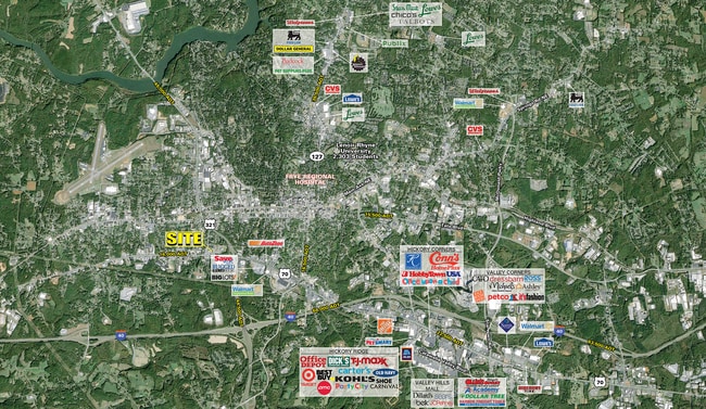
NEARBY LISTINGS FOR SALE OR LEASE
Property Detail
1234 Us Highway 70 Sw
Hickory-Lenoir-Morganton, NC
J C Plonk
2792129604490000
LOT 32-35 PT 31 PL 6-3
Stripcommercialcenter
Catawba
X
North Carolina
3710279200J
32-35
2024
0.28 AC
2025
Catawba County
010700
Charlotte
7,760 SF
DEMOGRAPHICS near 1234 Us Highway 70 Sw
1 Mile
3 Mile
5 Mile
2024 Total Population
4,368
30,948
66,879
2029 Population
4,595
32,245
69,488
Pop Growth 2024-2029
+ 5.20%
+ 4.19%
+ 3.90%
Average Age
39
41
41
2024 Total Households
1,861
12,708
27,769
HH Growth 2024-2029
+ 5.16%
+ 4.20%
+ 3.93%
Median Household Inc
$34,838
$51,083
$55,356
Avg Household Size
2.30
2.30
2.30
2024 Avg HH Vehicles
2.00
2.00
2.00
Median Home Value
$119,839
$171,177
$179,854
Median Year Built
1970
1971
1979
Nearby Places
Map Layers
Map Styles
 Street
 Aerial
- Restaurants
- Banks
- Shops
- Fitness
- Groceries
SALE & LEASE HISTORY
LISTING DATE
SALE/LEASE

Sep 28, 2016
For Lease
Sep 04, 2025
For Lease
May 17, 2021
For Sale
May 15, 2023
For Sale
Mar 02, 2021
For Lease
Jun 22, 2023
For Lease
Jun 07, 2024
For Lease
Nearby Properties
Address
Land Use
TOTAL SIZE
Lot Size
Zoning
Address
Land Use
TOTAL SIZE
Lot Size
Zoning
534,243 SF
285.78 AC
Address
Land Use
TOTAL SIZE
Lot Size
Zoning
10,422 SF
4.23 AC
OI
Address
Land Use
TOTAL SIZE
Lot Size
Zoning
19.87 AC
OI
Address
Land Use
TOTAL SIZE
Lot Size
Zoning
27.56 AC
OI
Address
Land Use
TOTAL SIZE
Lot Size
Zoning
57,658 SF
10.64 AC
OI
Address
Land Use
TOTAL SIZE
Lot Size
Zoning
9,376 SF
0.75 AC
C-1
Address
Land Use
TOTAL SIZE
Lot Size
Zoning
311,263 SF
37.58 AC
IND
Address
Land Use
TOTAL SIZE
Lot Size
Zoning
7,240 SF
INDUSTRIAL
Address
Land Use
TOTAL SIZE
Lot Size
Zoning
30,415 SF
1.59 AC
C-1
Address
Land Use
TOTAL SIZE
Lot Size
Zoning
146,932 SF
27.08 AC
C-3
Address
Land Use
TOTAL SIZE
Lot Size
Zoning
90,440 SF
5.17 AC
OI
Address
Land Use
TOTAL SIZE
Lot Size
Zoning
9,950 SF
9.42 AC
R-3
Address
Land Use
TOTAL SIZE
Lot Size
Zoning
8,960 SF
14.07 AC
R-4
Address
Land Use
TOTAL SIZE
Lot Size
Zoning
14.15 AC
OI
Address
Land Use
TOTAL SIZE
Lot Size
Zoning
60,130 SF
4.02 AC
IND
Address
Land Use
TOTAL SIZE
Lot Size
Zoning
8.36 AC
OI
Address
Land Use
TOTAL SIZE
Lot Size
Zoning
22.70 AC
R-2
Address
Land Use
TOTAL SIZE
Lot Size
Zoning
137,227 SF
12.03 AC
NC
Address
Land Use
TOTAL SIZE
Lot Size
Zoning
301,264 SF
19.88 AC
I
Address
Land Use
TOTAL SIZE
Lot Size
Zoning
2.36 AC
C-1
Address
Land Use
TOTAL SIZE
Lot Size
Zoning
73,702 SF
13.37 AC
C-2
Address
Land Use
TOTAL SIZE
Lot Size
Zoning
8,246 SF
37.33 AC
OI
Address
Land Use
TOTAL SIZE
Lot Size
Zoning
84,090 SF
10.51 AC
R-2
Address
Land Use
TOTAL SIZE
Lot Size
Zoning
109,602 SF
18.08 AC
C-3
Address
Land Use
TOTAL SIZE
Lot Size
Zoning
9.07 AC
NC
Address
Land Use
TOTAL SIZE
Lot Size
Zoning
13.07 AC
OI
Address
Land Use
TOTAL SIZE
Lot Size
Zoning
6,208 SF
6.12 AC
R-3
Address
Land Use
TOTAL SIZE
Lot Size
Zoning
20,503 SF
16.55 AC
INDUSTRIAL
Address
Land Use
TOTAL SIZE
Lot Size
Zoning
2.20 AC
OI
Address
Land Use
TOTAL SIZE
Lot Size
Zoning
57,427 SF
5.27 AC
C-2
The World's #1 Commercial Real Estate Marketplace
Connect with us
© 2025 CoStar Group
The information above has been obtained from sources believed reliable. While we do not doubt its accuracy we have not verified it and make no guarantee, warranty or representation about it. It is your responsibility to independently confirm its accuracy and completeness. Any projections, opinions, assumptions, or estimates used are for example only and do not represent the current or future performance of the property. The value of this transaction to you depends on tax and other factors which should be evaluated by your tax, financial, and legal advisors. You and your advisors should conduct a careful, independent investigation of the property to determine to your satisfaction the suitability of the property for your needs.