Property Record
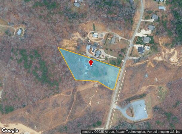
12401 Asbury Chapel Rd, Huntersville, NC 28078

This Property Is For Sale
NEARBY LISTINGS FOR SALE OR LEASE
Property Detail
12401 Asbury Chapel Rd
Charlotte-Concord-Gastonia, NC-SC
C E Ferrell Estate 05
019-181-17
Mecklenburg
Sfr
North Carolina
X
3.28 AC
3710466000K
Northeast/I-77
1,612 SF
Charlotte
DEMOGRAPHICS near 12401 Asbury Chapel Rd
1 Mile
3 Mile
5 Mile
2024 Total Population
1,991
48,916
151,875
2029 Population
2,185
53,325
164,402
Pop Growth 2024-2029
+ 9.74%
+ 9.01%
+ 8.25%
Average Age
40
38
37
2024 Total Households
706
18,249
57,241
HH Growth 2024-2029
+ 9.92%
+ 9.21%
+ 8.39%
Median Household Inc
$174,615
$120,884
$104,306
Avg Household Size
2.80
2.70
2.60
2024 Avg HH Vehicles
2.00
2.00
2.00
Median Home Value
$646,341
$462,085
$445,241
Median Year Built
2009
2005
2004
Nearby Places
Map Layers
Map Styles
 Street
 Aerial
- Restaurants
- Banks
- Shops
- Fitness
- Groceries
PUBLIC TRANSPORTATION
AIRPORT
Concord-Padgett Regional
DRIVE
WALK
Distance
Concord-Padgett Regional
16 min
8.9 mi
Charlotte/Douglas International
DRIVE
WALK
Distance
Charlotte/Douglas International
34 min
20.2 mi
Freight Ports
North Charleston Terminal
DRIVE
WALK
Distance
North Charleston Terminal
246 min
212.3 mi
Nearby Properties
Address
Land Use
TOTAL SIZE
Lot Size
Zoning
Address
Land Use
TOTAL SIZE
Lot Size
Zoning
316,033 SF
30.04 AC
R3
Address
Land Use
TOTAL SIZE
Lot Size
Zoning
310,576 SF
11.22 AC
Address
Land Use
TOTAL SIZE
Lot Size
Zoning
338,136 SF
15.13 AC
Address
Land Use
TOTAL SIZE
Lot Size
Zoning
15.72 AC
Address
Land Use
TOTAL SIZE
Lot Size
Zoning
252,523 SF
7.75 AC
R3
Address
Land Use
TOTAL SIZE
Lot Size
Zoning
284,316 SF
15.50 AC
R22MFCD
Address
Land Use
TOTAL SIZE
Lot Size
Zoning
30,682 SF
24.33 AC
LDR
Address
Land Use
TOTAL SIZE
Lot Size
Zoning
261,701 SF
11.05 AC
R-17MF(CD)
Address
Land Use
TOTAL SIZE
Lot Size
Zoning
223,714 SF
16.93 AC
CB
Address
Land Use
TOTAL SIZE
Lot Size
Zoning
211,601 SF
20.80 AC
Address
Land Use
TOTAL SIZE
Lot Size
Zoning
249,694 SF
41.60 AC
NR
Address
Land Use
TOTAL SIZE
Lot Size
Zoning
209,077 SF
5.76 AC
HC(CD)
Address
Land Use
TOTAL SIZE
Lot Size
Zoning
165,567 SF
22.80 AC
NR
Address
Land Use
TOTAL SIZE
Lot Size
Zoning
173,528 SF
6.30 AC
UR-3(CD)
Address
Land Use
TOTAL SIZE
Lot Size
Zoning
211,235 SF
49.22 AC
CI
Address
Land Use
TOTAL SIZE
Lot Size
Zoning
315,420 SF
21.83 AC
Address
Land Use
TOTAL SIZE
Lot Size
Zoning
588,388 SF
38.51 AC
CB
Address
Land Use
TOTAL SIZE
Lot Size
Zoning
155,951 SF
8.20 AC
Address
Land Use
TOTAL SIZE
Lot Size
Zoning
150,358 SF
6.01 AC
HC(CD)
Address
Land Use
TOTAL SIZE
Lot Size
Zoning
221,640 SF
30.04 AC
R3
Address
Land Use
TOTAL SIZE
Lot Size
Zoning
306,007 SF
22.40 AC
Address
Land Use
TOTAL SIZE
Lot Size
Zoning
148,280 SF
4.46 AC
Address
Land Use
TOTAL SIZE
Lot Size
Zoning
1,914 SF
2.84 AC
TC
Address
Land Use
TOTAL SIZE
Lot Size
Zoning
461,464 SF
24 AC
I-2
Address
Land Use
TOTAL SIZE
Lot Size
Zoning
131,917 SF
4.50 AC
Address
Land Use
TOTAL SIZE
Lot Size
Zoning
157,792 SF
4.39 AC
Address
Land Use
TOTAL SIZE
Lot Size
Zoning
69,347 SF
36.78 AC
R-3
Address
Land Use
TOTAL SIZE
Lot Size
Zoning
315,548 SF
30.10 AC
BP
Address
Land Use
TOTAL SIZE
Lot Size
Zoning
121,048 SF
3 AC
Address
Land Use
TOTAL SIZE
Lot Size
Zoning
78,300 SF
10.41 AC
SP
The World's #1 Commercial Real Estate Marketplace
Connect with us
© 2025 CoStar Group
The information above has been obtained from sources believed reliable. While we do not doubt its accuracy we have not verified it and make no guarantee, warranty or representation about it. It is your responsibility to independently confirm its accuracy and completeness. Any projections, opinions, assumptions, or estimates used are for example only and do not represent the current or future performance of the property. The value of this transaction to you depends on tax and other factors which should be evaluated by your tax, financial, and legal advisors. You and your advisors should conduct a careful, independent investigation of the property to determine to your satisfaction the suitability of the property for your needs.