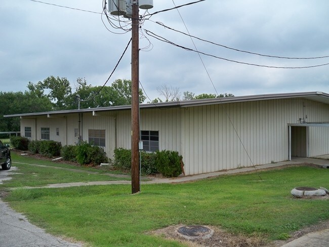
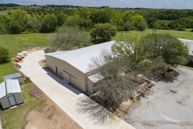
Property Record
12401 E Highway 290 St W, Burton, TX 77835

Property Detail
12401 E Highway 290 St W
0016-000-13900
A0016 A0016 - BORDEN, THOMAS H., TRACT 139, ACRES 6.69
Industrialgeneral
WASHINGTON
A Areas with a 1% annual chance of flooding and a 26% chance of flooding over the life of a 30-year mortgage.
Texas
2025
6.69 AC
2025
Central Texas Area
170501
Other Market Areas
24,518 SF
Brenham, TX
NEARBY LISTINGS FOR SALE OR LEASE
-
-
View all Burton listings for sale on LoopNet.com
DEMOGRAPHICS near 12401 E Highway 290 St W
1 mile
3 mile
5 mile
2025 Total Population
323
678
1,499
2030 Population
335
705
1,558
Pop Growth 2025-2030
+ 3.72%
+ 3.98%
+ 3.94%
Average Age
46
47
47
2025 Total Households
143
297
648
HH Growth 2025-2030
+ 4.90%
+ 4.71%
+ 4.94%
Median Household Inc
$102,206
$108,522
$110,495
Avg Household Size
2.20
2.30
2.30
2025 Avg HH Vehicles
3.00
2.00
2.00
Median Home Value
$627,659
$609,223
$587,662
Median Year Built
1987
1986
1985
Nearby Places
Map Layers
Map Styles
 Street
 Aerial
Transit
 Traffic
 Biking
Places
Listings with unknown addresses are not visible on the map
- Restaurants
- Banks
- Shops
- Fitness
- Groceries
PUBLIC TRANSPORTATION
AIRPORT
Easterwood Field
Drive
Walk
Distance
Easterwood Field
69 min
45.2 mi
SALE & LEASE HISTORY
LISTING DATE
SALE/LEASE

May 16, 2018
For Lease
Jul 18, 2018
For Sale
Nearby Properties
Address
Land Use
TOTAL SIZE
Lot Size
Zoning
Address
Land Use
TOTAL SIZE
Lot Size
Zoning
231.45 AC
Address
Land Use
TOTAL SIZE
Lot Size
Zoning
6,615 SF
113.25 AC
Address
Land Use
TOTAL SIZE
Lot Size
Zoning
756 SF
159.42 AC
Address
Land Use
TOTAL SIZE
Lot Size
Zoning
750 SF
160.09 AC
Address
Land Use
TOTAL SIZE
Lot Size
Zoning
1,053 SF
169.86 AC
Address
Land Use
TOTAL SIZE
Lot Size
Zoning
2,293 SF
124.03 AC
Address
Land Use
TOTAL SIZE
Lot Size
Zoning
1,419 SF
212 AC
Address
Land Use
TOTAL SIZE
Lot Size
Zoning
1,142 SF
136.41 AC
Address
Land Use
TOTAL SIZE
Lot Size
Zoning
401 SF
162.96 AC
Address
Land Use
TOTAL SIZE
Lot Size
Zoning
147.71 AC
Address
Land Use
TOTAL SIZE
Lot Size
Zoning
1,238 SF
119.61 AC
Address
Land Use
TOTAL SIZE
Lot Size
Zoning
160 SF
114.19 AC
Address
Land Use
TOTAL SIZE
Lot Size
Zoning
137.03 AC
Address
Land Use
TOTAL SIZE
Lot Size
Zoning
350 SF
111.96 AC
Address
Land Use
TOTAL SIZE
Lot Size
Zoning
1,618 SF
128.60 AC
Address
Land Use
TOTAL SIZE
Lot Size
Zoning
12,653 SF
115.32 AC
Address
Land Use
TOTAL SIZE
Lot Size
Zoning
4,943 SF
126.66 AC
Address
Land Use
TOTAL SIZE
Lot Size
Zoning
408.80 AC
Address
Land Use
TOTAL SIZE
Lot Size
Zoning
2,227 SF
80.23 AC
Address
Land Use
TOTAL SIZE
Lot Size
Zoning
3,468 SF
86.48 AC
Address
Land Use
TOTAL SIZE
Lot Size
Zoning
2,431 SF
90.22 AC
Address
Land Use
TOTAL SIZE
Lot Size
Zoning
3,200 SF
108.16 AC
Address
Land Use
TOTAL SIZE
Lot Size
Zoning
88.02 AC
Address
Land Use
TOTAL SIZE
Lot Size
Zoning
633 SF
84.25 AC
Address
Land Use
TOTAL SIZE
Lot Size
Zoning
66 AC
Address
Land Use
TOTAL SIZE
Lot Size
Zoning
71.72 AC
Address
Land Use
TOTAL SIZE
Lot Size
Zoning
88.51 AC
Address
Land Use
TOTAL SIZE
Lot Size
Zoning
4,135 SF
20.10 AC
Address
Land Use
TOTAL SIZE
Lot Size
Zoning
108.66 AC
Address
Land Use
TOTAL SIZE
Lot Size
Zoning
1,943 SF
74.69 AC
The World's #1 Commercial Real Estate Marketplace
Connect with us
© 2026 CoStar Group
The information above has been obtained from sources believed reliable. While we do not doubt its accuracy we have not verified it and make no guarantee, warranty or representation about it. It is your responsibility to independently confirm its accuracy and completeness. Any projections, opinions, assumptions, or estimates used are for example only and do not represent the current or future performance of the property. The value of this transaction to you depends on tax and other factors which should be evaluated by your tax, financial, and legal advisors. You and your advisors should conduct a careful, independent investigation of the property to determine to your satisfaction the suitability of the property for your needs.