Property Record
1241 20Th St, Ogden, UT 84401

NEARBY LISTINGS FOR SALE OR LEASE
Property Detail
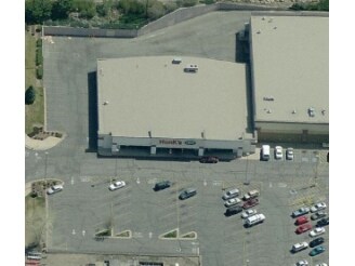
1241 20Th St
13-114-0008
City View Addition
Wholesaleoutletdiscountstore
PART OF THE NORTHWEST QUARTER OF SECTION 27, TOWNSHIP 6 NORTH RANGE 1 WEST, SALT LAKE BASE AND MERIDIAN, U.S. SURVEY:
X
Weber
49057C0427F
Utah
2025
1.67 AC
2025
Davis/Weber Counties
201900
Salt Lake City
16,965 SF
Ogden, UT
DEMOGRAPHICS near 1241 20Th St
1 Mile
3 Mile
5 Mile
2024 Total Population
15,522
75,800
139,410
2029 Population
16,634
81,357
149,677
Pop Growth 2024-2029
+ 7.16%
+ 7.33%
+ 7.36%
Average Age
37
35
36
2024 Total Households
6,327
28,468
50,570
HH Growth 2024-2029
+ 7.37%
+ 7.56%
+ 7.59%
Median Household Inc
$52,482
$52,677
$61,093
Avg Household Size
2.40
2.60
2.70
2024 Avg HH Vehicles
2.00
2.00
2.00
Median Home Value
$285,972
$282,667
$327,057
Median Year Built
1955
1959
1974
Nearby Places
Map Layers
Map Styles
 Street
 Aerial
- Restaurants
- Banks
- Shops
- Fitness
- Groceries
PUBLIC TRANSPORTATION
COMMUTER RAIL
Ogden (FrontRunner North - Utah Transit Authority (UTA))
DRIVE
WALK
Distance
Ogden (FrontRunner North - Utah Transit Authority (UTA))
6 min
2.3 mi
Roy (FrontRunner North - Utah Transit Authority (UTA))
DRIVE
WALK
Distance
Roy (FrontRunner North - Utah Transit Authority (UTA))
14 min
7.1 mi
Freight Ports
Port of Stockton
DRIVE
WALK
Distance
Port of Stockton
752 min
727.7 mi
Nearby Properties
Address
Land Use
TOTAL SIZE
Lot Size
Zoning
Address
Land Use
TOTAL SIZE
Lot Size
Zoning
841,756 SF
45.79 AC
Address
Land Use
TOTAL SIZE
Lot Size
Zoning
128,867 SF
3.36 AC
Address
Land Use
TOTAL SIZE
Lot Size
Zoning
97,932 SF
3.07 AC
Address
Land Use
TOTAL SIZE
Lot Size
Zoning
52,200 SF
9.95 AC
Address
Land Use
TOTAL SIZE
Lot Size
Zoning
305,444 SF
1.58 AC
Address
Land Use
TOTAL SIZE
Lot Size
Zoning
152,877 SF
4.96 AC
Address
Land Use
TOTAL SIZE
Lot Size
Zoning
9,464 SF
6.82 AC
Address
Land Use
TOTAL SIZE
Lot Size
Zoning
48,177 SF
5.54 AC
Address
Land Use
TOTAL SIZE
Lot Size
Zoning
106,752 SF
10.35 AC
Address
Land Use
TOTAL SIZE
Lot Size
Zoning
22,227 SF
10.81 AC
Address
Land Use
TOTAL SIZE
Lot Size
Zoning
66,896 SF
7.50 AC
Address
Land Use
TOTAL SIZE
Lot Size
Zoning
119,043 SF
2.05 AC
Address
Land Use
TOTAL SIZE
Lot Size
Zoning
95,949 SF
3.29 AC
Address
Land Use
TOTAL SIZE
Lot Size
Zoning
166,800 SF
0.12 AC
Address
Land Use
TOTAL SIZE
Lot Size
Zoning
19,594 SF
1.12 AC
Address
Land Use
TOTAL SIZE
Lot Size
Zoning
47,750 SF
2.10 AC
Address
Land Use
TOTAL SIZE
Lot Size
Zoning
73,942 SF
8.87 AC
Address
Land Use
TOTAL SIZE
Lot Size
Zoning
7,567 SF
5.12 AC
Address
Land Use
TOTAL SIZE
Lot Size
Zoning
14,520 SF
6.86 AC
Address
Land Use
TOTAL SIZE
Lot Size
Zoning
151,615 SF
5.08 AC
Address
Land Use
TOTAL SIZE
Lot Size
Zoning
108,083 SF
6.21 AC
Address
Land Use
TOTAL SIZE
Lot Size
Zoning
100,056 SF
2.03 AC
Address
Land Use
TOTAL SIZE
Lot Size
Zoning
11,248 SF
6.50 AC
Address
Land Use
TOTAL SIZE
Lot Size
Zoning
14,328 SF
4.28 AC
The World's #1 Commercial Real Estate Marketplace
Connect with us
© 2026 CoStar Group
The information above has been obtained from sources believed reliable. While we do not doubt its accuracy we have not verified it and make no guarantee, warranty or representation about it. It is your responsibility to independently confirm its accuracy and completeness. Any projections, opinions, assumptions, or estimates used are for example only and do not represent the current or future performance of the property. The value of this transaction to you depends on tax and other factors which should be evaluated by your tax, financial, and legal advisors. You and your advisors should conduct a careful, independent investigation of the property to determine to your satisfaction the suitability of the property for your needs.