Property Record
1241 E Kearney St, Springfield, MO 65803

NEARBY LISTINGS FOR SALE OR LEASE
Property Detail
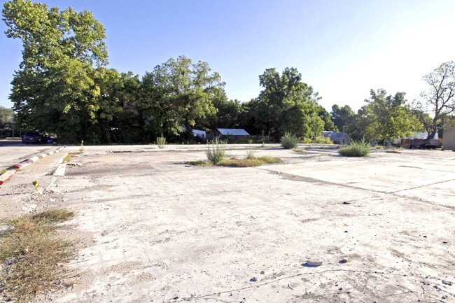
1241 E Kearney St
Springfield, MO
Haseltines Blvd
12-06-303-016
HASELTINE'S BLVD ADD LOT 27 (EX S 10 FT) & LOTS 28 29 30 31 & 32 BLK 3
Restaurantdrivein
Greene
X
Missouri
29077C0332E
27-32
2025
0.45 AC
2025
Northeast
003600
Springfield
8,090 SF
DEMOGRAPHICS near 1241 E Kearney St
1 Mile
3 Mile
5 Mile
2024 Total Population
10,089
60,893
126,322
2029 Population
10,476
63,419
131,738
Pop Growth 2024-2029
+ 3.84%
+ 4.15%
+ 4.29%
Average Age
37
36
37
2024 Total Households
4,349
25,585
55,076
HH Growth 2024-2029
+ 4.00%
+ 4.42%
+ 4.60%
Median Household Inc
$37,401
$38,245
$42,181
Avg Household Size
2.20
2.10
2.10
2024 Avg HH Vehicles
1.00
1.00
2.00
Median Home Value
$89,037
$119,347
$142,771
Median Year Built
1964
1971
1973
Nearby Places
Map Layers
Map Styles
 Street
 Aerial
- Restaurants
- Banks
- Shops
- Fitness
- Groceries
PUBLIC TRANSPORTATION
AIRPORT
Springfield-Branson Ntl
DRIVE
WALK
Distance
Springfield-Branson Ntl
20 min
7.9 mi
Nearby Properties
Address
Land Use
TOTAL SIZE
Lot Size
Zoning
Address
Land Use
TOTAL SIZE
Lot Size
Zoning
11.54 AC
Address
Land Use
TOTAL SIZE
Lot Size
Zoning
35.56 AC
INC
Address
Land Use
TOTAL SIZE
Lot Size
Zoning
343,758 SF
29.81 AC
INC
Address
Land Use
TOTAL SIZE
Lot Size
Zoning
297,760 SF
4.22 AC
INC
Address
Land Use
TOTAL SIZE
Lot Size
Zoning
233,445 SF
8.17 AC
INC
Address
Land Use
TOTAL SIZE
Lot Size
Zoning
22.01 AC
INC.
Address
Land Use
TOTAL SIZE
Lot Size
Zoning
1,728,457 SF
123.60 AC
INC
Address
Land Use
TOTAL SIZE
Lot Size
Zoning
340,000 SF
37.93 AC
INC
Address
Land Use
TOTAL SIZE
Lot Size
Zoning
359,020 SF
14 AC
INC
Address
Land Use
TOTAL SIZE
Lot Size
Zoning
355,759 SF
2.23 AC
INC
Address
Land Use
TOTAL SIZE
Lot Size
Zoning
349,216 SF
29.46 AC
INC
Address
Land Use
TOTAL SIZE
Lot Size
Zoning
5.84 AC
INC
Address
Land Use
TOTAL SIZE
Lot Size
Zoning
805,370 SF
54.30 AC
INC
Address
Land Use
TOTAL SIZE
Lot Size
Zoning
24.54 AC
INC.
Address
Land Use
TOTAL SIZE
Lot Size
Zoning
13.88 AC
INC
Address
Land Use
TOTAL SIZE
Lot Size
Zoning
1,825 SF
4.31 AC
INC
Address
Land Use
TOTAL SIZE
Lot Size
Zoning
5.47 AC
INC
Address
Land Use
TOTAL SIZE
Lot Size
Zoning
143,774 SF
5.85 AC
INC
Address
Land Use
TOTAL SIZE
Lot Size
Zoning
108,153 SF
7.37 AC
INC.
Address
Land Use
TOTAL SIZE
Lot Size
Zoning
290,844 SF
20.78 AC
INC
Address
Land Use
TOTAL SIZE
Lot Size
Zoning
127,740 SF
27.70 AC
INC
Address
Land Use
TOTAL SIZE
Lot Size
Zoning
92,702 SF
42.54 AC
INC
Address
Land Use
TOTAL SIZE
Lot Size
Zoning
20.11 AC
INC
Address
Land Use
TOTAL SIZE
Lot Size
Zoning
186,125 SF
21.09 AC
INC
Address
Land Use
TOTAL SIZE
Lot Size
Zoning
16.73 AC
Address
Land Use
TOTAL SIZE
Lot Size
Zoning
116,085 SF
3.45 AC
INC
Address
Land Use
TOTAL SIZE
Lot Size
Zoning
2.75 AC
INC
Address
Land Use
TOTAL SIZE
Lot Size
Zoning
2.92 AC
INC
Address
Land Use
TOTAL SIZE
Lot Size
Zoning
79.50 AC
INC
Address
Land Use
TOTAL SIZE
Lot Size
Zoning
4.62 AC
INC
The World's #1 Commercial Real Estate Marketplace
Connect with us
© 2025 CoStar Group
The information above has been obtained from sources believed reliable. While we do not doubt its accuracy we have not verified it and make no guarantee, warranty or representation about it. It is your responsibility to independently confirm its accuracy and completeness. Any projections, opinions, assumptions, or estimates used are for example only and do not represent the current or future performance of the property. The value of this transaction to you depends on tax and other factors which should be evaluated by your tax, financial, and legal advisors. You and your advisors should conduct a careful, independent investigation of the property to determine to your satisfaction the suitability of the property for your needs.