Property Record
1241 E Main St, Stamford, CT 06902


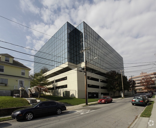
Property Detail
1241 E Main St
Commercialbuilding
Western Ct
CN
Connecticut
B and X Area of moderate flood hazard, usually the area between the limits of the 100-year and 500-year floods.
1.19 AC
2025
Stamford
2025
Westchester/So Connecticut
021900
Bridgeport-Stamford-Danbury, CT
94,248 SF
STAM-000000-000000-006856
NEARBY LISTINGS FOR SALE OR LEASE
DEMOGRAPHICS near 1241 E Main St
1 mile
3 mile
5 mile
2025 Total Population
26,383
130,369
195,521
2030 Population
26,641
133,651
200,218
Pop Growth 2025-2030
+ 0.98%
+ 2.52%
+ 2.40%
Average Age
39
39
40
2025 Total Households
9,381
51,615
74,153
HH Growth 2025-2030
+ 0.95%
+ 2.81%
+ 2.59%
Median Household Inc
$89,795
$107,018
$119,710
Avg Household Size
2.70
2.40
2.50
2025 Avg HH Vehicles
2.00
2.00
2.00
Median Home Value
$557,996
$705,082
$837,728
Median Year Built
1960
1973
1969
Nearby Places
Map Layers
Map Styles
 Street
 Aerial
Layers
 Traffic
 Biking
Places
Listings with unknown addresses are not visible on the map
- Restaurants
- Banks
- Shops
- Fitness
- Groceries
PUBLIC TRANSPORTATION
COMMUTER RAIL
Noroton Heights Station (New Haven Line - Metro-North Commuter Railroad Company (Metro-North))
Drive
Walk
Distance
Noroton Heights Station (New Haven Line - Metro-North Commuter Railroad Company (Metro-North))
3 min
1.4 mi
Glenbrook Station (New Haven Line - Metro-North Commuter Railroad Company (Metro-North))
Drive
Walk
Distance
Glenbrook Station (New Haven Line - Metro-North Commuter Railroad Company (Metro-North))
4 min
1.5 mi
AIRPORT
Westchester County
Drive
Walk
Distance
Westchester County
25 min
14.4 mi
LaGuardia
Drive
Walk
Distance
LaGuardia
51 min
33.6 mi
Freight Ports
Port of New Haven
Drive
Walk
Distance
Port of New Haven
58 min
39.8 mi
SALE & LEASE HISTORY
LISTING DATE
SALE/LEASE

Sep 05, 2019
For Sale
May 15, 2024
For Sale
Jun 22, 2020
For Sale
Nearby Properties
Address
Land Use
TOTAL SIZE
Lot Size
Zoning
Address
Land Use
TOTAL SIZE
Lot Size
Zoning
13.21 AC
CSCD
Address
Land Use
TOTAL SIZE
Lot Size
Zoning
8.91 AC
DC
Address
Land Use
TOTAL SIZE
Lot Size
Zoning
336,000 SF
40 AC
MU
Address
Land Use
TOTAL SIZE
Lot Size
Zoning
5.10 AC
MXD
Address
Land Use
TOTAL SIZE
Lot Size
Zoning
Address
Land Use
TOTAL SIZE
Lot Size
Zoning
397,378 SF
4.25 AC
CC
Address
Land Use
TOTAL SIZE
Lot Size
Zoning
543,005 SF
2.23 AC
RHD
Address
Land Use
TOTAL SIZE
Lot Size
Zoning
411,596 SF
3.30 AC
MZN
Address
Land Use
TOTAL SIZE
Lot Size
Zoning
4.13 AC
CC
Address
Land Use
TOTAL SIZE
Lot Size
Zoning
Address
Land Use
TOTAL SIZE
Lot Size
Zoning
46,302 SF
23.50 AC
MG
Address
Land Use
TOTAL SIZE
Lot Size
Zoning
9.62 AC
MZN
Address
Land Use
TOTAL SIZE
Lot Size
Zoning
17.54 AC
DWD
Address
Land Use
TOTAL SIZE
Lot Size
Zoning
359,686 SF
1.67 AC
CCN
Address
Land Use
TOTAL SIZE
Lot Size
Zoning
377,754 SF
2.06 AC
PD
Address
Land Use
TOTAL SIZE
Lot Size
Zoning
79.29 AC
P
Address
Land Use
TOTAL SIZE
Lot Size
Zoning
32.68 AC
MD
Address
Land Use
TOTAL SIZE
Lot Size
Zoning
8.21 AC
CWD
Address
Land Use
TOTAL SIZE
Lot Size
Zoning
304,617 SF
CI
Address
Land Use
TOTAL SIZE
Lot Size
Zoning
377,918 SF
22.42 AC
MZN
Address
Land Use
TOTAL SIZE
Lot Size
Zoning
304,345 SF
1.15 AC
PD
Address
Land Use
TOTAL SIZE
Lot Size
Zoning
277,740 SF
2.82 AC
TCDD
Address
Land Use
TOTAL SIZE
Lot Size
Zoning
308,621 SF
CI
Address
Land Use
TOTAL SIZE
Lot Size
Zoning
32.06 AC
DMR
Address
Land Use
TOTAL SIZE
Lot Size
Zoning
235,186 SF
1.29 AC
CG
Address
Land Use
TOTAL SIZE
Lot Size
Zoning
3.14 AC
RH
Address
Land Use
TOTAL SIZE
Lot Size
Zoning
1.95 AC
SRDS
Address
Land Use
TOTAL SIZE
Lot Size
Zoning
262,996 SF
1.37 AC
SRDS
Address
Land Use
TOTAL SIZE
Lot Size
Zoning
243,000 SF
3.02 AC
CG
Address
Land Use
TOTAL SIZE
Lot Size
Zoning
334,905 SF
2.52 AC
MXD
The World's #1 Commercial Real Estate Marketplace
Connect with us
© 2026 CoStar Group
The information above has been obtained from sources believed reliable. While we do not doubt its accuracy we have not verified it and make no guarantee, warranty or representation about it. It is your responsibility to independently confirm its accuracy and completeness. Any projections, opinions, assumptions, or estimates used are for example only and do not represent the current or future performance of the property. The value of this transaction to you depends on tax and other factors which should be evaluated by your tax, financial, and legal advisors. You and your advisors should conduct a careful, independent investigation of the property to determine to your satisfaction the suitability of the property for your needs.