Property Record
1241 Hawks Flight Ct, El Dorado Hills, CA 95762

NEARBY LISTINGS FOR SALE OR LEASE
Property Detail
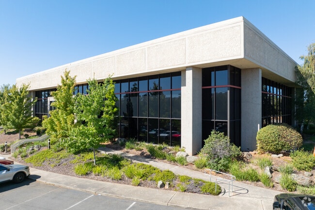
1241 Hawks Flight Ct
117-060-070-000
PM 50/100/3
Officebuilding
El Dorado
X
California
06067C0139J
2.03 AC
2024
El Dorado
2025
Sacramento
030711
Sacramento--Roseville--Arden-Arcade, CA
27,212 SF
DEMOGRAPHICS near 1241 Hawks Flight Ct
1 Mile
3 Mile
5 Mile
2024 Total Population
7,004
34,803
98,930
2029 Population
7,360
36,123
101,250
Pop Growth 2024-2029
+ 5.08%
+ 3.79%
+ 2.35%
Average Age
47
42
41
2024 Total Households
2,907
12,320
35,205
HH Growth 2024-2029
+ 5.13%
+ 3.86%
+ 2.34%
Median Household Inc
$105,958
$147,726
$144,214
Avg Household Size
2.40
2.80
2.80
2024 Avg HH Vehicles
2.00
2.00
2.00
Median Home Value
$729,097
$765,490
$752,501
Median Year Built
2010
2007
2001
Nearby Places
Map Layers
Map Styles
 Street
 Aerial
- Restaurants
- Banks
- Shops
- Fitness
- Groceries
PUBLIC TRANSPORTATION
AIRPORT
Sacramento International
DRIVE
WALK
Distance
Sacramento International
51 min
39.2 mi
Freight Ports
Port of Stockton
DRIVE
WALK
Distance
Port of Stockton
87 min
72.8 mi
Nearby Properties
Address
Land Use
TOTAL SIZE
Lot Size
Zoning
Address
Land Use
TOTAL SIZE
Lot Size
Zoning
352,146 SF
11.54 AC
SP-R-4 (SP
Address
Land Use
TOTAL SIZE
Lot Size
Zoning
Address
Land Use
TOTAL SIZE
Lot Size
Zoning
23.23 AC
SP-R-M (SP
Address
Land Use
TOTAL SIZE
Lot Size
Zoning
37.18 AC
SP-R-4 (SP
Address
Land Use
TOTAL SIZE
Lot Size
Zoning
8.54 AC
SP-MHD (PD
Address
Land Use
TOTAL SIZE
Lot Size
Zoning
553,153 SF
33.17 AC
Address
Land Use
TOTAL SIZE
Lot Size
Zoning
6.29 AC
SP-C-2 (SP
Address
Land Use
TOTAL SIZE
Lot Size
Zoning
203,397 SF
11.58 AC
SP-R-4 (SP
Address
Land Use
TOTAL SIZE
Lot Size
Zoning
114,835 SF
19.73 AC
SP-C-2 (SP
Address
Land Use
TOTAL SIZE
Lot Size
Zoning
45,846 SF
12.62 AC
C-3 (PD)
Address
Land Use
TOTAL SIZE
Lot Size
Zoning
354,406 SF
23.94 AC
VVSP
Address
Land Use
TOTAL SIZE
Lot Size
Zoning
6.07 AC
SP-OS2 (SP
Address
Land Use
TOTAL SIZE
Lot Size
Zoning
Address
Land Use
TOTAL SIZE
Lot Size
Zoning
148,663 SF
18.60 AC
SP-C-2 (SP
Address
Land Use
TOTAL SIZE
Lot Size
Zoning
127,600 SF
8.24 AC
CG
Address
Land Use
TOTAL SIZE
Lot Size
Zoning
Address
Land Use
TOTAL SIZE
Lot Size
Zoning
85,799 SF
4.67 AC
Address
Land Use
TOTAL SIZE
Lot Size
Zoning
150,808 SF
14.91 AC
R2
Address
Land Use
TOTAL SIZE
Lot Size
Zoning
50.99 AC
SP-GC (PD)
Address
Land Use
TOTAL SIZE
Lot Size
Zoning
76,737 SF
3.33 AC
C-3 (PD)
Address
Land Use
TOTAL SIZE
Lot Size
Zoning
8.85 AC
SP-SFHD (P
Address
Land Use
TOTAL SIZE
Lot Size
Zoning
93,440 SF
0.78 AC
C-3 (PD)
Address
Land Use
TOTAL SIZE
Lot Size
Zoning
524,157 SF
12.03 AC
VVSP
Address
Land Use
TOTAL SIZE
Lot Size
Zoning
130,715 SF
14.50 AC
C-3 (PD)
Address
Land Use
TOTAL SIZE
Lot Size
Zoning
70,787 SF
3.11 AC
C-3 (PD)
Address
Land Use
TOTAL SIZE
Lot Size
Zoning
40,559 SF
4.20 AC
CG
Address
Land Use
TOTAL SIZE
Lot Size
Zoning
15,227 SF
9.57 AC
CG
Address
Land Use
TOTAL SIZE
Lot Size
Zoning
8,064 SF
4.68 AC
R2
Address
Land Use
TOTAL SIZE
Lot Size
Zoning
90,924 SF
3.21 AC
SP-C-2 (SP
Address
Land Use
TOTAL SIZE
Lot Size
Zoning
65,151 SF
6.11 AC
R2
The World's #1 Commercial Real Estate Marketplace
Connect with us
© 2026 CoStar Group
The information above has been obtained from sources believed reliable. While we do not doubt its accuracy we have not verified it and make no guarantee, warranty or representation about it. It is your responsibility to independently confirm its accuracy and completeness. Any projections, opinions, assumptions, or estimates used are for example only and do not represent the current or future performance of the property. The value of this transaction to you depends on tax and other factors which should be evaluated by your tax, financial, and legal advisors. You and your advisors should conduct a careful, independent investigation of the property to determine to your satisfaction the suitability of the property for your needs.