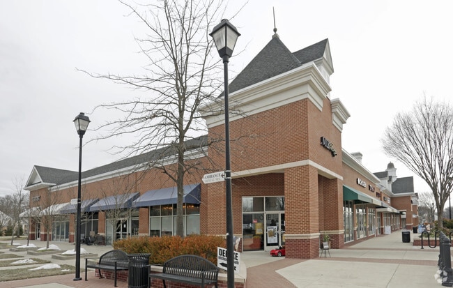
Property Record
12410 Fairwood Pkwy, Bowie, MD 20720


NEARBY LISTINGS FOR SALE OR LEASE
Property Detail
12410 Fairwood Pkwy
07-3641982
Fairwood
Supermarket
PARCEL A6
X
Prince George's
24033C0160E
Maryland
2024
12.82 AC
2025
Bowie
800514
Washington, DC
115,512 SF
Washington-Arlington-Alexandria, DC-VA-MD-WV
DEMOGRAPHICS near 12410 Fairwood Pkwy
1 Mile
3 Mile
5 Mile
2024 Total Population
6,999
62,446
175,265
2029 Population
6,903
60,938
170,957
Pop Growth 2024-2029
(1.37%)
(2.41%)
(2.46%)
Average Age
42
42
41
2024 Total Households
2,187
20,172
58,687
HH Growth 2024-2029
(1.60%)
(2.57%)
(2.59%)
Median Household Inc
$174,615
$135,765
$114,911
Avg Household Size
3.10
3.00
2.90
2024 Avg HH Vehicles
2.00
2.00
2.00
Median Home Value
$606,319
$449,711
$414,981
Median Year Built
2003
1987
1984
Nearby Places
Map Layers
Map Styles
 Street
 Aerial
- Restaurants
- Banks
- Shops
- Fitness
- Groceries
PUBLIC TRANSPORTATION
COMMUTER RAIL
Seabrook (PENN - WASHINGTON - Maryland Area Regional Commuter Trains (The MARC), Penn Line - Maryland Area Regional Commuter Trains (The MARC))
DRIVE
WALK
Distance
Seabrook (PENN - WASHINGTON - Maryland Area Regional Commuter Trains (The MARC), Penn Line - Maryland Area Regional Commuter Trains (The MARC))
8 min
4.2 mi
Bowie State Marc Sb (PENN - WASHINGTON - Maryland Transit Administration)
DRIVE
WALK
Distance
Bowie State Marc Sb (PENN - WASHINGTON - Maryland Transit Administration)
11 min
6.0 mi
AIRPORT
Ronald Reagan Washington Ntl
DRIVE
WALK
Distance
Ronald Reagan Washington Ntl
31 min
19.7 mi
Baltimore/Washington International Thurgood Marshall
DRIVE
WALK
Distance
Baltimore/Washington International Thurgood Marshall
38 min
23.8 mi
Freight Ports
Port of Baltimore
DRIVE
WALK
Distance
Port of Baltimore
47 min
30.0 mi
SALE & LEASE HISTORY
LISTING DATE
SALE/LEASE

Sep 25, 2016
For Lease
May 17, 2019
For Lease
May 10, 2022
For Lease
Jun 02, 2017
For Lease
Dec 14, 2016
For Lease
Nearby Properties
Address
Land Use
TOTAL SIZE
Lot Size
Zoning
Address
Land Use
TOTAL SIZE
Lot Size
Zoning
27.07 AC
RMF20
Address
Land Use
TOTAL SIZE
Lot Size
Zoning
286 SF
13.08 AC
RMF20
Address
Land Use
TOTAL SIZE
Lot Size
Zoning
20.50 AC
RMF20
Address
Land Use
TOTAL SIZE
Lot Size
Zoning
104,397 SF
27.71 AC
AG
Address
Land Use
TOTAL SIZE
Lot Size
Zoning
187,192 SF
7.15 AC
RE
Address
Land Use
TOTAL SIZE
Lot Size
Zoning
317 SF
14.09 AC
RMF20
Address
Land Use
TOTAL SIZE
Lot Size
Zoning
1,296 SF
10.78 AC
RMF20
Address
Land Use
TOTAL SIZE
Lot Size
Zoning
170,641 SF
4.30 AC
IE
Address
Land Use
TOTAL SIZE
Lot Size
Zoning
73,340 SF
10.72 AC
IE
Address
Land Use
TOTAL SIZE
Lot Size
Zoning
111,684 SF
10.93 AC
CGO
Address
Land Use
TOTAL SIZE
Lot Size
Zoning
88,440 SF
1.54 AC
IE
Address
Land Use
TOTAL SIZE
Lot Size
Zoning
102,545 SF
10.79 AC
CGO
Address
Land Use
TOTAL SIZE
Lot Size
Zoning
129,573 SF
2.49 AC
IE
Address
Land Use
TOTAL SIZE
Lot Size
Zoning
47,132 SF
3.53 AC
LMXC
Address
Land Use
TOTAL SIZE
Lot Size
Zoning
113,902 SF
4.08 AC
IE
Address
Land Use
TOTAL SIZE
Lot Size
Zoning
99,492 SF
9.20 AC
CGO
Address
Land Use
TOTAL SIZE
Lot Size
Zoning
106,334 SF
9.09 AC
IH
Address
Land Use
TOTAL SIZE
Lot Size
Zoning
79,648 SF
2.50 AC
CO
Address
Land Use
TOTAL SIZE
Lot Size
Zoning
122,948 SF
9.77 AC
CGO
Address
Land Use
TOTAL SIZE
Lot Size
Zoning
60,600 SF
6 AC
RR
Address
Land Use
TOTAL SIZE
Lot Size
Zoning
96,160 SF
4.81 AC
IH
Address
Land Use
TOTAL SIZE
Lot Size
Zoning
105,758 SF
11.82 AC
CGO
Address
Land Use
TOTAL SIZE
Lot Size
Zoning
90,382 SF
5.55 AC
IH
Address
Land Use
TOTAL SIZE
Lot Size
Zoning
42,120 SF
9.33 AC
LCD
Address
Land Use
TOTAL SIZE
Lot Size
Zoning
45,644 SF
3.90 AC
RR
Address
Land Use
TOTAL SIZE
Lot Size
Zoning
93,226 SF
2.04 AC
IE
Address
Land Use
TOTAL SIZE
Lot Size
Zoning
20.04 AC
ROS
Address
Land Use
TOTAL SIZE
Lot Size
Zoning
50,000 SF
2.76 AC
RR
Address
Land Use
TOTAL SIZE
Lot Size
Zoning
157,440 SF
5 AC
IE
The World's #1 Commercial Real Estate Marketplace
Connect with us
© 2026 CoStar Group
The information above has been obtained from sources believed reliable. While we do not doubt its accuracy we have not verified it and make no guarantee, warranty or representation about it. It is your responsibility to independently confirm its accuracy and completeness. Any projections, opinions, assumptions, or estimates used are for example only and do not represent the current or future performance of the property. The value of this transaction to you depends on tax and other factors which should be evaluated by your tax, financial, and legal advisors. You and your advisors should conduct a careful, independent investigation of the property to determine to your satisfaction the suitability of the property for your needs.