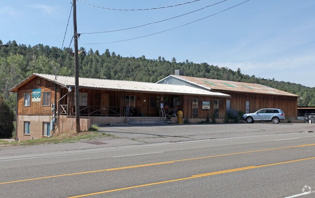
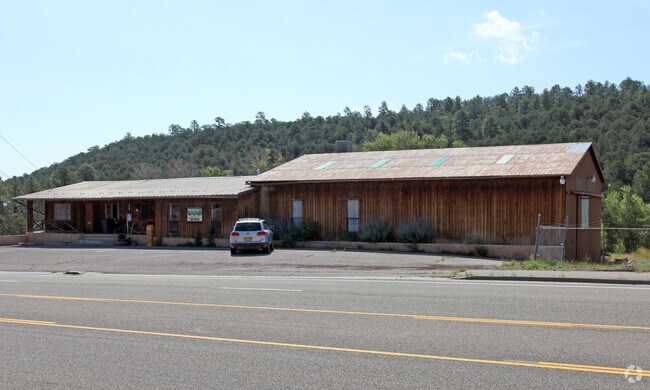
Property Record
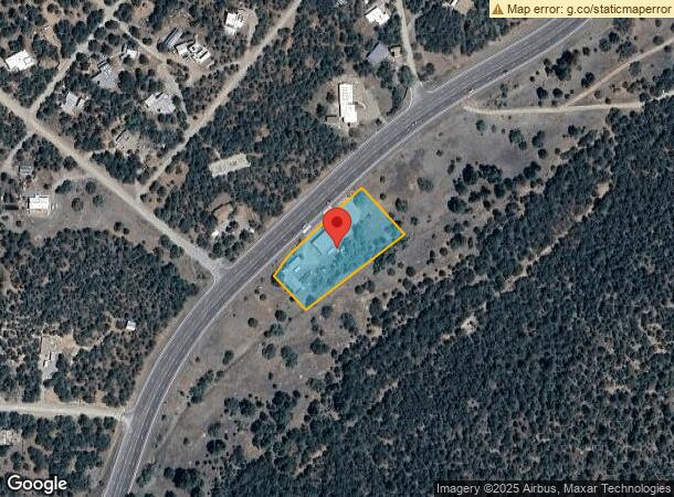
12418 N Highway 14, Cedar Crest, NM 87008
NEARBY LISTINGS FOR SALE OR LEASE
-
-
View all Cedar Crest listings for sale on LoopNet.com
Property Detail
12418 N Highway 14
1-030-062-380476-1-07-03
TRACT IN NE NW NE OF SCHOOL DIST 23 EXC PORTION OUT TO R/W S EC 25 T11N R5E
Warehouse
Bernalillo
X
New Mexico
35001C0188H
1.44 AC
2024
East Outlying
2025
Albuquerque
003804
Albuquerque, NM
7,775 SF
DEMOGRAPHICS near 12418 N Highway 14
1 Mile
3 Mile
5 Mile
2024 Total Population
1,031
4,123
8,763
2029 Population
1,004
4,017
8,514
Pop Growth 2024-2029
(2.62%)
(2.57%)
(2.84%)
Average Age
47
47
47
2024 Total Households
426
1,702
3,616
HH Growth 2024-2029
(2.82%)
(2.76%)
(3.04%)
Median Household Inc
$115,441
$113,456
$115,182
Avg Household Size
2.40
2.40
2.40
2024 Avg HH Vehicles
2.00
2.00
3.00
Median Home Value
$368,027
$359,194
$370,840
Median Year Built
1985
1985
1988
Nearby Places
Map Layers
Map Styles
 Street
 Aerial
- Restaurants
- Banks
- Shops
- Fitness
- Groceries
PUBLIC TRANSPORTATION
AIRPORT
Albuquerque International Sunport
DRIVE
WALK
Distance
Albuquerque International Sunport
39 min
22.1 mi
Freight Ports
Tulsa Port Of Catoosa
DRIVE
WALK
Distance
Tulsa Port Of Catoosa
676 min
651.1 mi
Nearby Properties
Address
Land Use
TOTAL SIZE
Lot Size
Zoning
Address
Land Use
TOTAL SIZE
Lot Size
Zoning
Address
Land Use
TOTAL SIZE
Lot Size
Zoning
Address
Land Use
TOTAL SIZE
Lot Size
Zoning
22,924 SF
11.65 AC
Address
Land Use
TOTAL SIZE
Lot Size
Zoning
40,200 SF
9.40 AC
Address
Land Use
TOTAL SIZE
Lot Size
Zoning
1,624 SF
2.30 AC
Address
Land Use
TOTAL SIZE
Lot Size
Zoning
Address
Land Use
TOTAL SIZE
Lot Size
Zoning
3,050 SF
4.39 AC
Address
Land Use
TOTAL SIZE
Lot Size
Zoning
25,795 SF
2.51 AC
Address
Land Use
TOTAL SIZE
Lot Size
Zoning
20.71 AC
Address
Land Use
TOTAL SIZE
Lot Size
Zoning
5,616 SF
8.28 AC
Address
Land Use
TOTAL SIZE
Lot Size
Zoning
7,779 SF
11.50 AC
Address
Land Use
TOTAL SIZE
Lot Size
Zoning
Address
Land Use
TOTAL SIZE
Lot Size
Zoning
14,156 SF
1.60 AC
Address
Land Use
TOTAL SIZE
Lot Size
Zoning
7,600 SF
3.46 AC
Address
Land Use
TOTAL SIZE
Lot Size
Zoning
7,300 SF
1.15 AC
Address
Land Use
TOTAL SIZE
Lot Size
Zoning
5,469 SF
3.70 AC
Address
Land Use
TOTAL SIZE
Lot Size
Zoning
1,800 SF
10 AC
Address
Land Use
TOTAL SIZE
Lot Size
Zoning
3,807 SF
0.49 AC
Address
Land Use
TOTAL SIZE
Lot Size
Zoning
168.50 AC
Address
Land Use
TOTAL SIZE
Lot Size
Zoning
6,808 SF
2.78 AC
Address
Land Use
TOTAL SIZE
Lot Size
Zoning
6,137 SF
3.95 AC
Address
Land Use
TOTAL SIZE
Lot Size
Zoning
3,565 SF
5.03 AC
Address
Land Use
TOTAL SIZE
Lot Size
Zoning
5,997 SF
0.74 AC
Address
Land Use
TOTAL SIZE
Lot Size
Zoning
12,895 SF
1.86 AC
Address
Land Use
TOTAL SIZE
Lot Size
Zoning
1,567 SF
5 AC
Address
Land Use
TOTAL SIZE
Lot Size
Zoning
8,840 SF
2.84 AC
Address
Land Use
TOTAL SIZE
Lot Size
Zoning
5,352 SF
0.59 AC
Address
Land Use
TOTAL SIZE
Lot Size
Zoning
4,213 SF
3.70 AC
Address
Land Use
TOTAL SIZE
Lot Size
Zoning
3,108 SF
2 AC
The World's #1 Commercial Real Estate Marketplace
Connect with us
© 2026 CoStar Group
The information above has been obtained from sources believed reliable. While we do not doubt its accuracy we have not verified it and make no guarantee, warranty or representation about it. It is your responsibility to independently confirm its accuracy and completeness. Any projections, opinions, assumptions, or estimates used are for example only and do not represent the current or future performance of the property. The value of this transaction to you depends on tax and other factors which should be evaluated by your tax, financial, and legal advisors. You and your advisors should conduct a careful, independent investigation of the property to determine to your satisfaction the suitability of the property for your needs.