Property Record
1242 E Pheasant View Dr, Layton, UT 84041
NEARBY LISTINGS FOR SALE OR LEASE
-
-
View all Layton listings for sale on LoopNet.com
Property Detail
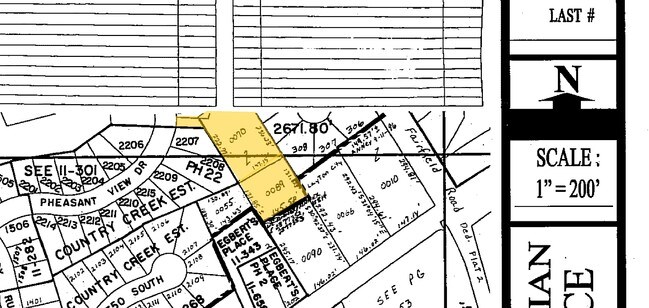
1242 E Pheasant View Dr
11-409-0341
BEG AT A PT ON THE W'LY BNDRY LINE EXT OF FIDDLERS CREEK SUB NO. 3, SD PT BEING N 89^46'40" W 386.19 FT ALG THE SEC LINE & S 115.73 FT FR THE CENTER 1/4 COR OF SEC 27-T4N-R1W, SLB&M; & RUN TH S 60^03'
Retirementnursinghomecombined
Davis
X
Utah
49011C0237F
1.24 AC
2025
Davis/Weber Counties
2025
Salt Lake City
125906
Ogden, UT
21,783 SF
DEMOGRAPHICS near 1242 E Pheasant View Dr
1 Mile
3 Mile
5 Mile
2024 Total Population
12,947
85,762
158,179
2029 Population
13,625
90,856
168,016
Pop Growth 2024-2029
+ 5.24%
+ 5.94%
+ 6.22%
Average Age
37
36
35
2024 Total Households
4,311
26,032
48,507
HH Growth 2024-2029
+ 5.31%
+ 5.98%
+ 6.27%
Median Household Inc
$87,077
$99,003
$95,439
Avg Household Size
3.00
3.30
3.20
2024 Avg HH Vehicles
2.00
2.00
2.00
Median Home Value
$420,434
$460,756
$450,876
Median Year Built
1987
1991
1994
Nearby Places
Map Layers
Map Styles
 Street
 Aerial
- Restaurants
- Banks
- Shops
- Fitness
- Groceries
PUBLIC TRANSPORTATION
COMMUTER RAIL
Layton (FrontRunner North - Utah Transit Authority (UTA))
DRIVE
WALK
Distance
Layton (FrontRunner North - Utah Transit Authority (UTA))
5 min
2.1 mi
Clearfield (FrontRunner North - Utah Transit Authority (UTA))
DRIVE
WALK
Distance
Clearfield (FrontRunner North - Utah Transit Authority (UTA))
12 min
5.5 mi
AIRPORT
Salt Lake City International
DRIVE
WALK
Distance
Salt Lake City International
35 min
25.5 mi
Nearby Properties
Address
Land Use
TOTAL SIZE
Lot Size
Zoning
Address
Land Use
TOTAL SIZE
Lot Size
Zoning
346,223 SF
36.29 AC
BRP
Address
Land Use
TOTAL SIZE
Lot Size
Zoning
17,930 SF
17.08 AC
RM1
Address
Land Use
TOTAL SIZE
Lot Size
Zoning
102,978 SF
6.42 AC
Address
Land Use
TOTAL SIZE
Lot Size
Zoning
100,348 SF
21.75 AC
R18
Address
Land Use
TOTAL SIZE
Lot Size
Zoning
67,233 SF
32.52 AC
A1
Address
Land Use
TOTAL SIZE
Lot Size
Zoning
16,184 SF
23.31 AC
PU
Address
Land Use
TOTAL SIZE
Lot Size
Zoning
1,484 SF
10.34 AC
Address
Land Use
TOTAL SIZE
Lot Size
Zoning
94,532 SF
7.07 AC
Address
Land Use
TOTAL SIZE
Lot Size
Zoning
147,675 SF
11.25 AC
C-H
Address
Land Use
TOTAL SIZE
Lot Size
Zoning
455,336 SF
22.93 AC
Address
Land Use
TOTAL SIZE
Lot Size
Zoning
111,724 SF
10.72 AC
RA
Address
Land Use
TOTAL SIZE
Lot Size
Zoning
67,536 SF
13.16 AC
LI
Address
Land Use
TOTAL SIZE
Lot Size
Zoning
104,342 SF
18.54 AC
M2
Address
Land Use
TOTAL SIZE
Lot Size
Zoning
61,926 SF
40.43 AC
PU
Address
Land Use
TOTAL SIZE
Lot Size
Zoning
140,364 SF
6.47 AC
RH
Address
Land Use
TOTAL SIZE
Lot Size
Zoning
218,896 SF
2.76 AC
MUTOD
Address
Land Use
TOTAL SIZE
Lot Size
Zoning
119,988 SF
10.63 AC
LI
Address
Land Use
TOTAL SIZE
Lot Size
Zoning
1,679 SF
7.49 AC
RM2
Address
Land Use
TOTAL SIZE
Lot Size
Zoning
72,750 SF
13.09 AC
A1
Address
Land Use
TOTAL SIZE
Lot Size
Zoning
312,601 SF
13.30 AC
R18
Address
Land Use
TOTAL SIZE
Lot Size
Zoning
220,887 SF
12.17 AC
CH
Address
Land Use
TOTAL SIZE
Lot Size
Zoning
61,864 SF
11.66 AC
Address
Land Use
TOTAL SIZE
Lot Size
Zoning
126,304 SF
4.70 AC
BRP
Address
Land Use
TOTAL SIZE
Lot Size
Zoning
132,251 SF
7.94 AC
Address
Land Use
TOTAL SIZE
Lot Size
Zoning
7,098 SF
183.50 AC
A
Address
Land Use
TOTAL SIZE
Lot Size
Zoning
77,091 SF
11.09 AC
A
Address
Land Use
TOTAL SIZE
Lot Size
Zoning
43,620 SF
67.58 AC
PU
Address
Land Use
TOTAL SIZE
Lot Size
Zoning
300,026 SF
4.39 AC
Address
Land Use
TOTAL SIZE
Lot Size
Zoning
52,223 SF
7.01 AC
Address
Land Use
TOTAL SIZE
Lot Size
Zoning
26,856 SF
5.92 AC
RM2
The World's #1 Commercial Real Estate Marketplace
Connect with us
© 2026 CoStar Group
The information above has been obtained from sources believed reliable. While we do not doubt its accuracy we have not verified it and make no guarantee, warranty or representation about it. It is your responsibility to independently confirm its accuracy and completeness. Any projections, opinions, assumptions, or estimates used are for example only and do not represent the current or future performance of the property. The value of this transaction to you depends on tax and other factors which should be evaluated by your tax, financial, and legal advisors. You and your advisors should conduct a careful, independent investigation of the property to determine to your satisfaction the suitability of the property for your needs.