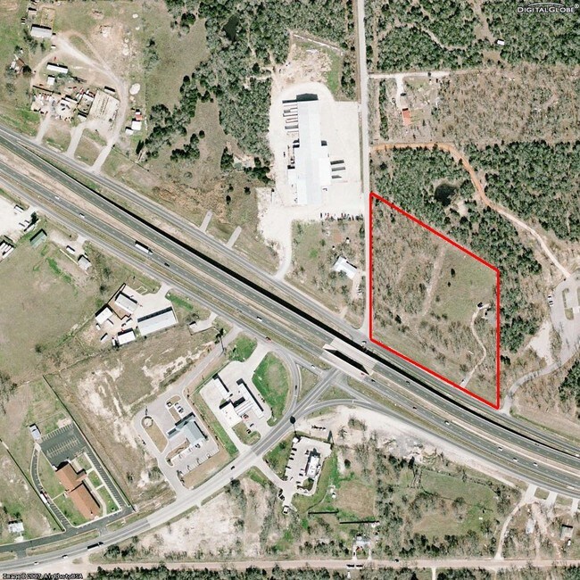
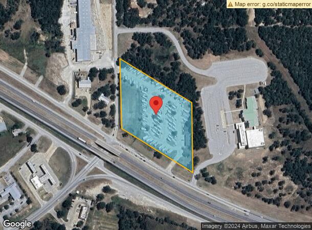
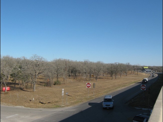
Property Record
1242 W Highway 71 W, Bastrop, TX 78602

NEARBY LISTINGS FOR SALE OR LEASE
Property Detail
1242 W Highway 71 W
37855
Blakey, Nancy
Commercialnec
A98 BLAKEY, NANCY, ACRES 5.053
X
Bastrop
48021C0335F
Texas
2024
5.05 AC
2025
Bastrop County
950401
Austin
3,742 SF
Austin-Round Rock, TX
DEMOGRAPHICS near 1242 W Highway 71 W
1 Mile
3 Mile
5 Mile
2024 Total Population
1,286
7,415
18,291
2029 Population
1,620
9,280
22,757
Pop Growth 2024-2029
+ 25.97%
+ 25.15%
+ 24.42%
Average Age
42
41
40
2024 Total Households
482
2,756
6,768
HH Growth 2024-2029
+ 26.97%
+ 26.27%
+ 25.55%
Median Household Inc
$155,652
$121,480
$93,067
Avg Household Size
2.60
2.60
2.60
2024 Avg HH Vehicles
3.00
2.00
2.00
Median Home Value
$434,351
$411,460
$266,868
Median Year Built
2003
2001
2001
Nearby Places
Map Layers
Map Styles
 Street
 Aerial
- Restaurants
- Banks
- Shops
- Fitness
- Groceries
PUBLIC TRANSPORTATION
AIRPORT
Austin-Bergstrom International
DRIVE
WALK
Distance
Austin-Bergstrom International
32 min
20.6 mi
Freight Ports
Calhoun Port
DRIVE
WALK
Distance
Calhoun Port
172 min
145.4 mi
Nearby Properties
Address
Land Use
TOTAL SIZE
Lot Size
Zoning
Address
Land Use
TOTAL SIZE
Lot Size
Zoning
35,983 SF
20 AC
Address
Land Use
TOTAL SIZE
Lot Size
Zoning
86,427 SF
23.38 AC
Address
Land Use
TOTAL SIZE
Lot Size
Zoning
20 AC
Address
Land Use
TOTAL SIZE
Lot Size
Zoning
72,496 SF
42.01 AC
Address
Land Use
TOTAL SIZE
Lot Size
Zoning
33,105 SF
21.89 AC
Address
Land Use
TOTAL SIZE
Lot Size
Zoning
37,058 SF
4.14 AC
Address
Land Use
TOTAL SIZE
Lot Size
Zoning
43,956 SF
6.29 AC
Address
Land Use
TOTAL SIZE
Lot Size
Zoning
33,183 SF
33.48 AC
Address
Land Use
TOTAL SIZE
Lot Size
Zoning
10,464 SF
108.47 AC
Address
Land Use
TOTAL SIZE
Lot Size
Zoning
28.45 AC
Address
Land Use
TOTAL SIZE
Lot Size
Zoning
156,609 SF
9.62 AC
Address
Land Use
TOTAL SIZE
Lot Size
Zoning
55,344 SF
4 AC
Address
Land Use
TOTAL SIZE
Lot Size
Zoning
52,973 SF
5.01 AC
Address
Land Use
TOTAL SIZE
Lot Size
Zoning
39,300 SF
3.50 AC
Address
Land Use
TOTAL SIZE
Lot Size
Zoning
19,040 SF
104.34 AC
Address
Land Use
TOTAL SIZE
Lot Size
Zoning
14 SF
42.70 AC
Address
Land Use
TOTAL SIZE
Lot Size
Zoning
54 SF
8.98 AC
Address
Land Use
TOTAL SIZE
Lot Size
Zoning
11,642 SF
7.51 AC
Address
Land Use
TOTAL SIZE
Lot Size
Zoning
42,115 SF
8.17 AC
Address
Land Use
TOTAL SIZE
Lot Size
Zoning
30,540 SF
1.75 AC
Address
Land Use
TOTAL SIZE
Lot Size
Zoning
11,540 SF
4.74 AC
Address
Land Use
TOTAL SIZE
Lot Size
Zoning
30,759 SF
8.43 AC
Address
Land Use
TOTAL SIZE
Lot Size
Zoning
31,528 SF
7.67 AC
Address
Land Use
TOTAL SIZE
Lot Size
Zoning
11,568 SF
1.48 AC
Address
Land Use
TOTAL SIZE
Lot Size
Zoning
14,960 SF
3 AC
Address
Land Use
TOTAL SIZE
Lot Size
Zoning
25,367 SF
10.22 AC
Address
Land Use
TOTAL SIZE
Lot Size
Zoning
24,150 SF
1.75 AC
Address
Land Use
TOTAL SIZE
Lot Size
Zoning
9,070 SF
10.49 AC
Address
Land Use
TOTAL SIZE
Lot Size
Zoning
15,729 SF
18.65 AC
The World's #1 Commercial Real Estate Marketplace
Connect with us
© 2025 CoStar Group
The information above has been obtained from sources believed reliable. While we do not doubt its accuracy we have not verified it and make no guarantee, warranty or representation about it. It is your responsibility to independently confirm its accuracy and completeness. Any projections, opinions, assumptions, or estimates used are for example only and do not represent the current or future performance of the property. The value of this transaction to you depends on tax and other factors which should be evaluated by your tax, financial, and legal advisors. You and your advisors should conduct a careful, independent investigation of the property to determine to your satisfaction the suitability of the property for your needs.