Property Record
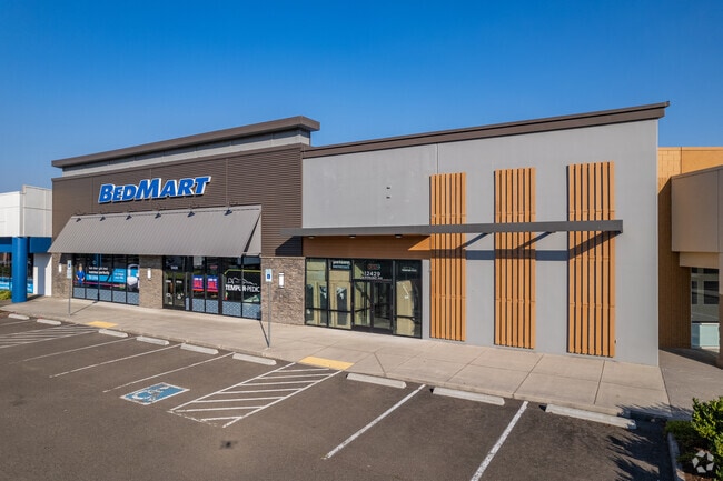
12425 N Starlight Ave, Portland, OR 97217


Property Detail
12425 N Starlight Ave
R236709
PARTITION PLAT 1990-6, LOT 2
Commercialnec
MULTNOMAH
CE
Oregon
B and X Area of moderate flood hazard, usually the area between the limits of the 100-year and 500-year floods.
2
2025
0.95 AC
2025
Hayden Island/Swan Island
007201
Portland
15,278 SF
Portland-Vancouver-Hillsboro, OR-WA
NEARBY LISTINGS FOR SALE OR LEASE
DEMOGRAPHICS near 12425 N Starlight Ave
1 mile
3 mile
5 mile
2025 Total Population
4,482
69,821
207,477
2030 Population
4,622
70,592
209,660
Pop Growth 2025-2030
+ 3.12%
+ 1.10%
+ 1.05%
Average Age
50
40
40
2025 Total Households
2,552
30,307
87,058
HH Growth 2025-2030
+ 4.15%
+ 1.57%
+ 1.15%
Median Household Inc
$66,791
$77,725
$88,395
Avg Household Size
1.70
2.20
2.30
2025 Avg HH Vehicles
1.00
2.00
2.00
Median Home Value
$389,999
$490,051
$552,856
Median Year Built
1996
1968
1969
Nearby Places
Map Layers
Map Styles
 Street
 Aerial
Transit
 Traffic
 Biking
Places
Listings with unknown addresses are not visible on the map
- Restaurants
- Banks
- Shops
- Fitness
- Groceries
PUBLIC TRANSPORTATION
AIRPORT
Portland International
Drive
Walk
Distance
Portland International
17 min
12.3 mi
Freight Ports
Port of Vancouver
Drive
Walk
Distance
Port of Vancouver
1 min
2.1 mi
SALE & LEASE HISTORY
LISTING DATE
SALE/LEASE

Oct 04, 2016
For Lease
Mar 28, 2017
For Lease
Jun 15, 2018
For Lease
Nearby Properties
Address
Land Use
TOTAL SIZE
Lot Size
Zoning
Address
Land Use
TOTAL SIZE
Lot Size
Zoning
200,109 SF
70.44 AC
IH
Address
Land Use
TOTAL SIZE
Lot Size
Zoning
15,473 SF
192.67 AC
IG2
Address
Land Use
TOTAL SIZE
Lot Size
Zoning
332,800 SF
12.78 AC
IH
Address
Land Use
TOTAL SIZE
Lot Size
Zoning
590,457 SF
53.12 AC
CPX
Address
Land Use
TOTAL SIZE
Lot Size
Zoning
522,778 SF
193.16 AC
CPX
Address
Land Use
TOTAL SIZE
Lot Size
Zoning
437,419 SF
37.90 AC
IG2
Address
Land Use
TOTAL SIZE
Lot Size
Zoning
465,188 SF
1.29 AC
CX
Address
Land Use
TOTAL SIZE
Lot Size
Zoning
Address
Land Use
TOTAL SIZE
Lot Size
Zoning
769,347 SF
8.52 AC
CX
Address
Land Use
TOTAL SIZE
Lot Size
Zoning
319,958 SF
53.08 AC
CPX
Address
Land Use
TOTAL SIZE
Lot Size
Zoning
490,802 SF
56.17 AC
CGX
Address
Land Use
TOTAL SIZE
Lot Size
Zoning
335,004 SF
17.06 AC
IL
Address
Land Use
TOTAL SIZE
Lot Size
Zoning
1,660,710 SF
110.33 AC
IG2
Address
Land Use
TOTAL SIZE
Lot Size
Zoning
463,000 SF
67.68 AC
CPX
Address
Land Use
TOTAL SIZE
Lot Size
Zoning
589,596 SF
9.63 AC
R-22
Address
Land Use
TOTAL SIZE
Lot Size
Zoning
278,788 SF
0.92 AC
CX
Address
Land Use
TOTAL SIZE
Lot Size
Zoning
307,468 SF
8.27 AC
CPX
Address
Land Use
TOTAL SIZE
Lot Size
Zoning
352,560 SF
18.34 AC
IL
Address
Land Use
TOTAL SIZE
Lot Size
Zoning
294,114 SF
2.03 AC
CX
Address
Land Use
TOTAL SIZE
Lot Size
Zoning
222,177 SF
4.96 AC
CX
Address
Land Use
TOTAL SIZE
Lot Size
Zoning
18,135 SF
0.45 AC
CX
Address
Land Use
TOTAL SIZE
Lot Size
Zoning
258,882 SF
15.50 AC
IL
Address
Land Use
TOTAL SIZE
Lot Size
Zoning
294,955 SF
14.10 AC
IL
Address
Land Use
TOTAL SIZE
Lot Size
Zoning
361,120 SF
20 AC
IH
Address
Land Use
TOTAL SIZE
Lot Size
Zoning
5.19 AC
IH
Address
Land Use
TOTAL SIZE
Lot Size
Zoning
253,011 SF
0.98 AC
CX
Address
Land Use
TOTAL SIZE
Lot Size
Zoning
516,079 SF
19.29 AC
R-30
Address
Land Use
TOTAL SIZE
Lot Size
Zoning
118,879 SF
35.19 AC
R-22
Address
Land Use
TOTAL SIZE
Lot Size
Zoning
127,050 SF
1.23 AC
CX
Address
Land Use
TOTAL SIZE
Lot Size
Zoning
118,469 SF
47.45 AC
IG2
The World's #1 Commercial Real Estate Marketplace
Connect with us
© 2026 CoStar Group
The information above has been obtained from sources believed reliable. While we do not doubt its accuracy we have not verified it and make no guarantee, warranty or representation about it. It is your responsibility to independently confirm its accuracy and completeness. Any projections, opinions, assumptions, or estimates used are for example only and do not represent the current or future performance of the property. The value of this transaction to you depends on tax and other factors which should be evaluated by your tax, financial, and legal advisors. You and your advisors should conduct a careful, independent investigation of the property to determine to your satisfaction the suitability of the property for your needs.