Property Record
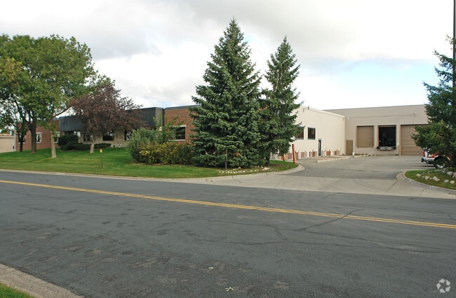
1243 Eagan Industrial Rd, Saint Paul, MN 55121


NEARBY LISTINGS FOR SALE OR LEASE
Property Detail
1243 Eagan Industrial Rd
Minneapolis/St Paul
Morgan Family Addition
Minneapolis-St. Paul-Bloomington, MN-WI
MORGAN FAMILY ADDITION 1 1
10-48880-01-010
Dakota
Industrialgeneral
Minnesota
2024
10
2024
3.47 AC
060726
South Central
33,528 SF
DEMOGRAPHICS near 1243 Eagan Industrial Rd
1 Mile
3 Mile
5 Mile
2024 Total Population
1,874
34,649
156,800
2029 Population
1,907
35,319
158,101
Pop Growth 2024-2029
+ 1.76%
+ 1.93%
+ 0.83%
Average Age
37
41
41
2024 Total Households
774
14,853
66,648
HH Growth 2024-2029
+ 1.81%
+ 1.84%
+ 0.78%
Median Household Inc
$71,531
$90,620
$84,501
Avg Household Size
2.40
2.30
2.30
2024 Avg HH Vehicles
2.00
2.00
2.00
Median Home Value
$371,697
$412,003
$350,558
Median Year Built
1988
1986
1979
Nearby Places
Map Layers
Map Styles
 Street
 Aerial
- Restaurants
- Banks
- Shops
- Fitness
- Groceries
PUBLIC TRANSPORTATION
COMMUTER RAIL
St. Paul-Minneapolis (Empire Builder - Amtrak)
DRIVE
WALK
Distance
St. Paul-Minneapolis (Empire Builder - Amtrak)
15 min
10.0 mi
AIRPORT
Minneapolis-St Paul International/Wold-Chamberlain
DRIVE
WALK
Distance
Minneapolis-St Paul International/Wold-Chamberlain
11 min
5.3 mi
Freight Ports
Port Milwaukee
DRIVE
WALK
Distance
Port Milwaukee
372 min
336.2 mi
SALE & LEASE HISTORY
LISTING DATE
SALE/LEASE

May 12, 2021
For Lease
Jul 24, 2020
For Lease
Nearby Properties
Address
Land Use
TOTAL SIZE
Lot Size
Zoning
Address
Land Use
TOTAL SIZE
Lot Size
Zoning
479,742 SF
11.35 AC
Address
Land Use
TOTAL SIZE
Lot Size
Zoning
466,503 SF
28.74 AC
Address
Land Use
TOTAL SIZE
Lot Size
Zoning
657,358 SF
17.12 AC
Address
Land Use
TOTAL SIZE
Lot Size
Zoning
264,370 SF
36.39 AC
Address
Land Use
TOTAL SIZE
Lot Size
Zoning
247,470 SF
2.21 AC
Address
Land Use
TOTAL SIZE
Lot Size
Zoning
291,589 SF
6.77 AC
Address
Land Use
TOTAL SIZE
Lot Size
Zoning
246,636 SF
7.20 AC
Address
Land Use
TOTAL SIZE
Lot Size
Zoning
233,578 SF
9.56 AC
Address
Land Use
TOTAL SIZE
Lot Size
Zoning
223,583 SF
5.32 AC
Address
Land Use
TOTAL SIZE
Lot Size
Zoning
381,158 SF
11.86 AC
Address
Land Use
TOTAL SIZE
Lot Size
Zoning
317,235 SF
32.38 AC
Address
Land Use
TOTAL SIZE
Lot Size
Zoning
378,880 SF
3.42 AC
Address
Land Use
TOTAL SIZE
Lot Size
Zoning
206,818 SF
2.84 AC
Address
Land Use
TOTAL SIZE
Lot Size
Zoning
300,000 SF
18.44 AC
Address
Land Use
TOTAL SIZE
Lot Size
Zoning
314,237 SF
10.63 AC
Address
Land Use
TOTAL SIZE
Lot Size
Zoning
240,316 SF
9.57 AC
Address
Land Use
TOTAL SIZE
Lot Size
Zoning
Address
Land Use
TOTAL SIZE
Lot Size
Zoning
170,292 SF
2.08 AC
Address
Land Use
TOTAL SIZE
Lot Size
Zoning
247,451 SF
9.57 AC
Address
Land Use
TOTAL SIZE
Lot Size
Zoning
110,979 SF
9.65 AC
Address
Land Use
TOTAL SIZE
Lot Size
Zoning
278,320 SF
31.12 AC
Address
Land Use
TOTAL SIZE
Lot Size
Zoning
159,341 SF
2.82 AC
Address
Land Use
TOTAL SIZE
Lot Size
Zoning
541,075 SF
88.93 AC
Address
Land Use
TOTAL SIZE
Lot Size
Zoning
206,503 SF
5.61 AC
Address
Land Use
TOTAL SIZE
Lot Size
Zoning
162,372 SF
9.11 AC
Address
Land Use
TOTAL SIZE
Lot Size
Zoning
436,701 SF
19.58 AC
Address
Land Use
TOTAL SIZE
Lot Size
Zoning
227,200 SF
14.78 AC
Address
Land Use
TOTAL SIZE
Lot Size
Zoning
237,170 SF
7.90 AC
Address
Land Use
TOTAL SIZE
Lot Size
Zoning
221,019 SF
37.17 AC
Address
Land Use
TOTAL SIZE
Lot Size
Zoning
97,109 SF
9.57 AC
The World's #1 Commercial Real Estate Marketplace
Connect with us
© 2025 CoStar Group
The information above has been obtained from sources believed reliable. While we do not doubt its accuracy we have not verified it and make no guarantee, warranty or representation about it. It is your responsibility to independently confirm its accuracy and completeness. Any projections, opinions, assumptions, or estimates used are for example only and do not represent the current or future performance of the property. The value of this transaction to you depends on tax and other factors which should be evaluated by your tax, financial, and legal advisors. You and your advisors should conduct a careful, independent investigation of the property to determine to your satisfaction the suitability of the property for your needs.