Property Record
12439 W Interstate 10, Marion, TX 78124

Save to a Folder
{{folder.Name}}
{{folder.ListingIds.length}} Properties
{{folder.ListingIds.length}} Property
Create a New Folder
Property Detail
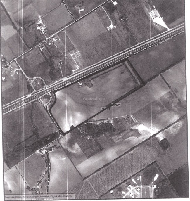
12439 W Interstate 10
2G0134-0000-13700-0-00
ABS: 134 SUR: JOSE FLORES 55.5750 AC.
Commercialnec
GUADALUPE
C and X Area of minimal flood hazard, usually depicted on FIRMs as above the 500-year flood level.
Texas
2024
55.58 AC
2025
Guadalupe County
210804
San Antonio
1,435 SF
San Antonio-New Braunfels, TX
NEARBY LISTINGS FOR SALE OR LEASE
DEMOGRAPHICS near 12439 W Interstate 10
1 mile
3 mile
5 mile
2025 Total Population
235
1,999
14,169
2030 Population
265
2,235
15,954
Pop Growth 2025-2030
+ 12.77%
+ 11.81%
+ 12.60%
Average Age
45
44
40
2025 Total Households
88
740
5,089
HH Growth 2025-2030
+ 13.64%
+ 12.30%
+ 13.03%
Median Household Inc
$99,999
$99,127
$91,433
Avg Household Size
2.70
2.70
2.80
2025 Avg HH Vehicles
3.00
3.00
2.00
Median Home Value
$374,999
$372,071
$352,236
Median Year Built
1996
1996
2008
Nearby Places
Map Layers
Map Styles
 Street
 Aerial
Layers
 Traffic
 Biking
Places
Listings with unknown addresses are not visible on the map
- Restaurants
- Banks
- Shops
- Fitness
- Groceries
PUBLIC TRANSPORTATION
AIRPORT
San Antonio International
Drive
Walk
Distance
San Antonio International
34 min
26.9 mi
Freight Ports
Calhoun Port
Drive
Walk
Distance
Calhoun Port
165 min
144.8 mi
Nearby Properties
Address
Land Use
TOTAL SIZE
Lot Size
Zoning
Address
Land Use
TOTAL SIZE
Lot Size
Zoning
Address
Land Use
TOTAL SIZE
Lot Size
Zoning
191,300 SF
5 AC
Address
Land Use
TOTAL SIZE
Lot Size
Zoning
47,601 SF
5.76 AC
Address
Land Use
TOTAL SIZE
Lot Size
Zoning
1,440 SF
275 AC
Address
Land Use
TOTAL SIZE
Lot Size
Zoning
143.30 AC
Address
Land Use
TOTAL SIZE
Lot Size
Zoning
189.56 AC
Address
Land Use
TOTAL SIZE
Lot Size
Zoning
101.94 AC
Address
Land Use
TOTAL SIZE
Lot Size
Zoning
1,302 SF
83.98 AC
Address
Land Use
TOTAL SIZE
Lot Size
Zoning
95.46 AC
Address
Land Use
TOTAL SIZE
Lot Size
Zoning
59,989 SF
5.07 AC
Address
Land Use
TOTAL SIZE
Lot Size
Zoning
4,778 SF
101.35 AC
Address
Land Use
TOTAL SIZE
Lot Size
Zoning
1,852 SF
207.81 AC
Address
Land Use
TOTAL SIZE
Lot Size
Zoning
6,800 SF
126.44 AC
Address
Land Use
TOTAL SIZE
Lot Size
Zoning
1,851 SF
217 AC
Address
Land Use
TOTAL SIZE
Lot Size
Zoning
1,152 SF
150.90 AC
Address
Land Use
TOTAL SIZE
Lot Size
Zoning
2,145 SF
166.44 AC
Address
Land Use
TOTAL SIZE
Lot Size
Zoning
3,539 SF
139.70 AC
Address
Land Use
TOTAL SIZE
Lot Size
Zoning
130.15 AC
Address
Land Use
TOTAL SIZE
Lot Size
Zoning
195.90 AC
Address
Land Use
TOTAL SIZE
Lot Size
Zoning
10,980 SF
4.94 AC
Address
Land Use
TOTAL SIZE
Lot Size
Zoning
1,669 SF
180.66 AC
Address
Land Use
TOTAL SIZE
Lot Size
Zoning
78.94 AC
Address
Land Use
TOTAL SIZE
Lot Size
Zoning
204.04 AC
Address
Land Use
TOTAL SIZE
Lot Size
Zoning
2,851,437 SF
156.68 AC
Address
Land Use
TOTAL SIZE
Lot Size
Zoning
54.71 AC
Address
Land Use
TOTAL SIZE
Lot Size
Zoning
72.10 AC
Address
Land Use
TOTAL SIZE
Lot Size
Zoning
9,957 SF
10 AC
Address
Land Use
TOTAL SIZE
Lot Size
Zoning
1,258 SF
75.79 AC
Address
Land Use
TOTAL SIZE
Lot Size
Zoning
12,804 SF
2.11 AC
The World's #1 Commercial Real Estate Marketplace
Connect with us
© 2026 CoStar Group
The information above has been obtained from sources believed reliable. While we do not doubt its accuracy we have not verified it and make no guarantee, warranty or representation about it. It is your responsibility to independently confirm its accuracy and completeness. Any projections, opinions, assumptions, or estimates used are for example only and do not represent the current or future performance of the property. The value of this transaction to you depends on tax and other factors which should be evaluated by your tax, financial, and legal advisors. You and your advisors should conduct a careful, independent investigation of the property to determine to your satisfaction the suitability of the property for your needs.