Property Record
1244 Berlin Tpke, Wethersfield, CT 06109

Property Detail
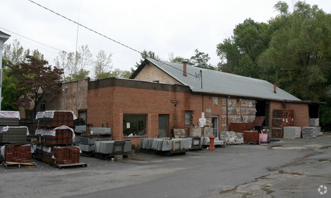
1244 Berlin Tpke
WETH-000071-000000-000017
HARTFORD
Commercialnec
Connecticut
BP
0.72 AC
B and X Area of moderate flood hazard, usually the area between the limits of the 100-year and 500-year floods.
Wethersfield
2025
Hartford
2025
Hartford-West Hartford-East Hartford, CT
492300
NEARBY LISTINGS FOR SALE OR LEASE
DEMOGRAPHICS near 1244 Berlin Tpke
1 mile
3 mile
5 mile
2025 Total Population
13,046
119,361
272,896
2030 Population
13,132
120,859
277,203
Pop Growth 2025-2030
+ 0.66%
+ 1.26%
+ 1.58%
Average Age
41
39
40
2025 Total Households
5,011
47,602
111,087
HH Growth 2025-2030
+ 0.68%
+ 1.37%
+ 1.72%
Median Household Inc
$81,731
$66,825
$73,340
Avg Household Size
2.50
2.40
2.30
2025 Avg HH Vehicles
2.00
1.00
1.00
Median Home Value
$241,383
$281,866
$307,987
Median Year Built
1952
1953
1957
Nearby Places
Map Layers
Map Styles
 Street
 Aerial
Layers
 Traffic
 Biking
Places
Listings with unknown addresses are not visible on the map
- Restaurants
- Banks
- Shops
- Fitness
- Groceries
PUBLIC TRANSPORTATION
AIRPORT
Bradley International
Drive
Walk
Distance
Bradley International
25 min
18.9 mi
Freight Ports
Port of Davisville, RI
Drive
Walk
Distance
Port of Davisville, RI
1 min
66.6 mi
SALE & LEASE HISTORY
LISTING DATE
SALE/LEASE

Sep 24, 2016
For Sale
Nearby Properties
Address
Land Use
TOTAL SIZE
Lot Size
Zoning
Address
Land Use
TOTAL SIZE
Lot Size
Zoning
147,644 SF
0.19 AC
CAMP
Address
Land Use
TOTAL SIZE
Lot Size
Zoning
173,601 SF
1.56 AC
DT-1
Address
Land Use
TOTAL SIZE
Lot Size
Zoning
516,804 SF
32.98 AC
CAMP
Address
Land Use
TOTAL SIZE
Lot Size
Zoning
15.73 AC
CAMP
Address
Land Use
TOTAL SIZE
Lot Size
Zoning
284,432 SF
32.12 AC
PL
Address
Land Use
TOTAL SIZE
Lot Size
Zoning
69.42 AC
CT R
Address
Land Use
TOTAL SIZE
Lot Size
Zoning
8.89 AC
MX-2
Address
Land Use
TOTAL SIZE
Lot Size
Zoning
261,072 SF
44.47 AC
PL
Address
Land Use
TOTAL SIZE
Lot Size
Zoning
205,719 SF
12.15 AC
MX-2
Address
Land Use
TOTAL SIZE
Lot Size
Zoning
416,762 SF
20 AC
CAMP
Address
Land Use
TOTAL SIZE
Lot Size
Zoning
20.41 AC
MX-2
Address
Land Use
TOTAL SIZE
Lot Size
Zoning
235,476 SF
198.32 AC
CT R
Address
Land Use
TOTAL SIZE
Lot Size
Zoning
4.76 AC
MX-2
Address
Land Use
TOTAL SIZE
Lot Size
Zoning
254,786 SF
36 AC
A
Address
Land Use
TOTAL SIZE
Lot Size
Zoning
223,885 SF
43.33 AC
CAMP
Address
Land Use
TOTAL SIZE
Lot Size
Zoning
2.04 AC
DT-3
Address
Land Use
TOTAL SIZE
Lot Size
Zoning
3,416 SF
19.31 AC
SRD
Address
Land Use
TOTAL SIZE
Lot Size
Zoning
326,367 SF
3.72 AC
MX-2
Address
Land Use
TOTAL SIZE
Lot Size
Zoning
86,600 SF
20.05 AC
R-6
Address
Land Use
TOTAL SIZE
Lot Size
Zoning
3.46 AC
CAMP
Address
Land Use
TOTAL SIZE
Lot Size
Zoning
130,151 SF
1.05 AC
DT-3
Address
Land Use
TOTAL SIZE
Lot Size
Zoning
160,936 SF
2.40 AC
CX-1
Address
Land Use
TOTAL SIZE
Lot Size
Zoning
225,477 SF
1.36 AC
CAMP
Address
Land Use
TOTAL SIZE
Lot Size
Zoning
126.75 AC
OS
Address
Land Use
TOTAL SIZE
Lot Size
Zoning
299,760 SF
3.89 AC
MX-2
Address
Land Use
TOTAL SIZE
Lot Size
Zoning
29.48 AC
MX-2
Address
Land Use
TOTAL SIZE
Lot Size
Zoning
171,729 SF
80.59 AC
R-12/
Address
Land Use
TOTAL SIZE
Lot Size
Zoning
116,979 SF
17 AC
B
Address
Land Use
TOTAL SIZE
Lot Size
Zoning
638,979 SF
3.24 AC
MX-2
Address
Land Use
TOTAL SIZE
Lot Size
Zoning
215,058 SF
R-6
The World's #1 Commercial Real Estate Marketplace
Connect with us
© 2026 CoStar Group
The information above has been obtained from sources believed reliable. While we do not doubt its accuracy we have not verified it and make no guarantee, warranty or representation about it. It is your responsibility to independently confirm its accuracy and completeness. Any projections, opinions, assumptions, or estimates used are for example only and do not represent the current or future performance of the property. The value of this transaction to you depends on tax and other factors which should be evaluated by your tax, financial, and legal advisors. You and your advisors should conduct a careful, independent investigation of the property to determine to your satisfaction the suitability of the property for your needs.