Property Record
12446 W State Road 81, Beloit, WI 53511
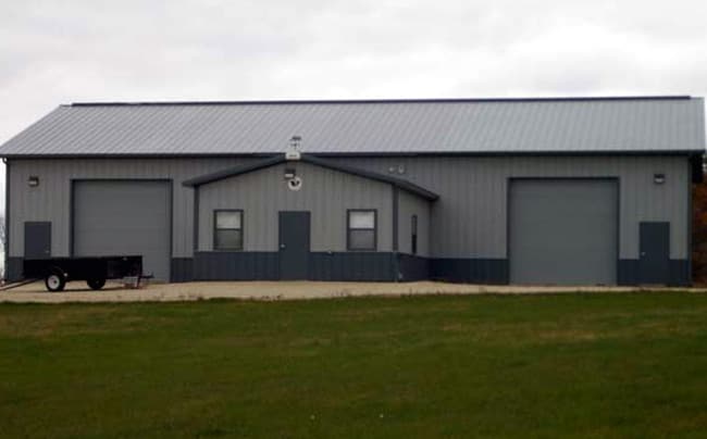

Property Detail
12446 W State Road 81
Janesville-Beloit, WI
FRL SW1/4 NW1/4 CERTIFIED SURVEY MAP #2001842 VOL 36 PG 124-126 LOT 1
614-148
Rock
Commercialnec
Wisconsin
B and X Area of moderate flood hazard, usually the area between the limits of the 100-year and 500-year floods.
1
2025
29.88 AC
2025
Rock County
002700
Milwaukee/Madison
NEARBY LISTINGS FOR SALE OR LEASE
-
-
View all Beloit listings for sale on LoopNet.com
DEMOGRAPHICS near 12446 W State Road 81
1 mile
3 mile
5 mile
2025 Total Population
108
837
2,029
2030 Population
106
821
1,978
Pop Growth 2025-2030
(1.85%)
(1.91%)
(2.51%)
Average Age
45
46
47
2025 Total Households
42
326
800
HH Growth 2025-2030
(2.38%)
(2.15%)
(2.75%)
Median Household Inc
$103,125
$98,632
$95,744
Avg Household Size
2.50
2.60
2.50
2025 Avg HH Vehicles
3.00
3.00
3.00
Median Home Value
$340,909
$340,104
$328,947
Median Year Built
1963
1964
1967
Nearby Places
Map Layers
Map Styles
 Street
 Aerial
Layers
 Traffic
 Biking
Places
Listings with unknown addresses are not visible on the map
- Restaurants
- Banks
- Shops
- Fitness
- Groceries
PUBLIC TRANSPORTATION
AIRPORT
Chicago/Rockford International
Drive
Walk
Distance
Chicago/Rockford International
56 min
31.5 mi
Freight Ports
Port Milwaukee
Drive
Walk
Distance
Port Milwaukee
105 min
86.3 mi
Nearby Properties
Address
Land Use
TOTAL SIZE
Lot Size
Zoning
Address
Land Use
TOTAL SIZE
Lot Size
Zoning
519.83 AC
Address
Land Use
TOTAL SIZE
Lot Size
Zoning
18.54 AC
Address
Land Use
TOTAL SIZE
Lot Size
Zoning
39.98 AC
Address
Land Use
TOTAL SIZE
Lot Size
Zoning
69.72 AC
Address
Land Use
TOTAL SIZE
Lot Size
Zoning
28.48 AC
Address
Land Use
TOTAL SIZE
Lot Size
Zoning
35.65 AC
Address
Land Use
TOTAL SIZE
Lot Size
Zoning
47.73 AC
Address
Land Use
TOTAL SIZE
Lot Size
Zoning
511.48 AC
Address
Land Use
TOTAL SIZE
Lot Size
Zoning
34.91 AC
Address
Land Use
TOTAL SIZE
Lot Size
Zoning
90.86 AC
Address
Land Use
TOTAL SIZE
Lot Size
Zoning
52.57 AC
Address
Land Use
TOTAL SIZE
Lot Size
Zoning
18.14 AC
Address
Land Use
TOTAL SIZE
Lot Size
Zoning
20.59 AC
Address
Land Use
TOTAL SIZE
Lot Size
Zoning
Address
Land Use
TOTAL SIZE
Lot Size
Zoning
69.22 AC
Address
Land Use
TOTAL SIZE
Lot Size
Zoning
Address
Land Use
TOTAL SIZE
Lot Size
Zoning
4.50 AC
Address
Land Use
TOTAL SIZE
Lot Size
Zoning
Address
Land Use
TOTAL SIZE
Lot Size
Zoning
50.34 AC
Address
Land Use
TOTAL SIZE
Lot Size
Zoning
14.90 AC
Address
Land Use
TOTAL SIZE
Lot Size
Zoning
369.30 AC
A1
Address
Land Use
TOTAL SIZE
Lot Size
Zoning
67.71 AC
Address
Land Use
TOTAL SIZE
Lot Size
Zoning
Address
Land Use
TOTAL SIZE
Lot Size
Zoning
6.40 AC
Address
Land Use
TOTAL SIZE
Lot Size
Zoning
Address
Land Use
TOTAL SIZE
Lot Size
Zoning
Address
Land Use
TOTAL SIZE
Lot Size
Zoning
28.87 AC
Address
Land Use
TOTAL SIZE
Lot Size
Zoning
112.13 AC
Address
Land Use
TOTAL SIZE
Lot Size
Zoning
38.28 AC
The World's #1 Commercial Real Estate Marketplace
Connect with us
© 2026 CoStar Group
The information above has been obtained from sources believed reliable. While we do not doubt its accuracy we have not verified it and make no guarantee, warranty or representation about it. It is your responsibility to independently confirm its accuracy and completeness. Any projections, opinions, assumptions, or estimates used are for example only and do not represent the current or future performance of the property. The value of this transaction to you depends on tax and other factors which should be evaluated by your tax, financial, and legal advisors. You and your advisors should conduct a careful, independent investigation of the property to determine to your satisfaction the suitability of the property for your needs.