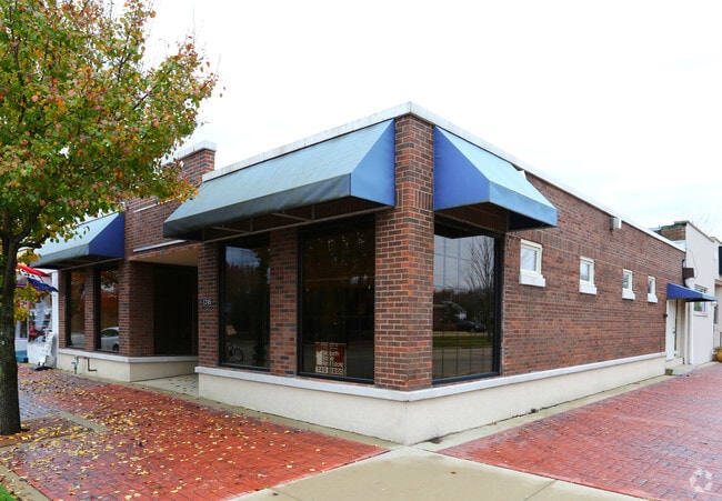
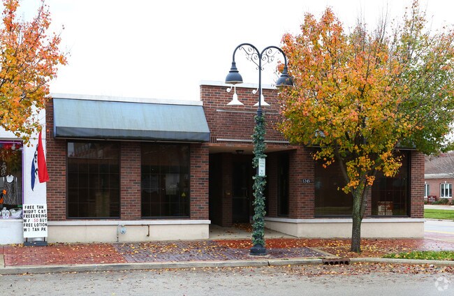
Property Record
1245 27Th St, Zion, IL 60099
NEARBY LISTINGS FOR SALE OR LEASE
Property Detail
1245 27Th St
Chicago-Naperville-Elgin, IL-IN-WI
Zion City
04-21-413-001
ZION CITY SEC.21 W 40 FT LOT 1 BLOCK 84
Taxexempt
Lake
X
Illinois
17097C0079L
1
0
0.05 AC
2024
Far North
860200
Chicago
4,000 SF
DEMOGRAPHICS near 1245 27Th St
1 Mile
3 Mile
5 Mile
2024 Total Population
10,116
42,886
80,920
2029 Population
10,052
42,454
79,913
Pop Growth 2024-2029
(0.63%)
(1.01%)
(1.24%)
Average Age
38
38
38
2024 Total Households
3,615
15,187
28,266
HH Growth 2024-2029
(0.80%)
(1.19%)
(1.40%)
Median Household Inc
$51,038
$69,409
$70,823
Avg Household Size
2.70
2.70
2.80
2024 Avg HH Vehicles
2.00
2.00
2.00
Median Home Value
$139,019
$169,140
$180,809
Median Year Built
1949
1972
1971
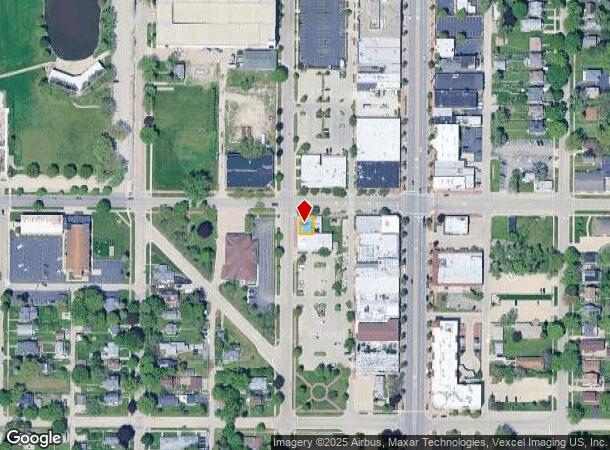
Nearby Places
Map Layers
Map Styles
 Street
 Aerial
- Restaurants
- Banks
- Shops
- Fitness
- Groceries
PUBLIC TRANSPORTATION
COMMUTER RAIL
Zion Station (Union Pacific North Line - Northeast Illinois Regional Commuter Railroad (Metra))
DRIVE
WALK
Distance
Zion Station (Union Pacific North Line - Northeast Illinois Regional Commuter Railroad (Metra))
2 min
12 min
0.7 mi
Winthrop Harbor Station (Union Pacific North Line - Northeast Illinois Regional Commuter Railroad (Metra))
DRIVE
WALK
Distance
Winthrop Harbor Station (Union Pacific North Line - Northeast Illinois Regional Commuter Railroad (Metra))
7 min
3.0 mi
Freight Ports
Port Milwaukee
DRIVE
WALK
Distance
Port Milwaukee
58 min
46.2 mi
SALE & LEASE HISTORY
LISTING DATE
SALE/LEASE

Sep 23, 2016
For Sale
Nearby Properties
Address
Land Use
TOTAL SIZE
Lot Size
Zoning
Address
Land Use
TOTAL SIZE
Lot Size
Zoning
32,000 SF
0.92 AC
Address
Land Use
TOTAL SIZE
Lot Size
Zoning
5,690 SF
93.61 AC
Address
Land Use
TOTAL SIZE
Lot Size
Zoning
18.23 AC
Address
Land Use
TOTAL SIZE
Lot Size
Zoning
244,800 SF
23.32 AC
Address
Land Use
TOTAL SIZE
Lot Size
Zoning
215,773 SF
20.50 AC
Address
Land Use
TOTAL SIZE
Lot Size
Zoning
96,384 SF
8.73 AC
Address
Land Use
TOTAL SIZE
Lot Size
Zoning
320,050 SF
0.96 AC
Address
Land Use
TOTAL SIZE
Lot Size
Zoning
224,750 SF
15.11 AC
Address
Land Use
TOTAL SIZE
Lot Size
Zoning
70,268 SF
8.66 AC
Address
Land Use
TOTAL SIZE
Lot Size
Zoning
66,140 SF
0.88 AC
Address
Land Use
TOTAL SIZE
Lot Size
Zoning
0.24 AC
Address
Land Use
TOTAL SIZE
Lot Size
Zoning
0.36 AC
Address
Land Use
TOTAL SIZE
Lot Size
Zoning
1,003 SF
25 AC
Address
Land Use
TOTAL SIZE
Lot Size
Zoning
34,476 SF
0.24 AC
Address
Land Use
TOTAL SIZE
Lot Size
Zoning
Address
Land Use
TOTAL SIZE
Lot Size
Zoning
0.40 AC
Address
Land Use
TOTAL SIZE
Lot Size
Zoning
55,087 SF
0.57 AC
Address
Land Use
TOTAL SIZE
Lot Size
Zoning
85,238 SF
1.14 AC
Address
Land Use
TOTAL SIZE
Lot Size
Zoning
192,376 SF
8.28 AC
Address
Land Use
TOTAL SIZE
Lot Size
Zoning
Address
Land Use
TOTAL SIZE
Lot Size
Zoning
90,234 SF
5.69 AC
Address
Land Use
TOTAL SIZE
Lot Size
Zoning
86,978 SF
2.81 AC
Address
Land Use
TOTAL SIZE
Lot Size
Zoning
0.24 AC
Address
Land Use
TOTAL SIZE
Lot Size
Zoning
17.39 AC
Address
Land Use
TOTAL SIZE
Lot Size
Zoning
65,440 SF
0.16 AC
Address
Land Use
TOTAL SIZE
Lot Size
Zoning
44,900 SF
3.83 AC
Address
Land Use
TOTAL SIZE
Lot Size
Zoning
882 SF
17.88 AC
Address
Land Use
TOTAL SIZE
Lot Size
Zoning
15.20 AC
Address
Land Use
TOTAL SIZE
Lot Size
Zoning
0.24 AC
Address
Land Use
TOTAL SIZE
Lot Size
Zoning
76,280 SF
3.88 AC
The World's #1 Commercial Real Estate Marketplace
Connect with us
© 2025 CoStar Group
The information above has been obtained from sources believed reliable. While we do not doubt its accuracy we have not verified it and make no guarantee, warranty or representation about it. It is your responsibility to independently confirm its accuracy and completeness. Any projections, opinions, assumptions, or estimates used are for example only and do not represent the current or future performance of the property. The value of this transaction to you depends on tax and other factors which should be evaluated by your tax, financial, and legal advisors. You and your advisors should conduct a careful, independent investigation of the property to determine to your satisfaction the suitability of the property for your needs.