Property Record
1245 Comstock St, Marne, MI 49435

Save to a Folder
{{folder.Name}}
{{folder.ListingIds.length}} Properties
{{folder.ListingIds.length}} Property
Create a New Folder
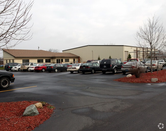
Property Detail
1245 Comstock St
70-06-35-100-049
PART OF S 1/2 OF N 1/2 COM CEN 1/4 COR, TH N 86D 53M 58S W 49268 FT, TH N 02D 46M 18S E 81435 FT TO PT OF BEG, TH N 02D 46M
Industrialgeneral
Ottawa
I
Michigan
B and X Area of moderate flood hazard, usually the area between the limits of the 100-year and 500-year floods.
9.77 AC
2025
Northern Ottawa County
2026
West Michigan
020100
Grand Rapids-Wyoming-Kentwood, MI
20,711 SF
NEARBY LISTINGS FOR SALE OR LEASE
DEMOGRAPHICS near 1245 Comstock St
1 mile
3 mile
5 mile
2025 Total Population
907
6,979
25,144
2030 Population
919
7,160
25,798
Pop Growth 2025-2030
+ 1.32%
+ 2.59%
+ 2.60%
Average Age
41
41
40
2025 Total Households
338
2,658
9,547
HH Growth 2025-2030
+ 1.78%
+ 2.82%
+ 2.68%
Median Household Inc
$72,161
$76,590
$78,913
Avg Household Size
2.70
2.60
2.60
2025 Avg HH Vehicles
2.00
2.00
2.00
Median Home Value
$401,829
$337,685
$311,097
Median Year Built
1968
1985
1986
Nearby Places
Map Layers
Map Styles
 Street
 Aerial
Layers
 Traffic
 Biking
Places
Listings with unknown addresses are not visible on the map
- Restaurants
- Banks
- Shops
- Fitness
- Groceries
PUBLIC TRANSPORTATION
AIRPORT
Gerald R Ford International
Drive
Walk
Distance
Gerald R Ford International
36 min
26.0 mi
Freight Ports
Port Milwaukee
Drive
Walk
Distance
Port Milwaukee
313 min
266.5 mi
Nearby Properties
Address
Land Use
TOTAL SIZE
Lot Size
Zoning
Address
Land Use
TOTAL SIZE
Lot Size
Zoning
410,206 SF
54.36 AC
MH
Address
Land Use
TOTAL SIZE
Lot Size
Zoning
198,000 SF
NOT APP
Address
Land Use
TOTAL SIZE
Lot Size
Zoning
247,168 SF
9.60 AC
MP
Address
Land Use
TOTAL SIZE
Lot Size
Zoning
140,841 SF
8.96 AC
Address
Land Use
TOTAL SIZE
Lot Size
Zoning
285,000 SF
17.66 AC
MH
Address
Land Use
TOTAL SIZE
Lot Size
Zoning
197,220 SF
10.94 AC
MP
Address
Land Use
TOTAL SIZE
Lot Size
Zoning
222,833 SF
20.49 AC
MH
Address
Land Use
TOTAL SIZE
Lot Size
Zoning
85,472 SF
12.17 AC
ARM - MULT
Address
Land Use
TOTAL SIZE
Lot Size
Zoning
121,584 SF
21.98 AC
I
Address
Land Use
TOTAL SIZE
Lot Size
Zoning
200,000 SF
13.41 AC
MP
Address
Land Use
TOTAL SIZE
Lot Size
Zoning
195,000 SF
11.09 AC
MP
Address
Land Use
TOTAL SIZE
Lot Size
Zoning
140,000 SF
22.04 AC
Address
Land Use
TOTAL SIZE
Lot Size
Zoning
88,113 SF
12.50 AC
Address
Land Use
TOTAL SIZE
Lot Size
Zoning
4.80 AC
Address
Land Use
TOTAL SIZE
Lot Size
Zoning
43,864 SF
NOT APP
Address
Land Use
TOTAL SIZE
Lot Size
Zoning
89,277 SF
5.06 AC
MP
Address
Land Use
TOTAL SIZE
Lot Size
Zoning
71,798 SF
8.51 AC
ML
Address
Land Use
TOTAL SIZE
Lot Size
Zoning
Address
Land Use
TOTAL SIZE
Lot Size
Zoning
65,562 SF
8.18 AC
Address
Land Use
TOTAL SIZE
Lot Size
Zoning
Address
Land Use
TOTAL SIZE
Lot Size
Zoning
96,406 SF
19.49 AC
I
Address
Land Use
TOTAL SIZE
Lot Size
Zoning
73,887 SF
7.30 AC
MP
Address
Land Use
TOTAL SIZE
Lot Size
Zoning
81,298 SF
4.50 AC
MP
Address
Land Use
TOTAL SIZE
Lot Size
Zoning
76,115 SF
4.70 AC
MP
Address
Land Use
TOTAL SIZE
Lot Size
Zoning
Address
Land Use
TOTAL SIZE
Lot Size
Zoning
6,160 SF
NOT APP
Address
Land Use
TOTAL SIZE
Lot Size
Zoning
86,918 SF
8.15 AC
I
Address
Land Use
TOTAL SIZE
Lot Size
Zoning
41,375 SF
6.80 AC
MP
Address
Land Use
TOTAL SIZE
Lot Size
Zoning
66,294 SF
3.50 AC
MP
Address
Land Use
TOTAL SIZE
Lot Size
Zoning
117,240 SF
25.26 AC
I
The World's #1 Commercial Real Estate Marketplace
Connect with us
© 2026 CoStar Group
The information above has been obtained from sources believed reliable. While we do not doubt its accuracy we have not verified it and make no guarantee, warranty or representation about it. It is your responsibility to independently confirm its accuracy and completeness. Any projections, opinions, assumptions, or estimates used are for example only and do not represent the current or future performance of the property. The value of this transaction to you depends on tax and other factors which should be evaluated by your tax, financial, and legal advisors. You and your advisors should conduct a careful, independent investigation of the property to determine to your satisfaction the suitability of the property for your needs.