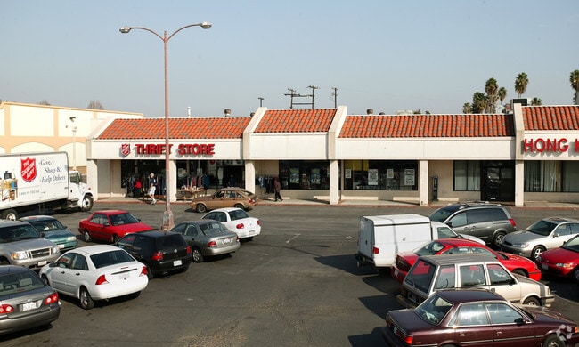
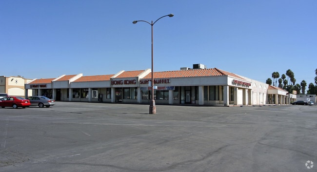
Property Record
1245 E Wilshire Ave, Fullerton, CA 92831

Property Detail
1245 E Wilshire Ave
033-211-02
S TWP 3 RGE 10 SEC 35 SEC 35 T 3 R 10 N 582.21 FT W 645.28 FT W1/2
Commercialnec
ORANGE
B and X Area of moderate flood hazard, usually the area between the limits of the 100-year and 500-year floods.
California
2024
3.26 AC
2025
Fullerton
011403
Orange County (California)
64,786 SF
Anaheim-Santa Ana-Irvine, CA
NEARBY LISTINGS FOR SALE OR LEASE
DEMOGRAPHICS near 1245 E Wilshire Ave
1 mile
3 mile
5 mile
2025 Total Population
17,936
215,030
535,472
2030 Population
17,652
214,514
534,619
Pop Growth 2025-2030
(1.58%)
(0.24%)
(0.16%)
Average Age
41
39
39
2025 Total Households
6,386
67,697
169,133
HH Growth 2025-2030
(1.80%)
(0.39%)
(0.33%)
Median Household Inc
$94,216
$92,258
$98,672
Avg Household Size
2.70
3.00
3.00
2025 Avg HH Vehicles
2.00
2.00
2.00
Median Home Value
$793,962
$794,550
$808,622
Median Year Built
1960
1968
1971
Nearby Places
Map Layers
Map Styles
 Street
 Aerial
Layers
 Traffic
 Biking
Places
Listings with unknown addresses are not visible on the map
- Restaurants
- Banks
- Shops
- Fitness
- Groceries
PUBLIC TRANSPORTATION
COMMUTER RAIL
Fullerton (91 Line - Southern California Regional Rail Authority (Metrolink), Orange County Line - Southern California Regional Rail Authority (Metrolink))
Drive
Walk
Distance
Fullerton (91 Line - Southern California Regional Rail Authority (Metrolink), Orange County Line - Southern California Regional Rail Authority (Metrolink))
4 min
1.4 mi
Anaheim Canyon (Inland Empire-Orange County Line - Southern California Regional Rail Authority (Metrolink))
Drive
Walk
Distance
Anaheim Canyon (Inland Empire-Orange County Line - Southern California Regional Rail Authority (Metrolink))
11 min
4.8 mi
AIRPORT
John Wayne/Orange County
Drive
Walk
Distance
John Wayne/Orange County
23 min
17.5 mi
Long Beach (Daugherty Field)
Drive
Walk
Distance
Long Beach (Daugherty Field)
31 min
21.5 mi
Ontario International
Drive
Walk
Distance
Ontario International
38 min
28.0 mi
Nearby Properties
Address
Land Use
TOTAL SIZE
Lot Size
Zoning
Address
Land Use
TOTAL SIZE
Lot Size
Zoning
Address
Land Use
TOTAL SIZE
Lot Size
Zoning
Address
Land Use
TOTAL SIZE
Lot Size
Zoning
Address
Land Use
TOTAL SIZE
Lot Size
Zoning
4.29 AC
Address
Land Use
TOTAL SIZE
Lot Size
Zoning
325,249 SF
19.20 AC
R3R
Address
Land Use
TOTAL SIZE
Lot Size
Zoning
29.16 AC
Address
Land Use
TOTAL SIZE
Lot Size
Zoning
Address
Land Use
TOTAL SIZE
Lot Size
Zoning
Address
Land Use
TOTAL SIZE
Lot Size
Zoning
47,520 SF
1.92 AC
C
Address
Land Use
TOTAL SIZE
Lot Size
Zoning
Address
Land Use
TOTAL SIZE
Lot Size
Zoning
Address
Land Use
TOTAL SIZE
Lot Size
Zoning
Address
Land Use
TOTAL SIZE
Lot Size
Zoning
26.38 AC
Address
Land Use
TOTAL SIZE
Lot Size
Zoning
Address
Land Use
TOTAL SIZE
Lot Size
Zoning
4.79 AC
Address
Land Use
TOTAL SIZE
Lot Size
Zoning
Address
Land Use
TOTAL SIZE
Lot Size
Zoning
Address
Land Use
TOTAL SIZE
Lot Size
Zoning
Address
Land Use
TOTAL SIZE
Lot Size
Zoning
12,040 SF
1.82 AC
Address
Land Use
TOTAL SIZE
Lot Size
Zoning
198,208 SF
11.62 AC
Address
Land Use
TOTAL SIZE
Lot Size
Zoning
Address
Land Use
TOTAL SIZE
Lot Size
Zoning
Address
Land Use
TOTAL SIZE
Lot Size
Zoning
Address
Land Use
TOTAL SIZE
Lot Size
Zoning
232,305 SF
10.78 AC
Address
Land Use
TOTAL SIZE
Lot Size
Zoning
208,000 SF
17.03 AC
Address
Land Use
TOTAL SIZE
Lot Size
Zoning
9.63 AC
Address
Land Use
TOTAL SIZE
Lot Size
Zoning
231,156 SF
8.06 AC
Address
Land Use
TOTAL SIZE
Lot Size
Zoning
Address
Land Use
TOTAL SIZE
Lot Size
Zoning
201,681 SF
7.81 AC
R3
Address
Land Use
TOTAL SIZE
Lot Size
Zoning
1,900 SF
23.52 AC
The World's #1 Commercial Real Estate Marketplace
Connect with us
© 2026 CoStar Group
The information above has been obtained from sources believed reliable. While we do not doubt its accuracy we have not verified it and make no guarantee, warranty or representation about it. It is your responsibility to independently confirm its accuracy and completeness. Any projections, opinions, assumptions, or estimates used are for example only and do not represent the current or future performance of the property. The value of this transaction to you depends on tax and other factors which should be evaluated by your tax, financial, and legal advisors. You and your advisors should conduct a careful, independent investigation of the property to determine to your satisfaction the suitability of the property for your needs.